Live on the road
Texas Hill Country Audio Tour
Whistlestop narrates far more of the drive than this guide can list, automatically, as you pass each one.

The field guide
The rock and the water
The Hill Country is the southeastern corner of the Edwards Plateau, and its eastern and southern edge is a fault. The Balcones Escarpment is where a belt of faults active roughly fifteen to twenty million years ago dropped the Gulf coastal plain away from the plateau, leaving a step a few hundred feet high that runs in an arc from around Waco south through Austin and San Antonio and then west toward Del Rio. Everything that makes the region distinctive follows from standing on the high side of that step. Where the region ends is genuinely disputed: the Texas Historical Commission draws nineteen counties, Texas Parks and Wildlife twenty-six, and the Hill Country Alliance seventeen.
The rock is Cretaceous limestone, and limestone dissolves. Rainwater takes it apart along joints and bedding planes until the drainage is as much underground as on the surface, which is what karst means and why creeks here vanish into their own beds and reappear miles away as springs. The Edwards Aquifer is the great one, recharged along a band where the limestone reaches the surface, and it is what comes back out at Comal Springs and San Marcos. The Trinity Aquifer underlies much of the western and northern hills and feeds Jacob's Well.
The exception, and it is a large one, is the Llano Uplift. Around Enchanted Rock and Marble Falls the limestone has been eroded off a structural dome to expose granite and older metamorphic rock about a billion years old, some of the oldest exposed anywhere in Texas. The change is obvious from the car: pink boulders in the riverbeds, thinner soil, different plants. It is why the northern edge of the Hill Country does not look like the rest of it.
Two consequences run through everything below. Springs are the reason there is anything to swim in, and springs depend on an aquifer that a multi-year drought and a growing population have both been drawing down. Jacob's Well is the visible instrument: flow fell to zero in October 2022 for only the fifth time on record, and it has been closed to swimming every summer since. Summer 2026 brought the best flow since 2022 after heavy rain, and it still was not enough to reopen, against an accumulated rainfall deficit in the Middle Trinity of more than thirty-seven inches.
Flash Flood Alley
The same geology that makes the swimming holes makes this the most flood-prone region in North America, and that is not a figure of speech. Flash Flood Alley follows the curve of the Balcones Escarpment from Waco south and west to Uvalde. Warm Gulf air runs into the escarpment, which lifts it like a ramp and wrings the rain out of it. The soil over the limestone is thin and quickly saturated, the hills are steep, and the valleys are narrow, so the water does not soak in and does not spread out. It concentrates. Texas State University researchers put the flood discharge per unit of drainage area here among the highest in the country.
On 4 July 2025 the remnants of Tropical Storm Barry dropped as much as twenty inches of rain on the Guadalupe watershed overnight. The river rose more than twenty feet in under an hour, in the dark, on a holiday weekend, along a stretch lined with camps and cabins. At least 135 people were killed, 107 of them in Kerr County and 37 of those children. Damage ran past a billion dollars. It is the deadliest inland flood in the United States in decades and it happened on water that people had swum in comfortably the previous afternoon.
What has changed since is real but partial. Texas funded flood-warning infrastructure in 2025, and by July 2026 new sirens were in place in Ingram and elsewhere in Kerr and Kendall counties; three of six new Kerr County sirens were used in a flood that month to tell people to get to high ground. Twenty-eight more counties are eligible for the funding and most are still working up plans. Camp safety rules were tightened. None of that makes the rivers safe, and sirens do not reach a tent.
So the practical advice is unglamorous and worth following. Check the forecast for the whole watershed upstream and not just for where you are standing, because the rain that kills you here falls somewhere you cannot see. Never camp on a gravel bar or a low terrace beside a Hill Country river, however settled the weather looks. Turn around at a flooded low-water crossing every single time, since most flood deaths in Texas happen in vehicles. And if you are staying somewhere on the water, ask what the plan is before you need it.
The Germans and the Comanche
The Adelsverein, a society of German noblemen with more enthusiasm than competence, began landing emigrants on the Texas coast in 1844 and moving them inland. New Braunfels was founded in 1845 and Fredericksburg in 1846, and the venture nearly killed the people it carried: hundreds died of disease and hunger waiting on the coast. What survived it was a genuine German-speaking belt across these hills, which kept its language, its churches, its singing societies and its bakeries for a century, and which voted against secession in 1861 at some cost to itself.
The settlers had been sold land they did not control. The Fisher-Miller grant lay well beyond the frontier in Penateka Comanche country, and no surveyor could work there. In early 1847 the Adelsverein's commissioner-general, John O. Meusebach, rode out to the San Saba with a small party and met the head chiefs, among them Buffalo Hump, Santa Anna and Mopechucope. The agreement they reached on 9 May 1847 traded presents worth some three thousand dollars and mutual right of passage for the safety of the surveyors. It is regularly described as the only treaty between settlers and Native Americans in Texas never to be broken, and that claim is usually made with a hedge attached, which is how it is repeated here.
It is worth being clear about what the treaty did and did not do. It held between these particular parties. It did not protect the Penateka from what followed, which was epidemic disease, the collapse of the bison, the Texas Rangers, and removal to Indian Territory within a generation. The peace that Fredericksburg remembers fondly was a local arrangement inside a general dispossession.
The other name on the land here is Johnson. Lyndon Johnson was born on the Pedernales in 1908, grew up in Johnson City, and never really left: he bought the ranch in 1951, spent something close to a fifth of his presidency working from it, and is buried in the family plot under the live oaks a short walk from the house. The park runs both places, and the ranch is still a working operation with Hereford cattle descended from his own herd.
What grows and what flies
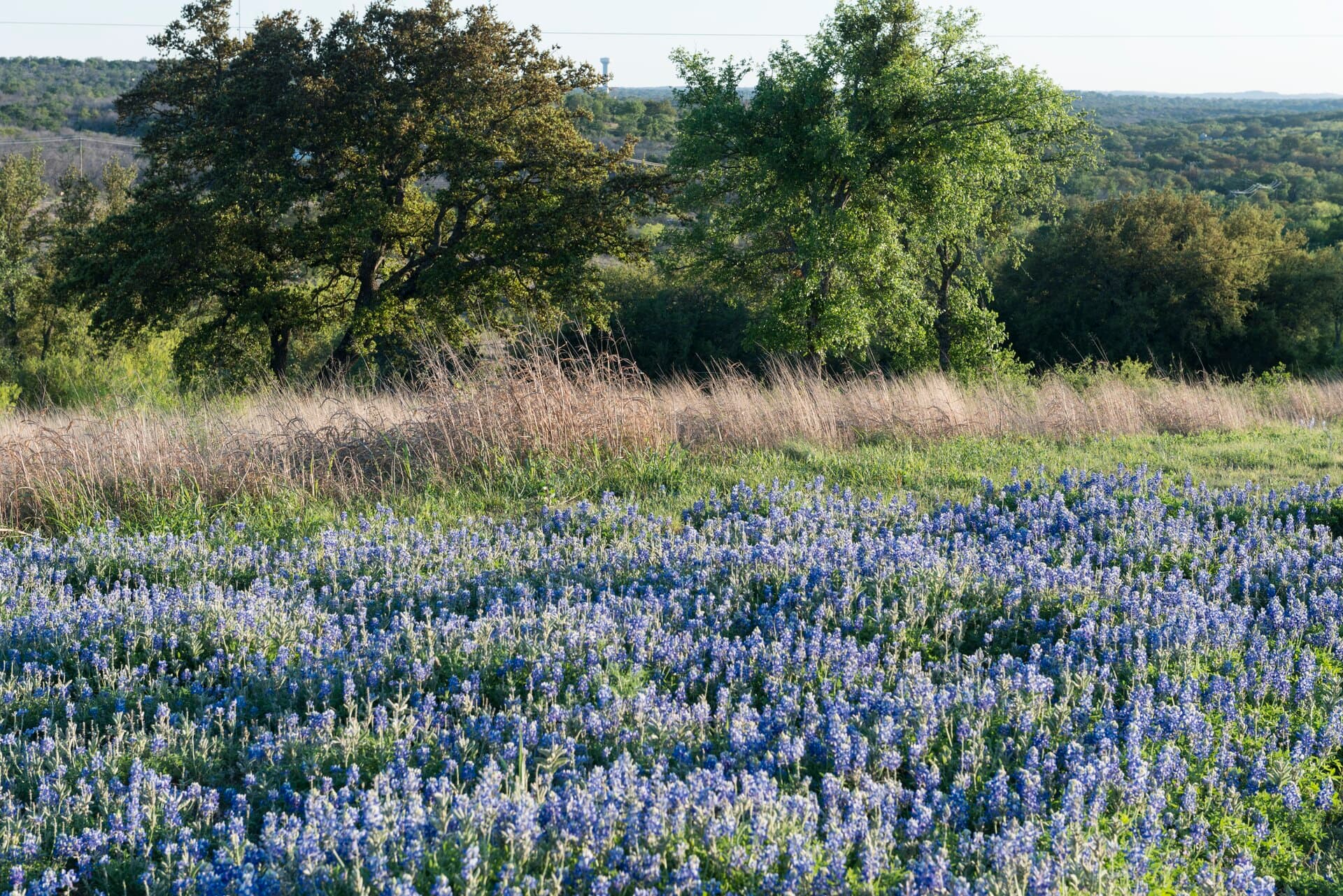
The bluebonnets are the reason a great many people come, and the timing is narrower than the postcards suggest. In the Hill Country they generally begin in late March and peak in the first half of April, and how good a year it is was decided the previous autumn by whether the rain came when the seed needed it. Indian paintbrush follows them, then firewheel and coreopsis. Lady Bird Johnson is the reason they are on the roadsides in such quantity: the highway department mows to a calendar that lets the seed set, and it has done for decades.
The signature trees are live oak and ashe juniper, the second of which everybody calls cedar and half the population blames for their winter allergies. Bald cypress line every spring-fed river, rooted in the streambed itself, and they are what hold the banks together through the floods. The great botanical oddity is in the western canyons: stands of Uvalde bigtooth maple, left behind when the ice-age climate that suited them retreated north, surviving in a few damp canyon bottoms and turning colors that have no business in Texas.
The golden-cheeked warbler nests in this ashe juniper and oak woodland and nowhere else on earth. It is the only bird whose entire breeding range sits inside a single American state, it is federally endangered, and the thing it needs is old juniper with bark that peels in strips, which takes decades to grow and an afternoon to clear. The black-capped vireo shares the same hills and the same problem.
Then there are the bats. Bracken Cave, on the northern edge of San Antonio, holds more than fifteen million Mexican free-tailed bats through the summer, which makes it the largest bat colony known anywhere. The emergence takes hours. The cave is owned by Bat Conservation International and visiting means a member reservation rather than turning up, and in 2014 the Nature Conservancy and BCI spent $20.5 million on the neighboring land specifically to stop 3,500 houses being built under the flight path.
Dance halls and vineyards
The dance halls are the most durable thing the Germans and Czechs built here. They went up as social halls for singing and shooting clubs from the 1870s on, wooden, high-roofed, with shutters instead of glass so the summer air could move through, and something like a dozen of the survivors still open their doors. Gruene Hall has been running since 1878 and is the oldest still operating in Texas. What matters about them is not the age but that they never became museums: they book bands on Tuesdays, the floors are still sprung, and nobody has installed air conditioning.
The wine is newer and stranger than it looks. The Texas Hill Country AVA covers about nine million acres, which makes it one of the largest appellations in the country by area, though sources disagree on whether it ranks second or third. The catch is that very little of that is planted: the appellation has only a few hundred acres under vine, while more than eighty-five per cent of the state's wine grapes are grown three hundred and fifty miles away in the Texas High Plains around Lubbock, where the elevation and the cold nights suit them better. A great deal of what is poured in a Fredericksburg tasting room was grown in the Panhandle, which is legal, normal and not always volunteered.
What does thrive here is the Mediterranean and Iberian end of the catalog, which makes sense in a place that regularly sees a hundred degrees: tempranillo, mourvedre, viognier, sangiovese. The stretch of US-290 between Johnson City and Fredericksburg has become the densest run of tasting rooms in the state and is busy enough at weekends that the shuttle buses are a genuine safety feature rather than a novelty.
More stories about places in and around Texas Hill Country
Whistlestop's audio tours work wherever you are, automatically as you drive past landmarks and areas of interest. Here are some more curated stories you'll hear around Texas Hill Country.
Natural Features
The Balcones Fault Zone
Read
This is the seam where Texas changes. A belt of faults, active roughly 15 to 20 million years ago, dropped the Gulf Coastal Plain down against the Edwards Plateau, and almost everything follows the line: the hills start on one side and the blackland begins on the other, the springs emerge along it, and the road pattern, the soil, the rainfall and the vegetation all shift within a few miles. San Antonio, New Braunfels, San Marcos, Austin, Waco and Dallas are all strung along it, sited on the water it brings to the surface. The faults are considered inactive now — there is no meaningful earthquake risk on them.
The Balcones Fault Zone on Whistlestop →Edwards Aquifer Recharge Zone
Read
For roughly 30 miles along this stretch, the highway runs across the band where the Edwards limestone reaches the surface and creeks vanish into it. Streams draining off the plateau lose their water into sinkholes, fractures and caves here rather than running on to the coast, and that water reappears at Comal and San Marcos springs and in the wells that supply about two million people. The zone is why a spill on this road is treated differently than a spill 20 miles east, and why the recharge area has its own development rules.
Edwards Aquifer Recharge Zone on Whistlestop →Comal Springs
Read
The largest spring system in Texas, discharging an average of about 290 cubic feet per second from the Edwards Aquifer along the Comal Springs fault, and the source of the Comal River — at roughly two and a half miles, one of the shortest rivers in the country. The springs stopped flowing for about five months during the drought of 1956, the only time in recorded history, and the fountain darter was wiped out here and had to be reintroduced from the San Marcos River. Two species found nowhere else on earth live in the spring openings: the Comal Springs riffle beetle and the Comal Springs dryopid beetle.
Comal Springs on Whistlestop →The Llano Uplift
Read
The riverbed here is full of pink and gray boulders that belong to no other part of Texas. This is a broad structural dome about 65 miles across where erosion has stripped away the flat-lying limestone of the Hill Country and exposed the Precambrian basement beneath it — granite, gneiss and schist between about 1.0 and 1.4 billion years old, the oldest rock at the surface in the state. The uplift is also the state's mineral district: llanite, topaz, iron and the granite quarried at Marble Falls all come out of it.
The Llano Uplift on Whistlestop →Guadalupe River Cypress
Read
The bald cypress lining this river are not incidental to it — they are what holds it together. The trees root directly in the streambed, tolerate months underwater, and their trunks and knees slow floodwater and trap gravel, which is why the Guadalupe keeps clear runs and deep green pools instead of scouring to bare rock. Some of the largest are estimated at well over 500 years old, and they survive because cypress was hard to reach with a wagon in a steep valley.
Guadalupe River Cypress on Whistlestop →The Frio River
Read
Frio means cold, and it earns the name — the river is fed by springs emerging from the Edwards limestone at a steady temperature, so it runs notably colder than the summer air above it. It has cut a canyon into the southern rim of the Edwards Plateau here with bluffs several hundred feet high. Bat Cave nearby holds a maternity colony of Mexican free-tailed bats numbering in the millions, and the evening emergence is visible on weather radar.
The Frio River on Whistlestop →The Colorado River at Marble Falls
Read
The river drops over a granite ledge here — the falls the town is named for, now under Lake Marble Falls since the dam went in. The stone is not marble but granite from the Llano Uplift, and Granite Mountain a few miles west supplied the roughly 15,000 carloads of pink granite used to build the Texas Capitol, donated by its owners in exchange for the state's labor and a railroad spur. The Colorado runs about 860 miles from the Llano Estacado to Matagorda Bay and shares no water with the Colorado of the Grand Canyon.
The Colorado River at Marble Falls on Whistlestop →The Nueces Strip
Read
For twelve years this river, not the Rio Grande, was where Texas ended as far as Mexico was concerned. The Republic claimed the Rio Grande in 1836; Mexico recognized the Nueces; and the 150 miles of brush country between them was left as a disputed and largely lawless belt. Sending U.S. troops into that gap in 1846 is what started the Mexican-American War. The Nueces rises on the Edwards Plateau and is one of the clear spring-fed rivers up on the plateau, running muddy and slow by the time it reaches the coast.
The Nueces Strip on Whistlestop →Balcones Escarpment at San Antonio
Read
The ground rises several hundred feet over the next few miles as the road climbs off the coastal plain onto the Edwards Plateau. Spanish accounts named the feature — los balcones, the balconies — for exactly this stepped profile seen from below. The escarpment is the reason San Antonio exists where it does: the San Antonio Springs and San Pedro Springs rise along the fault line, and the Spanish sited the presidio and the missions on that water in 1718.
Balcones Escarpment at San Antonio on Whistlestop →Historical Markers
Oak Hill (Shiloh)
Read
First settlers arrived in area in 1840s. The community founded here in 1856 was called Live Oak Springs; in 1865 it was renamed Shiloh. Later schools known as Live Oak and Oatmanville Gave names temporarily to the settlement. It has been known as Oak Hill since 1900. Limestone quarries were opened, 1882, to supply stone for capitol building in Austin. By 1886, ten carloads of stone were shipped daily over railroad which joined quarries with capitol grounds. It is estimated that one-third of capitol's walls are line with limestone from Oak Hill quarries.
Incise on base: Sponsored by Oakhill-Cedar Valley Pioneer Association
Within this region, the area along the Colorado River was only sparsely populated by pioneers from the U.S. partly due to conflicts with the native Commanches. In 1835, one such settler, William Cannon, obtained a land grant from the Mexican government that stretched from Williamson Creek to Slaughter Creek, an area which comprised the heart of what we now know as "Oak Hill".
Oak Hill (Shiloh) on Whistlestop →Camp Ben McCulloch
Read
Camp Ben McCulloch, near Driftwood in Hays County, was organized in the summer of 1896 as a reunion camp for Confederate veterans and named for Benjamin McCulloch. The first commander was Capt. M. L. Reed of Henly. Annual three-day reunions were held at the camp, often with 5,000 to 6,000 persons attending. In 1930 Ben McCulloch was said to be the largest Confederate camp in existence. The last reunion, the Golden Jubilee, was held on August 9, 1946, and included a memorial service for the camp's last two members, who had died the previous year. Subsequently, the camp became the location of the annual meetings of the Sons and Daughters of the Confederacy, with various activities and services spanning a week in early June. The campsite, on a branch of Onion Creek, also remains a popular picnic area for residents of northern Hays County.
Ben McCulloch originally came to Texas in 1836 at age 24 to join family friend David Crockett. Arriving too late to meet Crockett at the Alamo (and share his fate), McCulloch joined Sam Houston's army and commanded one the famed Twin Sisters cannons at the Battle of San Jacinto. In his lifetime, he would serve in several political offices, but his enduring fame is as a soldier. During the Republic of Texas era, he gained a reputation as an Indian fighter and scout, playing a key role in border skirmishes with the Mexicans. During the Mexican War, he served as Zachary Taylor's chief of scouts and became nationally known for his exciting reconnaissance expeditions into Mexico. McCulloch set off for the California gold fields after the war, but failed to strike it rich. In the 1850s, he was a U.S. marshall in East Texas, and also traveled to Utah as a peace commissioner to help prevent hostilities between the U.S. and the Mormon church.
When Texas seceded from the Union in 1861, Ben McCulloch was appointed a brigadier general in the Confederate army. He led the seizure of the federal arsenal in San Antonio, then was assigned command of Indian Territory. Operating out of Little Rock, Arkansas, he began to build the Army of the West, establishing vital alliances with Indian tribes in present-day Oklahoma. McCulloch was killed in battle at Pea Ridge, Arkansas, on March 7, 1862.
Camp Ben McCulloch on Whistlestop →More are waiting in the app, which carries the whole record and picks up whatever is near the road ahead, ready to narrate as you drive.
How long to give it
One day
The classic loop out of Austin or San Antonio. Enchanted Rock first thing while it is cool and before the day passes run out, then into Fredericksburg for lunch and the museum, then Luckenbach in the late afternoon when somebody is usually playing. Add the LBJ ranch if the timing works.
Enchanted Rock · Fredericksburg · Luckenbach · Lyndon B. Johnson National Historical Park
A weekend
Base in Fredericksburg or Wimberley. One day on the granite in the north, one on the water in the east. In April take the Willow City Loop early on the second morning; in November swap the whole second day for the western canyons and the maples.
Enchanted Rock · Willow City Loop · Fredericksburg · Pedernales Falls State Park · Hamilton Pool Preserve · Jacob's Well · Gruene Hall
Four or five days
Work east to west, which is also oldest rock last. Start on the Balcones edge with the springs and the dance halls, spend two days on the Pedernales around Fredericksburg, then drop southwest to Bandera and give the canyons a full two days, because the Twisted Sisters deserve to be driven slowly and Lost Maples and the Frio are an hour apart.
Comal Springs, New Braunfels · Gruene Hall · Jacob's Well · Hamilton Pool Preserve · Pedernales Falls State Park · Fredericksburg · Enchanted Rock · Bandera · Lost Maples State Natural Area · The Twisted Sisters · Garner State Park and the Frio
When to come
Spring is the headline and April is the center of it. Bluebonnets generally start in late March and peak through the first half of April, with the paintbrush behind them, and the weather is the best of the year. It is also the busiest, and the wildflower weekends on the Willow City Loop and around Fredericksburg are genuinely congested.
Autumn is the underrated season and the second half of November is when the bigtooth maples in the western canyons turn, assuming a proper cold front arrives to trigger them. Lost Maples runs a foliage report through the season and reaches capacity daily, so treat a reservation as mandatory rather than prudent.
Summer is hot, frequently past a hundred degrees, and it is when the rivers are busiest for the obvious reason. Start early, and remember that the spring-fed water sits near 70 degrees all year regardless of the air. Winter is quiet and mild, good for walking and for the dance halls, with the caveat that the ashe juniper pollen season runs from around December to February and is severe if you are susceptible.
Know before you drive
- Check the upstream forecast before any river day and never camp on a gravel bar. Low-water crossings flood fast and most Texas flood deaths happen in vehicles: turn around, every time.
- The popular sites are reservation-only and sell out. Hamilton Pool requires a booking every day of the year and swimming is separately suspended whenever bacteria levels rise after rain. Enchanted Rock day passes go up to thirty days ahead and the park closes when full. Lost Maples fills daily through the autumn color.
- Jacob's Well has been closed to swimming every summer since 2022 because the spring flow will not support it. The natural area is open for walking and guided tours, and entry is free.
- The Texas White House at the LBJ Ranch has been closed for rehabilitation since January 2024. The grounds, the driving tour and the Johnson City district remain open.
- The Willow City Loop is private land on both sides. Do not park, cross a fence or walk into the flowers, and do not stop on a curve. The residents have been asking for thirty years.
- Fuel and phone signal both thin out fast west of Bandera. Fill up before the Twisted Sisters and expect livestock on the road.
- Burn bans are common and are set county by county, so check the county you are actually in rather than the one you left.
In an RV or with a trailer
Most of the region is easy going in an RV, with full hookups at the state parks and a large private campground trade around New Braunfels, Fredericksburg and the Frio. Two cautions: the Twisted Sisters have sharp switchbacks and steep grades that are genuinely unsuitable for anything long, and low-water crossings throughout the Hill Country should be treated as impassable when running, since a motorhome floats sooner than its driver expects.
Questions
- When do the bluebonnets bloom in the Hill Country?
- Generally from late March, peaking in the first half of April, with the season running roughly six weeks. How good a year it is depends on the previous autumn and winter rain, which determines germination. The Willow City Loop north of Fredericksburg and the roadsides along US-290 are the reliable places to see them.
- Can you swim at Jacob's Well?
- Not at present, and not since 2022. Spring flow dropped to zero in October 2022 for only the fifth time on record and Hays County has suspended swimming every summer since. Flow improved in summer 2026 after heavy rain but not enough to reopen. The natural area remains open and free for hiking and guided tours.
- Do you need a reservation for Hamilton Pool or Enchanted Rock?
- Yes for both, and they are different systems. Hamilton Pool Preserve requires a reservation every day of the year through Travis County, and even with one, swimming may be closed on bacteria levels after rain. Enchanted Rock sells day passes through Texas Parks and Wildlife up to thirty days ahead, and the park closes its gate when it reaches capacity, which happens often on spring weekends.
- How dangerous are the rivers here?
- The Hill Country is the most flood-prone region in North America, and this deserves to be taken literally. On 4 July 2025 the Guadalupe rose more than twenty feet in under an hour and killed at least 135 people. Thin soil over limestone, steep hills and narrow valleys mean rain that falls miles upstream arrives fast and without warning where you are. Check the whole watershed's forecast, never camp on a gravel bar, and never drive a flooded crossing.
- Is Hill Country wine actually made from Hill Country grapes?
- Often not. The Texas Hill Country AVA is one of the largest appellations in the country by area but has only a few hundred acres planted, and more than eighty-five per cent of Texas wine grapes are grown in the Texas High Plains near Lubbock. Plenty of excellent wine is poured in Fredericksburg tasting rooms from fruit grown in the Panhandle. Ask if it matters to you.
Connects to
Sources: Texas Parks and Wildlife, Edwards Plateau ecoregion, Texas State Historical Association, the Meusebach-Comanche Treaty, Texas Water Resources Institute, on Flash Flood Alley, Hays County Parks, Jacob's Well Natural Area, Travis County Parks, Hamilton Pool Preserve, Lyndon B. Johnson National Historical Park, National Park Service, Lady Bird Johnson Wildflower Center, bluebonnet FAQ, The Nature Conservancy, Bracken Bat Cave.
Reviewed August 2026
Hear it from the road
Whistlestop tells you these stories automatically as you pass them. No searching, no tapping, nothing to ask.