Live on the road
Austin Audio Tour
Whistlestop narrates far more of the drive than this guide can list, automatically, as you pass each one.

The field guide
A city built on the seam
Austin sits on a crack. The Balcones Fault zone runs roughly under Interstate 35, and it is the reason the two halves of the city look nothing alike. West of it the ground rises into the Edwards Plateau: white limestone, thin soil, live oak and juniper, creeks in canyons. East of it lies the Blackland Prairie, flat and dark and deep, some of the best farmland in Texas. You can feel the transition driving west on any of the main roads, and the city's whole real estate history is a story about which side of that line a neighbourhood is on.
The limestone is not solid. Rain falling on the plateau west of town sinks into fractures in the Edwards Aquifer, travels underground, and comes back up along the fault where the rock is broken, which is why a capital city has cold springs running through the middle of it. Barton Springs is the fourth largest spring system in Texas and the outlet everyone swims in. It is also the reason Austin has spent forty years arguing about development over the recharge zone: what goes onto the ground out west arrives downtown, in the pool, within days.
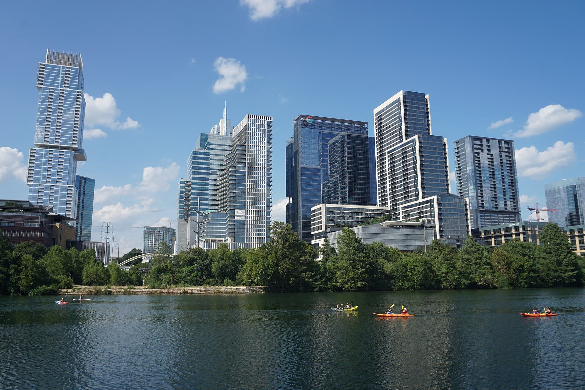
The river is the Colorado, and it is not the one that carved the Grand Canyon. That is a separate river entirely, 1,450 miles long, which was called the Grand until it was renamed in 1921. This one is 862 miles from the Llano Estacado to Matagorda Bay and never leaves Texas; Spanish explorers called it the Rio Colorado for the red clay it carries. Downtown it is not really a river any more either. Longhorn Dam holds it as Lady Bird Lake, a constant level pool with a hike and bike trail all the way round, which is why the skyline stands over flat water rather than a floodplain.
How a hamlet got the government
In 1838 there was a settlement of a few families on the north bank called Waterloo. In 1839 Mirabeau B. Lamar, president of the Republic of Texas and a man with a taste for the phrase seat of empire, had the government moved there, renamed it for Stephen F. Austin, and sent Edwin Waller out to survey a grid, sell lots and build something to govern from. Waller laid fourteen blocks between two creeks with Congress Avenue aimed at the hill, sold the lots in August, and was elected the town's first mayor the following January. The street plan he drew is still the street plan.
It very nearly did not last. Sam Houston, back in office and unenthusiastic about a capital on the Comanche frontier, sent men in December 1842 to remove the Republic's archives to Houston. Angelina Eberly, who kept a boarding house, saw them loading and fired a six pound cannon down Congress Avenue at the General Land Office. She hit the building, hurt nobody, and the raiding party left in a hurry with a posse behind them. The papers came back. The episode is remembered as the Archive War, and the state's records have been in Austin ever since.
The capitol they eventually built is the fourth. Fire took its predecessor in 1881, and the state had no money, so it paid in the only currency it had: three million acres of the Panhandle, traded to the contractors, which became the XIT Ranch. Construction ran from 1882 to 1888 and a week of dedication ceremonies in May 1888 marked the finish. The final cost came to $3,744,630.60, of which the state itself paid about half a million dollars. Everything else was land.
East of the interstate
In 1927 the city council hired the Dallas firm of Koch and Fowler to write Austin a master plan, and what came back the following year is the most consequential document in the city's history. Outright segregation ordinances had been struck down by the Supreme Court in 1917, so the plan achieved the same end by other means: it designated East Austin as the district where Black residents would receive city services, and the city then declined to extend sewers, paving and utilities to the freedmen's communities scattered elsewhere. Pull and push together. By 1932 almost the entire Black population had moved east, and the older neighbourhoods had effectively disappeared.
What grew there was a whole city within the city, with East Eleventh and East Twelfth as its main street: churches, funeral homes, drugstores, doctors, and by 1945 the Victory Grill. Mexican American Austin was pushed into the same quadrant, south of it, and the two communities have shared and contested the east side ever since. When Interstate 35 was laid along East Avenue in the 1960s it followed the line the 1928 plan had drawn, and made it concrete and eight lanes wide.
The east side is now the fastest changing ground in the city, and the guide cannot tell you how to feel about that. What it can tell you is that the buildings are still legible if you slow down: a 1940s club next to a new duplex, a Baptist church with its congregation commuting back in from the suburbs it was priced out to, a cemetery for the state's governors a few hundred yards from all of it. Drive East Eleventh and East Twelfth end to end. It takes ten minutes and it explains more than any museum in town.
Why it got loud
The claim is on the airport signs and it is younger than most people assume. In August 1991 the city council adopted Live Music Capital of the World by resolution, on the strength of a music commission count showing more venues per head of population than anywhere else. The commission had actually proposed Capital of America, and council member Max Nofziger is the reason it is not: this is Texas, he said, now is not the time to be modest.
The machinery underneath it was older and was mostly accidental. A large state university supplied an endless renewing audience with time and no money. Rent was cheap for decades. The Victory Grill and the east side clubs had been bringing touring blues players through since the forties, and in 1970 an old National Guard armoury south of the river became the Armadillo World Headquarters, which put rednecks and hippies in the same room for the same country rock and invented most of what outsiders now think Austin sounds like. It closed on the last night of 1980.
Sixth Street took over, and then South by Southwest started in 1987 as a regional music conference and became the thing the world books flights for. Austin City Limits has been taping in this city since 1974, which makes it the longest running music series on American television, and the festival named after it fills Zilker Park each autumn. The honest footnote is that a working musician's Austin has got much harder: the venues that made the reputation sit on land worth more as condominiums, and the Broken Spoke in its notch on South Lamar is the picture of it.
Bats, a salamander and a warbler
The bats are the famous ones and they are genuinely an accident of engineering. When the Congress Avenue bridge was rebuilt in 1980, its underside got long expansion joints about sixteen inches deep and an inch wide, which happen to be a near perfect roost: narrow enough to keep a predator out, deep enough to hold the day's heat after dark. Mexican free-tailed bats arriving from central Mexico found them, and roughly 1.5 million now summer under the traffic, eating something in the order of ten to thirty thousand pounds of insects a night. Austin's first response, in the early eighties, was a petition to have them exterminated.
The rarest animal in the city is four inches long and lives in a swimming pool. The Barton Springs salamander is neotenic, meaning it keeps its feathery external gills and never leaves the water, and its entire known range is the handful of spring outlets in Zilker Park. It was listed as endangered in 1997, and it is the reason the pool is drained and scrubbed on a schedule and closed when the creek runs dirty. A species whose whole world is four holes in the ground inside one city park is a strong argument about the aquifer, and it has been used as one.
West of town the bird to know is the golden-cheeked warbler, which nests nowhere on Earth but central Texas and builds with strips of bark peeled from mature Ashe juniper, so it needs old cedar breaks rather than the young thickets that follow clearing. The canyons west of Mansfield Dam and the preserves out toward Dripping Springs are among the reliable places to hear one in spring. The same limestone country holds the black-capped vireo, and between them they are why so much land west of Austin is in preserves rather than subdivisions.
More stories about places in and around Austin
Whistlestop's audio tours work wherever you are, automatically as you drive past landmarks and areas of interest. Here are some more curated stories you'll hear around Austin.
Natural Features
The Balcones Fault Zone
Read
This is the seam where Texas changes. A belt of faults, active roughly 15 to 20 million years ago, dropped the Gulf Coastal Plain down against the Edwards Plateau, and almost everything follows the line: the hills start on one side and the blackland begins on the other, the springs emerge along it, and the road pattern, the soil, the rainfall and the vegetation all shift within a few miles. San Antonio, New Braunfels, San Marcos, Austin, Waco and Dallas are all strung along it, sited on the water it brings to the surface. The faults are considered inactive now — there is no meaningful earthquake risk on them.
The Balcones Fault Zone on Whistlestop →The Colorado Enters Austin
Read
The river arrives here having just left the Hill Country, and the change is abrupt: a few miles upstream it runs in a limestone canyon, and here it is on the coastal plain in a wide, flat valley. That break is the Balcones fault zone, and the city grew along it. The Colorado through Austin has been held at a constant level by a downstream dam since 1960 — the reason it looks like a lake rather than a river — and the constant temperature and level are what allowed an urban stretch of water to become the recreational centre of the city.
The Colorado Enters Austin on Whistlestop →Onion Creek
Read
Onion Creek drops over a set of hard limestone ledges here on its way to the Colorado, and the rock is the tell: this is Austin Chalk and the harder beds beneath it, the first limestone the highway has met since leaving the Hill Country side of the state. The creek drains off the Edwards Plateau and crosses the Balcones fault zone a few miles upstream, which is why a stream on the coastal plain is running over stone at all. A bald cypress beside the lower falls is estimated at around 500 years old.
Onion Creek on Whistlestop →Hornsby Bend Bird Observatory
Read
Hornsby Bend Bird Observatory is a hidden gem for bird enthusiasts in southeast Austin, Texas. This 1,200-acre site, part of the Austin Water Utility's Center for Environmental Research, is home to the Hornsby Bend Biosolids Management Plant. Despite its industrial purpose, the area is renowned for its biodiversity, attracting birders from near and far. The observatory offers a unique blend of habitats, including ponds, wooded areas, agricultural fields, and 3.5 miles of Colorado River bottom, making it a prime location for spotting a wide variety of bird species.
The story of Hornsby Bend as a birding hotspot began in 1959 when G. Frank 'Pancho' Oatman, a young birder from Austin, stumbled upon the sewage facilities while visiting relatives in Del Valle. Intrigued by ducks flying across the Colorado River, Pancho discovered the ponds and was thrilled to spot waterfowl in large numbers, including rare finds like the common goldeneye and Bonaparte's gull. His discovery quickly drew the attention of local birding experts, Edgar Kincaid and Fred Webster, who joined Pancho for further exploration. Their visits yielded even more rare sightings, such as a dunlin and lapland longspurs, marking the beginning of Hornsby Bend's reputation as a birding haven.
Over the years, Hornsby Bend has continued to attract birders eager to catch sight of its impressive avian diversity. With 349 species listed, the observatory offers birdwatchers a chance to see a wide array of birds throughout the year. The changing seasons bring different species, and even daily visits can offer new surprises. Binoculars and scopes are essential tools for birders navigating the treatment areas, and those on foot often have the advantage of seeing up to 50% more birds than those viewing from cars.
While many migrating birds merely pass over Hornsby Bend without stopping, the observatory remains a vibrant spot for birdwatching. The Center for Environmental Research enhances the experience with feeders and birdhouses, making it a welcoming place for both birds and birders alike. Whether you're a seasoned birder or a curious newcomer, Hornsby Bend Bird Observatory offers a unique opportunity to connect with nature in an unexpected setting.
Hornsby Bend Bird Observatory on Whistlestop →Roadside Attractions
Antone's Nightclub
Read
Clifford Antone opened a blues club on Sixth Street on the fifteenth of July, 1975, and Clifton Chenier played the first night. It was an eccentric thing to do. Disco was ascendant, the Chicago and Delta players who had made the music were ageing and largely unbooked, and Antone spent his own money flying them to Texas to work. That is the reason the club matters. Muddy Waters, Albert King, Jimmy Reed, Jimmy Rogers and Eddie Taylor played long residencies here, and Antone made a habit of putting young Austin musicians on the same bills, so that Stevie Ray Vaughan, Jimmie Vaughan, Kim Wilson, Angela Strehli, Marcia Ball and Doyle Bramhall learned the music standing next to the people who invented it. The Austin blues scene of the 1980s came substantially out of that arrangement, and the club's nickname, Home of the Blues, was earned rather than adopted. The address kept changing. Antone's moved to Anderson Lane around 1980, to Guadalupe near the university in 1981, to West Fifth Street in 1997 and to East Riverside in 2013, before reopening downtown at 305 East Fifth Street on New Year's Eve of 2015, about three blocks from where it started. Clifford Antone died in 2006. The booking still leans on the blues, which for a club of this age is not a given.
Antone's Nightclub on Whistlestop →Stubb's Amphitheater
Read
Christopher B. Stubblefield, known to everyone as Stubb, ran a barbecue joint in Lubbock from 1968 where Joe Ely, Jimmie Dale Gilmore and Butch Hancock played Sunday night jam sessions in a room with a few tables and a jukebox. He was a better cook and a better host than businessman, went broke more than once, and moved to Austin in 1986, where he became a well known figure long before there was a restaurant with his name on it. He died in 1995. The Austin restaurant that carries his name opened the following year in an old stone building on Red River Street, and the part that changed the city is behind it: an outdoor amphitheatre cut into the slope down toward Waller Creek, holding roughly two thousand people, with the downtown skyline directly behind the stage. That yard is one of the reasons Red River became Austin's live music district. It is large enough to take touring acts that would otherwise skip the city or play a shed in the suburbs, and small enough that it still feels like a club show. During South by Southwest it is one of the festival's principal outdoor stages. Stubb never saw it, which is worth saying plainly, because the venue is named for a man whose actual contribution was thirty years of feeding musicians for free in another town.
Stubb's Amphitheater on Whistlestop →Hole in the Wall
Read
This bar opened on Guadalupe Street across from the University of Texas in 1974 and was never meant to be a music venue. Its owner Doug Cugini has said as much: musicians drank there, so he let some of them play, and the stage grew out of that rather than from any plan. It turned fifty in 2024, and something like ten thousand musicians have worked it. The first years were a folk room, with Townes Van Zandt, Blaze Foley and Nanci Griffith on the bill. Cugini has said Griffith was the first act that people came specifically to see, packing the place with the forty or so who would follow her. What followed was less predictable. The bar became a proving ground for punk, cosmic country and whatever the university crowd was listening to next, and Timbuk 3, Fastball, Spoon and Shakey Graves all played it before anyone had heard of them. Stevie Ray Vaughan, Lucinda Williams, Doug Sahm, Shawn Colvin and Reverend Horton Heat played it too. It sits on the Drag, the commercial strip facing the campus, in a low building that has been swallowed on both sides by newer and taller student housing. The room is small, the front bar is separate from the back stage, and it opens early. Very few American college towns still have a venue of this age doing the same job in the same building.
Hole in the Wall on Whistlestop →The White Horse
Read
A honky tonk that opened on Comal Street in December 2011 and immediately became the centre of gravity for country music in East Austin. Nathan Hill and Denis O'Donnell built it deliberately: O'Donnell had managed the Hole in the Wall for years, and the idea was a room where the honky tonk players they most respected could work several nights a week rather than occasionally. That residency model is what makes it worth stopping for. Modern outlaw and traditional country acts including Mike and the Moonpies and Leo Rondeau established themselves on this stage through repeated weekly bookings, which is how a scene is actually built and is close to extinct as a business practice. There is a dance floor, it is used, and free dance lessons early in the evening mean a room full of people who can two step by the time the band starts. It sits a block south of the East Sixth Street bar strip in a plain building with a patio and a taco trailer out back, and free dance lessons early in the evening mean the floor fills with people who can actually two step by the time the headliner starts. Austin has older country venues and grander ones, and the Broken Spoke on South Lamar is the famous one, a 1964 dance hall with a four lane road built up around it. This is where the younger half of the same tradition plays. The revival of two step dancing among Austinites in their twenties and thirties over the past decade ran substantially through this room, and on most nights it is the busier of the two.
The White Horse on Whistlestop →Hi, How Are You Mural
Read
The "Hi, How Are You" mural by singer-songwriter Daniel Johston, is one of the most recognizable and cherished pieces of public art in Texas. Painted in dark ink against a brick wall, the mural depicts a wide-eyed, stalk-eyed cartoon frog greeting passersby with an unassuming speech bubble asking: *"Hi, How Are You?"*
What began as a quick $100 store commission has transformed into an internationally recognized emblem of Austin’s eccentric art scene, independent music history, and \mental health advocacy.
## History of the Mural
In 1993, the building at 21st and Guadalupe housed Sound Exchange, an iconic independent record shop frequented by UT students and local music collectors. Craig Koon, the store’s manager, asked local singer-songwriter and visual artist Daniel Johnston to paint a mural on the building’s exterior brick wall to give the storefront a distinctive identity. Johnston agreed and was paid $100 for his work. Armed with paint, he recreated the friendly creature that had adorned his 1983 self-released cassette tape, *Hi, How Are You: The Unfinished Album*.
When Sound Exchange closed its doors in 2003, the property was purchased by a fast-casual Mexican chain, Baja Fresh. The original plan was to paint over the wall during renovations. The announcement triggered an overwhelming community backlash from Austin residents, students, and local musicians who viewed the mural as sacred local heritage. Recognizing the public outrage, the new owners preserved the wall intact and built the restaurant around it.
Subsequent tenants have continued to respect and preserve the artwork. In 2014, the site was officially declared a cultural landmark. Despite facing occasional acts of graffiti over the decades, the mural has been repeatedly restored by local arts preservationists and stands as a permanent fixture of Austin iconography.
## The Character: Jeremiah the Innocent
The friendly, stalk-eyed creature featured on the wall is named **Jeremiah the Innocent**. Though often misidentified simply as a generic bullfrog, Jeremiah was a central recurring figure in Daniel Johnston’s personal mythology and artwork.
* **Origins:** Johnston named the character in playful homage to the opening line *"Jeremiah was a bullfrog"* from Three Dog Night’s 1970 hit single "Joy to the World".
* **Symbolism:** Drawn with raw, childlike simplicity, Johnston often portrayed Jeremiah as a symbol of pure innocence, vulnerability, and a gentle defense against dark thoughts and internal demons.
* **First Appearance:** Jeremiah originally entered the public realm on the hand-copied cassette sleeves of Johnston’s 1983 album *Hi, How Are You*, which Johnston hand-distributed around Austin.
## The Legend: Who Was Daniel Johnston?
Born in Sacramento, California, and raised in West Virginia, Johnston was an outsider artist and singer-songwriter.. In the mid-1980s, Johnston ran away with a traveling carnival before settling in Austin, Texas. While working behind the counter at a local McDonald’s on Guadalupe Street, he became a fixture on The Drag, handing out handmade cassette tapes of his piano-and-organ home recordings.
Johnston's songs, recorded on cheap cassette boomboxes with unvarnished, squeaky vocals and deeply poetic lyrics about love, unrequited longing, and superhero mythologies, captured the attention of the local music scene. He became a central figure in Austin’s "New Sincerity" alternative music movement.
Johnston’s cult status erupted into global fame when Nirvana frontman Kurt Cobain routinely wore a T-shirt featuring Jeremiah the Innocent and the phrase "Hi, How Are You" during promotional tours and high-profile appearances, including the 1992 MTV Video Music Awards. Cobain's endorsement catapulted Johnston into international music headlines, leading to major-label attention and widespread acclaim from alternative rock figures like Tom Waits, Beck, Built to Spill, and The Flaming Lips.
His life and struggles were later captured in the critically acclaimed 2005 documentary *The Devil and Daniel Johnston*. Following Johnston’s passing in 2019, the Austin City Council officially designated January 22 (Johnston's birthday) as **"Hi, How Are You Day"**. Led by the Hi, How Are You Project non-profit, the annual event uses the mural's simple greeting as a prompt for open conversations surrounding mental health awareness, encouraging people around the world to check in on friends and loved ones.
## Visitor Information
* **Address:** 2100 Guadalupe Street, Austin, TX 78705 (Corner of W. 21st St & Guadalupe St).
* **Best Time to Visit:** Morning or late afternoon offer clear lighting for photos without blocking foot traffic along The Drag.
* **Photography Etiquette:** The mural sits directly on a public sidewalk. Be mindful of pedestrians, UT Austin students rushing to class, and local patrons.
* **Nearby Highlights:** Combine your visit with a walk through UT Austin's campus, a visit to the nearby Harry Ransom Center, or a browse through historic shops along Guadalupe Street.
Hi, How Are You Mural on Whistlestop →I Love You So Much
Read
Eight words in red spray paint on a green wall, and they were not meant to be public art. In 2010 the musician Amy Cook wrote them on the side of Jo's Coffee on South Congress in the middle of an argument with her partner Liz Lambert, who was the majority owner of Jo's. It was a private apology written in the most public place available, in daylight, on her girlfriend's own building. South Congress already had heavy foot traffic, and the wall was absorbed almost immediately into the city's photographic routine. It is now one of the most photographed spots in Austin and appears in a great many engagement announcements, which is a strange fate for a line written during a fight. In January 2011 someone painted over it. The wall went back to plain green, and after a few weeks Cook and Lambert restored the message exactly as it had been. Since then it has been retouched rather than left to fade, and there is generally a short queue of people waiting their turn in front of it. Jo's is still a coffee window with a patio rather than a gift shop, and it sits beside the Hotel San José, another Lambert project and one of the buildings that started the transformation of this stretch of South Congress in the 1990s. Amy Cook is a working songwriter with a substantial catalogue of her own records. The wall itself is the ordinary side wall of an ordinary single storey building, which is worth noticing, because the entire attraction is eight words of hand sprayed paint that no one commissioned, approved or planned.
I Love You So Much on Whistlestop →Philosophers' Rock
Read
Three men in bronze are arguing at the entrance to Barton Springs Pool, and they are life size, unheroic and mostly undressed. Glenna Goodacre's sculpture was installed under the pecan trees here on the twenty first of November, 1994, commissioned by the Austin nonprofit Capital Area Statues. It shows the folklorist J. Frank Dobie, the naturalist Roy Bedichek and the historian Walter Prescott Webb, three friends who genuinely did spend afternoons at this pool through the 1940s and 1950s talking about Texas. The staging is the point. Dobie and Bedichek sit on the rock in swimming trunks, potbellied, wrinkled and slack muscled, and Webb stands in front of them in a shirt, suspenders and rolled up trousers with his glasses on. It is a monument to three of the most important interpreters of the state that shows them exactly as they would have looked to anyone walking past with a towel. Goodacre was among the best known American sculptors of her generation. She also made the Vietnam Women's Memorial in Washington and designed the face of Sacagawea on the dollar coin, and she died in 2020. Barton Springs itself is a spring fed pool that holds near sixty eight degrees all year, so the swimmers walking past these three are doing exactly what the three of them came here for.
Philosophers' Rock on Whistlestop →Museum of the Weird
Read
Behind a souvenir shop on Sixth Street is a deliberate revival of a form of entertainment that died out a century ago. Steve and Veronica Busti opened Lucky Lizard Curios and Gifts here in 2005, and Steve began filling an unused room at the back with the oddities he collected, on the model of the dime museums P. T. Barnum ran in the middle 1800s: a paid room of curiosities, shown without apology and without much explanation. What is in it includes shrunken heads, two headed animals, mummified remains, wax figures of the Universal movie monsters, a Fiji mermaid of the sort stitched together from a monkey and a fish for the nineteenth century sideshow trade, and a frozen manlike figure that toured carnival midways in the 1960s as a supposed missing link. A small stage upstairs runs live sideshow acts, the sword swallowing and escape artistry that would have shared the bill with the exhibits originally. The point is not that any of it is real. A dime museum never claimed to sort the genuine from the fake, and this one does not either. It is one of the few places left in the country working in that tradition rather than exhibiting it at arm's length, and it sits on the loudest three blocks of bars in Texas, which is roughly where it belongs.
Museum of the Weird on Whistlestop →Bergstrom's Bomber Base
Read
Austin's airport is a converted bomber base, and the runways beneath the airliners were laid out in 1942. It opened that September as Del Valle Army Air Base, on three thousand acres leased from the city, and in March 1943 it was renamed for Captain John August Earl Bergstrom. He was an Austin man, serving as an administrative officer with the 19th Bombardment Group at Clark Field in the Philippines, and he was killed there on the eighth of December, 1941, the day after Pearl Harbor, in the attack that destroyed most of the American air strength in the Pacific. He was the first Austinite to die in the war. His former employer, Austin National Bank, pressed the case for the name, and their congressman, Lyndon Johnson, took it to the Army Air Force. It became Bergstrom Air Force Base in 1948 and spent the Cold War flying reconnaissance aircraft and later fighters, closing on the thirtieth of September, 1993, when the land reverted to the city. Austin's old airport, Robert Mueller, was hemmed in by neighbourhoods and could not be extended, so the city moved out here, and Austin Bergstrom International opened in May 1999. Everyone in Texas says the name several times a year without thinking about it. It belongs to a man who was thirty four when he was killed and who never came home.
Bergstrom's Bomber Base on Whistlestop →Historical Markers
The Governor's Mansion
Read
Official residence of the Governor of Texas. By law, each chief executive must live here during his term of office. Before the erection of this building in 1855-1856, the only official executive home had been the rough, two-story frame "President's House" at present Seventh and San Jacinto streets. Within these walls, many decisions of statewide import have taken place. Here in 1861, Gov. Sam Houston decided not to support the Confederacy. Also, like numerous 19th-century houses, the mansion acquired a ghost story after the nephew of Gov. Pendleton Murrah (1863-1865) committed suicide here. Built some thirty years before the pink granite capitol, this structure was first occupied by Gov. Elisha M. Pease, who selected the site and design. Pioneer architect-contractor Abner Cook supervised the construction of the stately residence, in Greek Revival style. Austin-made bricks were used, and huge pine logs were hauled from Bastrop, then adzed to form the six massive pillars with Ionic capitals. Distinguished visitors have included U.S. Presidents and heads of state from other countries. More than perhaps any other residence in Texas, the Governor's Mansion is a repository of Texas history. (1969) (Recorded Texas Historic Landmark - 1962)
The Governor's Mansion on Whistlestop →Millett Opera House
Read
Lumber dealer Charles F. Millett's 1878 Opera House became a cultural center for Austin, The theater had 800 moveable seats, plus boxes. Operas and dramatic performances featured such noted actors as Edwin Booth, Joseph Jefferson, Sir Henry Irving, and Otis Skinner. On March 10, 1899, Democratic Presidential nominee William Jennings Bryan gave a speech here. Other activities included Legislative sessions, balls, inaugurations, songfests, political conventions, commencements, and skating. The two-story limestone building was altered in 1896 and 1911 to include a third story addition and a two-story Classical portico. Recorded Texas Historic Landmark ' 1965
Millett Opera House on Whistlestop →Paramount Theater
Read
Originally called the 'Majestic,' this theatre was erected in 1915 by businessman Ernest Nalle (1876-1950). Designed by the Chicago architectural firm of Eberson, Fugard, and Knapp, it was constructed under the direction of local architect George Endress. During the 1930s, the theatre was renamed the 'Paramount' and was lavishly remodeled. Since its opening, the theatre has been a showcase for traveling vaudeville shows, dramatic and musical stage productions, and motion pictures. Recorded Texas Historic Landmark -- 1976
Paramount Theater on Whistlestop →Scottish Rite Temple
Read
Built 1871-72 as an opera house by Austin Turn Verein, a German social society. Used for gymnastics, feasting and dancing, it was a social center for years. Purchased in 1912 for Ben Hur Shrine Temple and remodeled, blending Southwest and Mission style architecture with Arabic accents. Transferred in 1914 to Scottish Rite bodies of Austin who allow other Masonic groups to meet here. Recorded Texas Historic Landmark - 1967
Scottish Rite Temple on Whistlestop →O. Henry Hall
Read
Built during the period 1877-1881 as a federal courthouse and post office, this was the sixth United States post office location in Austin, dating from the establishment of the first post office in 1840. The building was constructed by Abner Cook, famed early Texas builder, at a cost of $200,000. James G. Hill of the U. S. Treasury Department was the supervising architect. Following construction of the new post office at 210 West Sixth Street in 1912-1914, the building continued to be used as a courthouse and later for miscellaneous federal agencies until 1968. Given to the University of Texas System by the federal government, the building was restored by the university in 1971 and named O. Henry Hall after William Sidney Porter, a noted American short story writer whose psuedonym was O. Henry and whose trial was held here in the federal courthouse. Architecturally, the building is considered to be of national significance because of its exact symmetry and pure lines apparently inspired by the design of Italian High Renaissance palaces popular in the late 1870's. Compared to typical architectural design of federal courthouses in this period, this building is unique both in Texas and the nation. [Recorded Texas Historic Landmark - 1974]
O. Henry Hall on Whistlestop →Susanna W. Dickinson
Read
(1814-1883). Almaron and Susanna Dickinson settled in Gonzales about 1835 as members of DeWitt's Colony. Present with her daughter, Angelina, when the Alamo fell in March 1836, Susanna witnessed the deaths of Almaron and the other Texans. She was released by Mexican General Santa Anna after the battle, and with an escort made her way to Sam Houston with news of the Alamo. She married Joseph Hannig in 1857 and lived in Austin until her death. Recorded-1993.
Susanna W. Dickinson on Whistlestop →Neill-Cochran House
Read
Greek Revival architecture, typical of the South. Erected about 1853 for Washington L. Hill by master builder Abner Cook. The hand-cut limestone walls were cemented with a mortar containing pig bristles. First Institute for the Blind in State of Texas, 1856. Hospital for Civil War soldiers, 1865. Home in 1880 of Republic of Texas patriot, Col. Andrew Neill; 1893-1913, Judge Thos. B. Cochran, Bar President, Masonic leader. Recorded Texas Historical Landmark - 1966
Neill-Cochran House on Whistlestop →Seaholm Power Plant
Read
This complex is an industrial and architectural landmark in Austin. Electric power arrived in the Texas capital in 1895, after the Colorado River was first dammed to generate electricity. The city of Austin has owned its own generation and distribution system ever since, a rarity among large cities. A growing population and post-World War II demand for new appliances and air conditioning increased the need for electricity. In 1948, the city of Austin commissioned a new power generation plant to be built here, just west of the existing site. Designed by the nationally known Kansas City engineering firm of Burns & McDonnell, the complex developed in two phases in 1950 and 1955. The massive plant included a generator building, which initially housed two Hydrogen-cooled turbine generators but was designed to expand to five as demand increased; outdoor boilers; an oil heating plant; a demineralization building; and a water intake structure. The buildings reflect the Art Moderne style, with site-cast structural concrete, scored concrete panel cladding, metal divided-light windows and glass blocks. The turbine generator building includes distinctive illuminated Moderne graphics in its signage. The buildings are solid concrete construction, although other power plants built by Burns & McDonnell up to that time had utilized structural steel. On June 2, 1960, the city of Austin posthumously dedicated "Power Plant No. 2" to Walter E. Seaholm (1897-1956), who served the city of Austin for 35 years, including stints as City Manager and Director of Utilities. Seaholm Power Plant remained an active part of the city's power generation system until 1989. Recorded Texas Historic Landmark ' 2007
Seaholm Power Plant on Whistlestop →Tillotson College
Read
Founded in 1875 by the Rev. George J. Tillotson with the support of the American Missionary Association and congregational churches, Tillotson Collegiate and Normal Institute was chartered in 1877. Building on a foundation already set in Austin by the Evans Industrial School, Tillotson College focused on teacher training and quality education for African Americans. In 1925 Tillotson was designated a junior college. In 1926 it became a women's college and Mary Elizabeth Branch assumed the presidency in 1930. During her tenure, the school returned to its co-educational status as a full four-year institution. Through Branch's efforts, a partnership with Samuel Huston College was established, and in 1952 the two schools merged to form Huston-Tillotson College. (1999)
Tillotson College on Whistlestop →L. C. Anderson High School
Read
To accommodate an increasing African American population, the Austin Public School system (later the AISD) built E.H. Anderson High School in 1909, renaming it L.C. Anderson High School in 1938. The same year, the Austin City Plan restricted construction of future African American schools to the segregated neighborhood east of East Avenue. Post-war population growth and the need to improve its "separate but equal" facilities led AISD in 1953 to build a larger, more modern building for Anderson High School. L.C. Anderson High School became a social center for the entire community, hosting athletics, plays, concerts, and graduations, and despite its disadvantages, the students excelled in academics, athletics, and music. In 1955, the U.S. Supreme Court's second Brown v. Board of Education decision ordered schools nationwide to desegregate "with all deliberate speed." Austin implemented a "freedom of choice" program, allowing students to choose where they attended school, but in 1968, the U.S. Department of Health, Education, and Welfare declared AISD noncompliant with the Civil Rights Act of 1964. In 1969, AISD attempted to integrate Anderson, but only 17 white students enrolled. In 1971, when a U.S. district court redrew attendance boundaries, only 40 white students attended, as many white parents would not allow their children to attend Anderson. In 1971, AISD, with the court's approval, closed Anderson High School and ordered the busing of African American students to predominantly white high schools within the district. The closure of L.C. Anderson High School at this location, Austin's only Black public high school, diminished the cohesiveness which made the historic L.C. Anderson High School such a focal point for the surrounding community. (2018)
L. C. Anderson High School on Whistlestop →More are waiting in the app, which carries the whole record and picks up whatever is near the road ahead, ready to narrate as you drive.
How long to give it
One day
The capital and the water, which is the shortest honest version of the city. Start early at the Capitol while it is cool and empty, and end on the bridge at sunset.
Texas State Capitol · The Bullock and the Blanton · Barton Springs · South Congress · The Congress Avenue Bridge bats
Two days
Add the university and the east side. Day two is the one that explains how the city came to be shaped the way it is, and it is mostly free.
The Harry Ransom Center · The LBJ Presidential Library · The Victory Grill and East Eleventh · The French Legation and the State Cemetery · The Broken Spoke
A long weekend
Give the third day to the water and the hills, and make it an early start: the greenbelt and the pools are all better before the afternoon, and the drive out to the dam is worth doing in good light.
The Barton Creek Greenbelt · Deep Eddy Pool · Mount Bonnell · Mansfield Dam and Lake Travis · McKinney Falls and Onion Creek
When to come
March to May is the best of it. The bats are back by late March, the hill country is in bloodweed and bluebonnet through April, the creeks are usually running, and the days sit in the seventies and eighties. It is also when the city is busiest: South by Southwest takes over downtown for a week in March and rooms triple in price.
Summer is hot in a way that reorganises a day. July and August routinely run over a hundred degrees, and the sensible schedule is water in the middle of the day and everything else early or late. This is when Barton Springs and the greenbelt earn their reputations, and also when the greenbelt is most likely to be dry rock.
October and November are the quiet reward: warm afternoons, cool mornings, thin crowds once Austin City Limits weekends are past in early October. The bats normally thin out and go by about the end of October, so a November visit gets the weather and misses the emergence.
Winter is mild and underrated. Highs in the sixties are common, the Capitol and the museums are empty, and Barton Springs at 68 degrees is warmer than the air. Hard freezes do happen and the city handles them badly; February 2021 is still a live memory here.
Know before you drive
- Interstate 35 divides the city and is congested for most of the day, with a double-decked section downtown whose exits arrive without warning. Give yourself far more time than the distance suggests, and use MoPac (Loop 1) or South Congress to cross town north to south where you can.
- Downtown parking is metered and app-based, and garages around Sixth Street and the Capitol are the practical answer. The Capitol has free visitor parking off San Jacinto with a two hour limit. Campus parking is genuinely difficult on weekdays; the university's garages charge by the hour and are the only realistic option.
- McKinney Falls charges a state park day-use fee and its campground books out at weekends. Barton Springs and Deep Eddy both charge admission in season, and Barton Springs is closed on Thursday mornings for cleaning. If you want Hamilton Pool, which is 24 miles west and covered on the Hill Country guide, it needs a reservation booked well ahead for every single day of the year.
- The Capitol, the Harry Ransom Center, the Elisabet Ney Museum, the French Legation grounds, the State Cemetery, Mount Bonnell, Hornsby Bend and the bats are all free. The Bullock, the Blanton and the LBJ Library charge; the Blanton is free on some weekday evenings, which is worth checking before you pay.
- Cell coverage is fine everywhere in this guide except the bottom of the Barton Creek canyon, where it is patchy, and stretches of the hill roads west of Mansfield Dam.
- Flash flooding is a real hazard here and not a formality. Onion Creek, Barton Creek, Shoal Creek and Bull Creek all rise fast, and low water crossings west of town close without much notice. If it has rained hard, check road status before driving the hill country roads.
In an RV or with a trailer
McKinney Falls State Park has the only campground inside the city, with 81 sites, water and electric hookups, and a dump station, and it books out on weekends. Downtown is not RV country: the garages have low clearances and street parking will not take length, so park at the campground and use a tow car or transit. Mansfield Dam Park on Lake Travis is the easy big-vehicle stop out west, with its own campground; Mount Bonnell's roadside parking on Mount Bonnell Road is not, and a long rig should not attempt it.
Questions
- What time do the bats come out from under the Congress Avenue Bridge?
- Around sunset, with most of the colony emerging in the first five to ten minutes after the sun is down, though the flight can run as long as forty-five minutes. Arrive thirty minutes early for a spot on the bridge sidewalk. The bats are in Austin from late March to about October, and the biggest emergences are in August and September once the year's pups are flying.
- How cold is Barton Springs, really?
- About 68 degrees Fahrenheit, every day of the year, because it is spring water from the Edwards Aquifer rather than a heated pool. In August that feels shocking for roughly ninety seconds and then wonderful. In January it is warmer than the air, and there are people who swim it daily through the winter.
- Where can you actually swim in Austin?
- Barton Springs is the one everybody means, at a steady 68 degrees and open year round. Deep Eddy is a mile and a half north, spring fed and unchlorinated and a few degrees warmer. Onion Creek at McKinney Falls and the pools on the Barton Creek greenbelt are both free and both depend entirely on recent rain, so check before you drive out. Hamilton Pool, the collapsed grotto people picture, is 24 miles west of the city and needs a reservation booked well ahead for every day of the year.
- Is the Texas Capitol the tallest state capitol?
- No, though it is often said to be. At 302.64 feet to the tip of the Goddess of Liberty's star it is the sixth tallest of the fifty. The claim that is true, and the one the building was designed to make, is that it stands 14.64 feet taller than the United States Capitol in Washington.
- Can you go up the UT Tower?
- Yes. The observation deck closed after the 1966 shooting and stayed shut for most of three decades, reopening in 1999 along with the memorial garden at the base. Tours run on a limited schedule and tickets should be booked in advance through the university.
- Is Austin's Colorado River the same one as the Grand Canyon's?
- No. They are two unrelated rivers that share a name. The Texas Colorado runs 862 miles from the Llano Estacado to Matagorda Bay and never leaves the state; Spanish explorers named it for its red clay. The Grand Canyon river was called the Grand until 1921, when it was renamed after the state it rises in.
Connects to
Sources: Texas State Preservation Board, the Capitol, Texas State Historical Association, Handbook of Texas, Texas Parks and Wildlife, Congress Avenue Bridge bats, U.S. Fish and Wildlife Service, Barton Springs salamander, City of Austin Parks and Recreation, Barton Springs Pool, City of Austin Parks and Recreation, Deep Eddy Pool, Lower Colorado River Authority, the Highland Lakes dams, Austin History Center, the 1928 city plan, Bullock Texas State History Museum, the Goddess of Liberty, University of Texas, Tower history.
Reviewed September 2026
Hear it from the road
Whistlestop tells you these stories automatically as you pass them. No searching, no tapping, nothing to ask.