Live on the road
New Orleans Audio Tour
Whistlestop narrates far more of the drive than this guide can list, automatically, as you pass each one.

The field guide
French, Spanish, French again, American
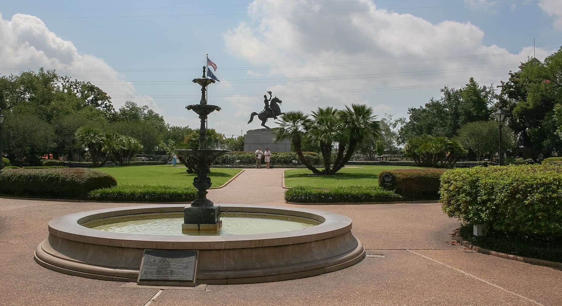
Jean-Baptiste Le Moyne de Bienville founded New Orleans in 1718 on a crescent of relatively high ground, chosen because Bayou St. John gave a back route to Lake Pontchartrain and saved a hundred miles of river. France ran it until 1762, when Louis XV handed Louisiana to his Spanish cousin in a secret treaty; Spain held it for four decades, gave it back to France in 1800, and Napoleon sold the whole territory to the United States three years later. The formal transfers both happened in the Cabildo on Jackson Square, twenty days apart in the winter of 1803.
The Spanish period is the one you can see. Two fires, in March 1788 and December 1794, destroyed most of the original wooden French town, and the rebuilding happened under Spanish building codes that required brick, tile roofs and firewalls. So the Vieux Carre a visitor photographs is Spanish colonial architecture on a French street plan, with the cast iron galleries added later still, in the nineteenth century, under American rule. Almost nothing French colonial survives above ground. The Old Ursuline Convent of 1752 is the exception and is worth seeing for that reason alone.
The Quarter came close to being lost twice, once to slum clearance and once to a riverfront expressway proposed in the 1960s and killed in 1969. The Vieux Carre Commission, created in 1937 to control what could be done to buildings there, is among the earliest such bodies in the United States, though not the first: Charleston beat it by six years.
What Creole actually means here
Creole in New Orleans originally meant born in the colony rather than in Europe or Africa, and it applied across race: there were white Creoles, Creoles of color and enslaved Creoles. It described a culture, a language and a legal position rather than an ancestry, which is why the word is used so loosely elsewhere and so precisely here. The people it named were Catholic, French and Spanish speaking, and organized socially in ways the arriving Anglo-Americans found alien.
The category that has no equivalent in the rest of the American South is the gens de couleur libres, the free people of color. Under French and Spanish law they could own property, inherit, learn trades, sue and be educated, and by the 1840s they owned a substantial share of Faubourg Treme, the neighborhood immediately behind the Quarter that is usually described as the oldest Black neighborhood in the country. Treme produced the first Black daily newspaper in the United States, L'Union, in 1862.
The Caribbean layer arrived almost all at once. Refugees from the Haitian Revolution had been trickling in for years when Spain expelled them from Cuba in 1809, and more than 10,000 landed in New Orleans within a year, split roughly evenly between white colonists, free people of color and the enslaved. They effectively doubled the city's population and nearly tripled its free population of color, and they brought French Caribbean food, Catholicism folded around West African practice, and musical habits that stayed. A city that had been drifting toward American English went back to speaking French for another generation.
Where the music came from
The honest version is a chain rather than a moment. Congo Square preserved African drumming, dance and call and response in public, legally, on Sundays, for longer than anywhere else in the American South, and that ended around the middle of the nineteenth century. Jazz appears about fifty years later. The connection is real but it runs through people rather than through the ground: the music went on being played in Black New Orleans, in churches, in benevolent society parades and at funerals, and it was still there when a generation with brass instruments and European harmony picked it up.
The other ingredients are specific to this city. Military band instruments were cheap and plentiful after the Civil War. Benevolent societies and social aid clubs paid for funerals with music, which is where the second line comes from and why it still happens most Sundays somewhere in the city. Opera was a genuine popular art here. And Storyville, the legal red light district that ran from 1897 until the Navy forced it shut in November 1917, put a great many musicians in steady paid work in the same few blocks at the same time.
Charles Buddy Bolden, a cornet player loud enough to be heard across a park, is usually named as the first jazz musician, playing around 1900; he was institutionalised in 1907 and never recorded. Sidney Bechet, Jelly Roll Morton and Louis Armstrong all came out of the same handful of blocks. When Storyville closed, the work went north, and so did they. Almost nothing of Storyville itself survives to look at, which is why the New Orleans Jazz National Historical Park interprets the story rather than pointing at a building.
The Creole city and the American one
After 1803 Americans arrived in numbers and were not welcome downriver, so they built upriver instead, in the Faubourg St. Mary and then further up in what became the Garden District. The two populations disliked each other enough that between 1836 and 1852 New Orleans formally split into three self governing municipalities with separate councils and budgets, divided by Canal Street. The width of that street, and the enormous median down the middle of it, is a physical record of the argument, and neutral ground survives as the local word for a median because of it.
The architecture divides along the same line and is the easiest thing to read from a car. Downriver you get the Creole townhouse and the Creole cottage: built to the pavement, no front garden, the life of the house turned inward to a courtyard, four openings across the front and a steep roof. Upriver you get detached American houses set back on lawns behind fences, Greek Revival columns and Italianate brackets, gardens on all four sides. The shotgun house, which is everywhere in between, is a nineteenth century form with likely Haitian and West African antecedents, and it spread across the whole city regardless of which side it was on.
A city below the water
New Orleans sits in a bowl. The natural high ground is the river levee and the old bayou ridges, which is exactly where the oldest neighborhoods are: the Quarter, Treme, Esplanade Ridge, Algiers Point and the sliver by the river all sit at or above sea level and all of them stayed dry in 2005. The low ground is the drained back swamp, developed only after powerful pumps arrived in the early twentieth century, and it is below sea level and sinking as the drained soil compacts.
Hurricane Katrina made landfall on 29 August 2005 and the flooding that followed was a failure of engineering rather than a simple overtopping: floodwalls and levees failed in dozens of places, including breaches on the Industrial Canal that emptied into the Lower Ninth Ward. Roughly eighty percent of the city flooded. The federal system has since been rebuilt at a cost above fourteen billion dollars, and the city's population is smaller than it was in 2005 and much smaller than its 1960 peak.
The Lower Ninth Ward is the place where that history is still visible from the street, and it is worth a slow drive and no photographs of anybody's house. Recovery there has run far behind the rest of the city: a neighborhood of more than 14,000 before the storm is roughly a third of that now, with vacant lots where the grid used to be continuous.
How to actually see it
This is a driving guide to a city whose most famous square mile should not be driven. The Quarter's grid is narrow and mostly one way, stretches of Bourbon and Royal close to vehicles during the day and evening, delivery trucks block what is left, and street parking is scarce, metered and enforced without mercy. The move is to park once in a garage on the edge of the Quarter or in the Central Business District and walk everything between Canal Street and Esplanade Avenue. It is thirteen blocks by six. You can cross it in twenty minutes.
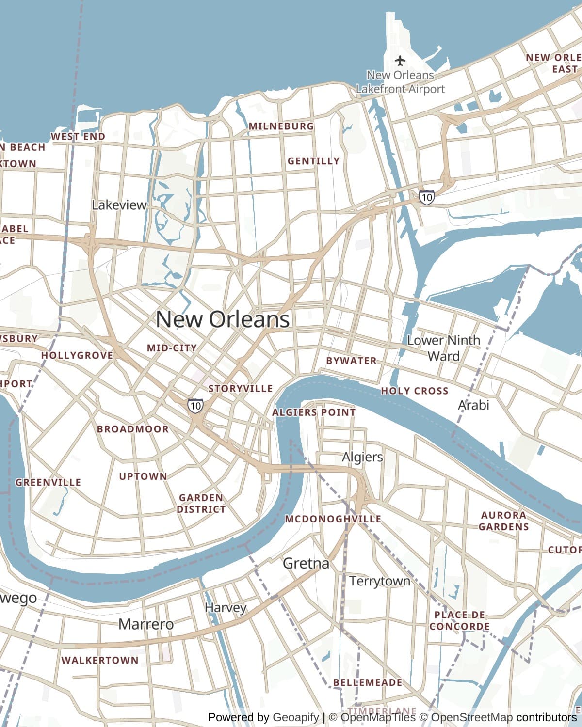
The car earns its place between neighborhoods. Esplanade out to City Park, St. Claude or Chartres downriver to Bywater and the Lower Ninth, St. Charles upriver to the Garden District and Audubon, and the bridge or the ferry across to Algiers are all genuine drives, and several of them are among the better urban drives in the country. The St. Charles streetcar covers the same upriver route more pleasantly than a car does if you would rather not park twice.
Two things worth knowing before you plan a day around them: St. Louis Cemetery No. 1 cannot be entered without a licensed guide, and Lafayette Cemetery No. 1 in the Garden District has been closed to the public for restoration and had not reopened as of August 2026.
How long to give it
One day
Park at the edge of the Quarter and walk it in the morning, then drive out Esplanade to City Park and back down to Frenchmen Street for the evening. This is the compact version and it stays inside the oldest, highest ground.
The Vieux Carre · Jackson Square and the Cabildo · Congo Square · City Park and Bayou St. John · Frenchmen Street
Two days
Day one is the Quarter, Treme and the ridge. Day two takes the car upriver for Canal Street, St. Charles, the Garden District and Audubon, then the ferry to Algiers Point at the end of the afternoon.
The Vieux Carre · Jackson Square and the Cabildo · Congo Square · St. Louis Cemetery No. 1 · City Park and Bayou St. John · Frenchmen Street · Canal Street · St. Charles Avenue and the streetcar · The Garden District · Audubon Park · Algiers Point
Three days
All fourteen stops, with the third day given to the downriver run: Bywater, the Lower Ninth Ward and Chalmette Battlefield. That day is the one most visitors skip and the one that explains the most about what happened to this city.
The Vieux Carre · Jackson Square and the Cabildo · Congo Square · St. Louis Cemetery No. 1 · City Park and Bayou St. John · Frenchmen Street · Bywater · The Lower Ninth Ward · Chalmette Battlefield · Canal Street · St. Charles Avenue and the streetcar · The Garden District · Audubon Park · Algiers Point
When to come
February through May is the good stretch: warm rather than hot, low humidity by local standards, and the season that carries Mardi Gras, French Quarter Festival in April and Jazz Fest across the last weekend of April and the first of May. Those weeks are also when hotels are most expensive and the Quarter is fullest, so the trade is real.
October and November are the underrated months, with the heat broken and the crowds thinner. Summer is genuinely punishing: high nineties with humidity to match, near daily afternoon thunderstorms, and very little shade in the Quarter. Atlantic hurricane season runs 1 June to 30 November and peaks from mid August into September, which is worth factoring into travel insurance rather than into fear.
Know before you drive
- Do not plan to drive inside the French Quarter. Park once in a garage on the edge or in the Central Business District and walk; sections of Bourbon and Royal close to vehicles, the grid is narrow and one way, and meters are enforced strictly.
- St. Louis Cemetery No. 1 has admitted visitors only with a licensed tour guide since 1 March 2015. Descendants and tomb owners can arrange access through the Archdiocese, but you cannot simply walk in.
- Lafayette Cemetery No. 1 in the Garden District remains closed to the public for restoration as of August 2026, past its projected late 2025 reopening. The surrounding streets are open and are much of the appeal.
- The Canal Street ferry to Algiers Point runs roughly every half hour for a couple of dollars each way, and takes foot passengers rather than cars. Check the current timetable, which differs at weekends.
- The St. Charles streetcar is a working transit line rather than a ride, with 1920s cars, no air conditioning and no luggage space. Pay with exact change or the transit app.
- The Lower Ninth Ward is a residential neighborhood where people live among vacant lots. Drive it slowly if at all and do not photograph houses or residents.
In an RV or with a trailer
There is nowhere sensible to take a large rig inside the French Quarter, and most of the older neighborhoods have low branches, tight one-way corners and no turning room. Campgrounds sit out in Metairie, Chalmette and across the lake, and the practical approach is to leave the rig on a site and come in by car, rideshare or the streetcar. Chalmette Battlefield and City Park are the two stops on this route with parking that suits a big vehicle.
Questions
- Can you drive around the French Quarter?
- You can, but it is a poor idea. The grid is narrow and largely one way, sections of Bourbon and Royal close to vehicles, delivery traffic blocks the rest, and parking is scarce and strictly enforced. The Quarter is thirteen blocks by six and crosses in about twenty minutes on foot. Park once at the edge and walk it, and use the car between neighborhoods.
- Why does the French Quarter look Spanish?
- Because the Spanish rebuilt it. Fires in 1788 and 1794 destroyed most of the original French wooden town while Spain governed Louisiana, and reconstruction followed Spanish codes requiring brick, tile roofs and firewalls. The street plan is French, surveyed in 1721, and the iron galleries are later American additions. The Old Ursuline Convent of 1752 is the only French colonial building in the Quarter to survive both fires.
- Can you visit St. Louis Cemetery No. 1 on your own?
- No. Since 1 March 2015 the Archdiocese has required all visitors to be accompanied by a licensed tour guide, following years of vandalism. Families of those buried there, tomb owners and genealogists can arrange separate access.
- Is Lafayette Cemetery No. 1 open?
- Not as of August 2026. It closed for a major restoration of walkways and tombs that was once projected to finish in late 2025 or early 2026, and the reopening has slipped. Only permitted workers and families tending graves are admitted. The Garden District streets around it are open.
- Was jazz really born in Congo Square?
- Not directly. Congo Square is where African drumming, dance and call and response survived publicly and legally under the Code Noir's Sunday rule, longer than anywhere else in the American South, but it stopped being a performance space around the mid nineteenth century and jazz emerges around 1900. The music passed through Black New Orleans in churches, parades and funerals in between, and was folded into jazz by a later generation.
- How much of New Orleans is below sea level?
- Roughly half. The oldest neighborhoods, including the French Quarter, Treme, Esplanade Ridge and Algiers Point, sit on the natural river levee and old bayou ridges at or above sea level, which is why they stayed dry in 2005. The low-lying areas are drained former swamp developed in the twentieth century, and they continue to subside as the soil compacts.
Connects to
Sources: Jean Lafitte National Historical Park and Preserve, New Orleans Jazz National Historical Park, The Historic New Orleans Collection, 64 Parishes, Louisiana Endowment for the Humanities, Louisiana State Museum, Preservation Resource Center of New Orleans.
Reviewed August 2026
Hear it from the road
Whistlestop tells you these stories automatically as you pass them. No searching, no tapping, nothing to ask.