Live on the road
Skyline Drive Audio Tour
Whistlestop narrates far more of the drive than this guide can list, automatically, as you pass each one.

The field guide
The road itself
Surveyors went out on the ridge in January 1931, and ground was broken on 18 July that year. The first money was federal drought relief, and the first crews were Virginia farmers and apple pickers who needed the work. Congress added a million dollars in the autumn of 1932. The road cost between $39,000 and $51,500 a mile, and it went in a section at a time: Thornton Gap to Swift Run Gap, thirty-four miles through the middle, opened on 15 September 1934; the north end to Front Royal on 1 October 1936; the south end to Jarman Gap on 29 August 1939.
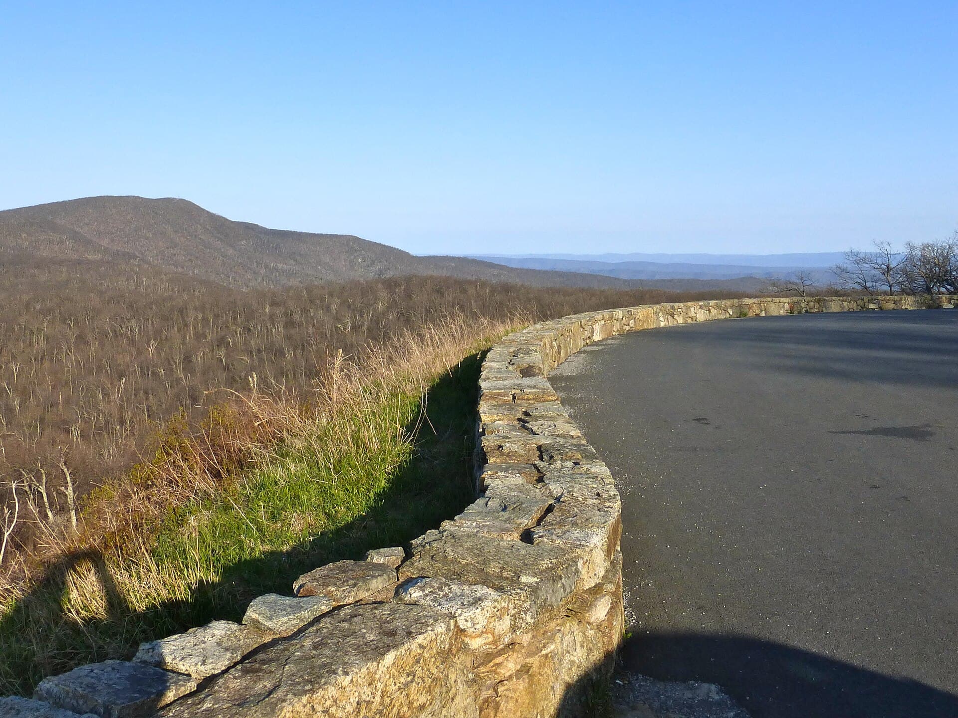
The Civilian Conservation Corps arrived in 1933 and did much of what makes the road look the way it does. Ten CCC camps worked in the park. They cut the dead chestnuts the blight had left standing along the ridge, graded and planted the cut slopes with native stock grown in their own nursery, and laid the dry stone guard walls that still line the overlooks. The first guardrails were chestnut logs, and they came out in the 1950s. The overlooks were sited to frame two views the park's founding legislation named, west over the Shenandoah Valley and east over the Piedmont, and more than seventy of them were built.
The speed limit is thirty-five, and it is enforced, and it is the point. Driven straight through, the whole length takes about three hours. Nobody who drives it that way has really seen it.
Skyline Drive was listed on the National Register in 1997, named a National Scenic Byway in 2005 and designated a National Historic Landmark in October 2008. Fifty-six miles of it were repaved and nineteen overlooks restored in an eighteen-month, $15 million project the Park Service reported finished in April 2024.
How it became half of something longer
In August 1933 Franklin Roosevelt came up to see the CCC camps in the new park with Harold Ickes, his Secretary of the Interior, and Virginia's senator Harry Byrd. Riding the finished middle of the Drive, Byrd suggested carrying a road like it south along the Blue Ridge all the way to the Great Smoky Mountains, where the other new eastern national park was taking shape. Ickes approved the park-to-park highway as a public works project that November. It became the Blue Ridge Parkway.
The two roads meet at Rockfish Gap, and the seam is less tidy than it looks on a map. The last eight and a half miles of Skyline Drive, from Jarman Gap down to the gap, were built in 1939 as part of the Parkway and only transferred to Shenandoah in 1961. Drive south off the end of Skyline Drive and the milepost numbering starts again at zero, which is the only way you will know you have crossed from one to the other.
They are twins with different temperaments. Skyline Drive runs entirely inside one national park that charges an entrance fee; the Parkway threads four hundred and sixty-nine miles between two of them and has never charged anything. The Parkway is a long, narrow ribbon of parkland through farm country; Skyline Drive is the spine of a single wild place, and almost everything you stop for is a short walk from the car.
Who lived here first
Shenandoah was not wilderness when the park was made. Congress authorized it in 1926 on condition that Virginia deliver the land, and Virginia did so by buying or condemning more than three thousand separate tracts under a Public Park Condemnation Act passed in 1928. At least five hundred families were displaced from the mountains in the process. The Fox Hollow trail at Dickey Ridge walks through one of their farms, and on many trails in the park the stone walls, the rock piles and the periwinkle in the woods are what they left.
They were described at the time, in books and in official argument for the park, as people almost entirely cut off from the rest of American life. The National Park Service's own later archaeology contradicted that: the homesites turned up the same bought goods and the same ties to a cash economy as anywhere else in rural Virginia. That picture had suited the case for taking the land.
The other kind of mountain resident was the resort guest. George Freeman Pollock had been running Skyland near Stony Man since the 1890s, and it became part of the park rather than being cleared from it. Herbert Hoover built his summer camp on the Rapidan in 1929 and gave it away three years later. The park was established on 26 December 1935, and Roosevelt dedicated it at Big Meadows on 3 July 1936.
Separate, then together
Shenandoah was built as a segregated park in a segregated state. The planning papers of the 1930s set aside Lewis Mountain as a separate area for Black visitors, and it opened in the summer of 1939: a picnic ground and campground first, then a lodge and cabins in 1940. For a time in the 1940s the park's own sign there carried the words "Negro Area."
The same year it opened, the park tried the other thing. Pinnacles Picnic Ground was chosen for its first integration effort in 1939, open to everyone, and the superintendent reported complaints from white visitors that August. Arno Cammerer, who led the Park Service, and Harold Ickes at Interior both pushed against the separate facilities, and the park's own first superintendent resisted them.
A federal rule in December 1945 required full desegregation of every facility in the national parks. Lewis Mountain and the main dining room at Panorama were integrated in October 1947, and every facility in the park by the summer of 1950. Black families kept coming to Lewis Mountain through the 1950s regardless. It is still there at milepost 57.5, still with thirty campsites, and the old sign is now an exhibit.
Two mountain ranges, one on top of the other
The oldest rock in the park formed between 1.2 and 1.0 billion years ago, deep in the roots of a mountain range geologists call the Grenville, raised by colliding plates much as the Himalayas are now. It wore down over hundreds of millions of years to rolling hills, which is roughly what the Piedmont east of the park still looks like.
About 570 million years ago the plates began to pull apart, and lava poured up through the rifts, flow after flow over several million years, each layer twenty to more than a hundred feet thick, until it covered more than four thousand square miles of what is now Virginia, Maryland and Pennsylvania. Mountain-building later cooked that basalt into greenstone, the green coming from new minerals, chlorite and epidote. It caps Stony Man, Hawksbill and many of the highest peaks, and its flows are why Stony Man rises in steps.
The rift widened into an ocean, the Iapetus, which laid down sand and mud on top. Then the plates reversed again, closed that ocean, and pushed up the Appalachians, which at their height around 350 to 300 million years ago were probably as big as the Himalayas. What you drive along now is their worn-down stump. To see the lava's cooling cracks as columns, stop at Compton Peak, the Indian Run Overlook near mile 10, or Crescent Rock near mile 44.
The forest, and what lives in it
The woods along the Drive are younger than they look, and they have lost two trees within a century. The American chestnut, once common on these ridges, was effectively gone by the 1930s to an imported blight, and the CCC spent years clearing the dead trunks. Then the hemlock woolly adelgid, a small aphid-like pest, cost the park about ninety percent of its hemlocks; the Limberlost grove is where to see what that looks like, and what the survivors under treatment look like too.
Black bears are common. The park puts the population somewhere from the low to the high hundreds, depending on how much food the forest produces in a given year. They den in October and November, the cubs are born around February, and they come out in April or May. Keep your distance, and never feed one.
Deer and wild turkey cross the Drive all day, which is one more reason for the thirty-five. On the cliffs, peregrine falcons have come back after the park released thirty-six young birds from Hawksbill between 1989 and 1993; a pair nested on Stony Man from 2005 to 2007 and raised eight young. Big Meadows is burned and mowed on purpose to keep it open, and it is the best place in the park to see what grows and grazes in open ground.
How long to give it
Half a day
The middle of the Drive, which is also the part built first. Come in at Thornton Gap from Luray or Sperryville, go south through the tunnel, climb Stony Man or Hawksbill, walk the Limberlost, and finish at Big Meadows with gas, lunch and the visitor center.
Marys Rock Tunnel · Skyland and Stony Man · Limberlost · Hawksbill · Big Meadows
One day
The whole length, north to south, with a short walk in each district. It is about three hours of driving at the limit, so this is a full day with time to stop, and it ends at the head of the Blue Ridge Parkway if you want to keep going.
Front Royal Entrance · Dickey Ridge Visitor Center and Fox Hollow · Marys Rock Tunnel · Skyland and Stony Man · Hawksbill · Big Meadows · Lewis Mountain · Blackrock Summit · Rockfish Gap
A long weekend
Two nights, at Skyland or Big Meadows, or in one of the campgrounds, with time for the longer walks: Overall Run Falls on the way in, Dark Hollow Falls and a booked Rapidan Camp tour in the middle, and Loft Mountain and Blackrock on the way out.
Front Royal Entrance · Dickey Ridge Visitor Center and Fox Hollow · Compton Peak · Overall Run Falls · Marys Rock Tunnel · Pinnacles Picnic Ground · Skyland and Stony Man · Limberlost · Hawksbill · Dark Hollow Falls · Big Meadows · Rapidan Camp · Lewis Mountain · Loft Mountain · Blackrock Summit · Rockfish Gap
When to come
October is the answer most people give and the one with the crowds. The park declines to predict a peak, because a road a hundred miles long at these elevations turns over weeks rather than on a date; color moves down the mountains through the month, and the park's valley webcam is the best way to watch it happen. Fall weekends fill the overlooks and the campgrounds, which are often booked months ahead.
The views are clearest in winter and haziest in high summer. Some of that haze is natural, from the forest itself, and much of it is pollution, and in summer more of the sulphur in the air turns to particles. A cold, clear winter day can show several ridgelines and the farms in the valley in detail; a hot August afternoon may show the next mountain and not much else.
Most facilities open between late March and early May and close between early and late November. The Drive itself stays open around the clock but shuts, sometimes for days, when ice or snow makes it unsafe. The visitor centers close when it does.
Know before you drive
- The entrance fee is $30 per private vehicle, good for seven days, or $55 for a Shenandoah annual pass; America the Beautiful passes are accepted. The park has taken no cash at its entrance stations since 1 July 2025, so bring a card.
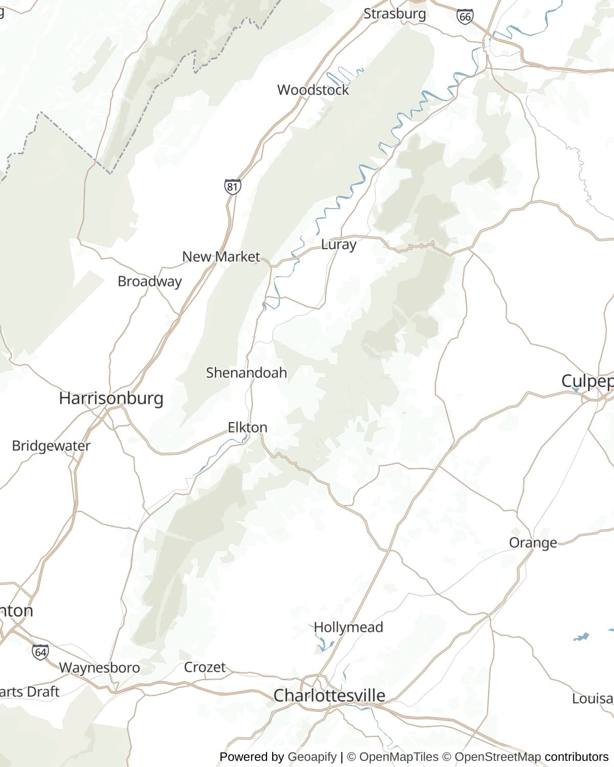
- There are four entrances: Front Royal at mile 0, Thornton Gap at 31.5 (US 211, Luray and Sperryville), Swift Run Gap at 65.5 (US 33, Elkton) and Rockfish Gap at 104.6 (I-64 and US 250).
- There is one gas station in the park, at the Big Meadows Wayside, mile 51.2, and it is seasonal (25 March to 29 November in 2026). Fill up outside before you come in.
- The speed limit is 35 miles an hour almost everywhere, and conditions often call for less. Deer, bears and turkeys cross without warning. To look at wildlife, pull completely off the road and stay in the car.
- Old Rag, the park's most famous hike, is not on the Drive; its trailhead is on the east side of the park. It needs a day-use ticket from 1 March to 30 November in addition to the entrance pass.
- For closures, text SHENALERTS to 888777, or check the Skyline Drive status page on nps.gov before you set out in winter.
In an RV or with a trailer
RVs and trailers are welcome, but Marys Rock Tunnel at mile 32.2 clears 12 feet 8 inches in both lanes, so anything taller cannot drive the full length and has to stay north of the tunnel or join south of it at Swift Run Gap or Rockfish Gap; the park also asks drivers to use low gear on the downhills. Mathews Arm, Big Meadows and Loft Mountain campgrounds all take most RVs with a tow vehicle and have seasonal dump stations and potable water, but there are no hookups anywhere in the park; Lewis Mountain has three pull-through sites and no dump station.
Questions
- How long does it take to drive Skyline Drive?
- About three hours end to end without stopping, at the 35 mile-an-hour limit. With overlooks and a couple of short walks, give it a full day for the whole 105 miles, or a half day for the central section between Thornton Gap and Big Meadows.
- Does it cost money to drive Skyline Drive?
- Yes. The whole Drive is inside Shenandoah National Park, so the park's entrance fee applies: $30 per private vehicle for seven days, card only. The Blue Ridge Parkway, which begins where Skyline Drive ends, is free.
- How many overlooks are on Skyline Drive?
- More than seventy. Counts vary with what gets called an overlook: the Park Service says seventy-six were built in the 1930s, and its planning documents count sixty-nine historic overlooks today, besides many drive-by views.
- Is Skyline Drive part of the Blue Ridge Parkway?
- No, though they join end to end at Rockfish Gap and together run about 574 miles. The Parkway was proposed in 1933 after Franklin Roosevelt toured Skyline Drive, and the last eight and a half miles of Skyline Drive were in fact built as Parkway and transferred to Shenandoah in 1961.
- Can you drive an RV on Skyline Drive?
- Yes, as long as it clears 12 feet 8 inches for Marys Rock Tunnel at mile 32.2, the only tunnel on the Drive. Three of the four campgrounds have seasonal dump stations, and none has hookups.
Connects to
Sources: Shenandoah National Park, National Park Service, NPS, Skyline Drive history, NPS, Driving Skyline Drive, NPS, Operating dates and hours, NPS, The Displaced, NPS, Greenstone lava flows, NPS, Scenic vistas and air quality, Skyline Drive Historic District, Virginia Department of Historic Resources, Skyline Drive, The Cultural Landscape Foundation, Peregrine hacking in Shenandoah, Center for Conservation Biology.
Reviewed September 2026
Hear it from the road
Whistlestop tells you these stories automatically as you pass them. No searching, no tapping, nothing to ask.