Live on the road
Blue Ridge Parkway Audio Tour
Whistlestop narrates far more of the drive than this guide can list, automatically, as you pass each one.

The field guide
The road itself
The idea came out of a single 1933 visit: Franklin Roosevelt toured the newly built Skyline Drive in Virginia, and Senator Harry Byrd proposed stringing a scenic road south from it all the way to the Great Smoky Mountains, then also new. Secretary of the Interior Harold Ickes approved it that November, and a twenty-six-year-old landscape architect named Stanley Abbott, three years out of Cornell, was put in charge of designing the whole four hundred and sixty-nine miles. Construction began on 11 September 1935.
Abbott thought of the road as sculpture rather than infrastructure: a ribbon laid across the mountains with wayside parks bulging out along it like beads on a string, framing fields, fences, lakes and hills rather than paving through them. 'The idea is to fit the Parkway into the mountains as if nature had put it there,' he said, and the road still reads that way, with no billboards, no commercial development, and a speed limit that has never exceeded 45 miles an hour anywhere on it. The Civilian Conservation Corps, the Boys in Green, replanted the roadside with native trees and wildflowers under Abbott's direction while the Works Progress Administration built the grade itself.
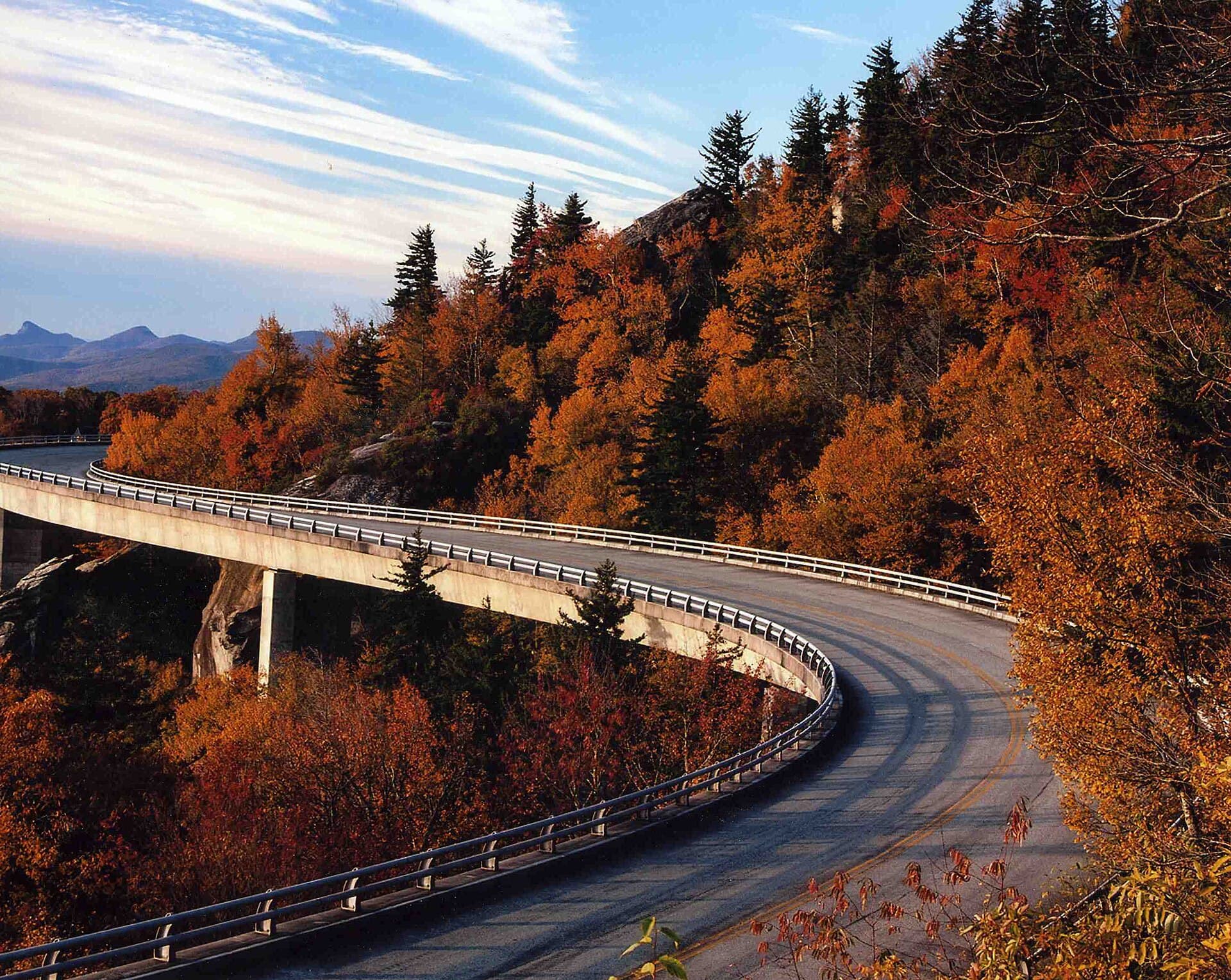
Most of the parkway was finished by the end of 1966. The last piece, the Linn Cove Viaduct around Grandfather Mountain, took another twenty-one years and wasn't dedicated until 11 September 1987, fifty-two years to the day after the first shovel went in. There is no entrance fee anywhere on the parkway and no toll was ever charged, a fight the North Carolina highway commissioner E. B. Jeffress won on the road's behalf. In 2025 it recorded 16,533,753 visits, more than any other unit in the National Park System, Great Smoky Mountains and Yellowstone included.
Hurricane Helene, and the parkway now
In September 2024, Hurricane Helene put more damage on this parkway than anything in its ninety years before it: roughly $1.7 billion, concentrated in a run of North Carolina mountains where landslides took out whole sections of roadbed rather than merely blocking it. As of the National Park Service's closures page, dated 16 August 2026, a stretch running in segments from around milepost 317 near Linville Falls to milepost 355 near the Mount Mitchell spur remains closed, with access prohibited outright on some sections and recreation prohibited on others. The Craggy Gardens area further south, including its picnic grounds, has also been closed.
Recovery is running in phases and the Park Service has been specific about timing. Phase 2, covering repairs to landslide sites mostly between roughly milepost 318 and 323, was targeted for completion by fall 2026. Phase 3, covering more than twenty sites between roughly milepost 337 and 352, was targeted for the end of 2026. NPS has said it expects all road-related Helene recovery work finished by the end of 2026, though heavy equipment will keep moving through open sections on the way to active work sites well past that.
What this means for a drive planned now: Linville Falls, Mount Mitchell, and Craggy Gardens, three of the parkway's signature stops, sit inside or hard against the closed zone. Treat Linville Falls as the effective southern end of a drive from Virginia until the closures lift, and check nps.gov/blri/planyourvisit/roadclosures.htm before you leave, not the week before. This is the single fastest-changing fact about the parkway and nothing printed here should be trusted over that page on the day you travel.
Mountains old enough to have worn down twice
The rock at the core of the Blue Ridge is about 1.1 billion years old, crystallized during the Grenville orogeny when these mountains were part of an entirely different, far taller range on the supercontinent Rodinia. That range wore flat, the crust it sat on rifted apart to open the Iapetus Ocean, and hundreds of millions of years later the collision that closed that ocean and stitched Africa against North America, the Alleghenian orogeny, threw the Appalachians back up a second time from what was left of the first. The Blue Ridge is, in a real sense, mountains built twice from the same material.
That deep age shows in what lives on it. The high balsams above about 5,500 feet, at Richland Balsam and a handful of other peaks, carry one of only ten surviving stands of southern Appalachian spruce-fir forest, a boreal ecosystem more at home in Quebec that has been stranded here since the last ice age by nothing but elevation. The whole region is sometimes called the salamander capital of the world, with more species of the animal than anywhere else on Earth, and black bear sightings along the roadside are common enough that rangers post reminders rather than warnings.
The color show runs on elevation rather than the calendar. Above 5,000 feet the leaves start turning in late September, and the front works downhill through October, usually cresting in the North Carolina section somewhere around the fifteenth to the twenty-second before finishing in the lowest valleys by early November. Rhododendron runs the opposite direction earlier in the year, starting in low country in early June and climaxing on the high balds at Craggy Gardens around the eighteenth to the twenty-second of the month, in a normal year, closures permitting.
Whose ground it crosses
The parkway touches Cherokee land at both ends, in different centuries and in different ways. Up at Peaks of Otter, Sharp Top Mountain once marked the recognized northern boundary of the Cherokee Nation. Four hundred miles south, the final fifteen miles of the road run through the Qualla Boundary, the home of the Eastern Band of Cherokee, and getting there took five years of negotiation: the Eastern Band withheld the right-of-way from 1935 until 1940, and only agreed to it after the federal government committed to the road's design and to compensation on the tribe's terms. Oconaluftee Indian Village, a recreated Cherokee town from the 1700s, stands a short walk from where the parkway now ends.
In between, the road passes through a landscape that was mostly small mountain farms until the twentieth century turned it into something else. Humpback Rocks preserves what one of those farms looked like. Mabry Mill preserves what its economy ran on. Moses Cone's estate is the other extreme entirely, a textile fortune's idea of a mountain retreat, twenty-three Colonial Revival rooms with carriage roads cut for pleasure rather than passage. The Blue Ridge Music Center, further north on the Virginia line, exists because this stretch of mountains produced more old-time and bluegrass musicians per capita than anywhere else in the country, a fact the road did not create but happens to run directly through the middle of.
How long to give it
One day
The Virginia highlights, out of Roanoke: Peaks of Otter for the lake and the lodge, then south to Mabry Mill for lunch, with the Blue Ridge Music Center as an easy add if it's open season. Comfortably done in a day with room to walk.
Peaks of Otter · Mabry Mill · Blue Ridge Music Center
A long weekend
Virginia end to end, or as much of North Carolina as the current closures allow. Northbound from Cherokee, Waterrock Knob and Richland Balsam make a strong first afternoon; from there, check status before committing to anything past Linville Falls, since the Helene-damaged stretch may force a turnaround well short of Asheville.
Humpback Rocks · James River · Peaks of Otter · Mabry Mill · Doughton Park · Moses H. Cone Memorial Park · Linn Cove Viaduct · Linville Falls
A week
The whole road, or as much of it as is open, at a pace that leaves room to walk every trail listed here. Expect the North Carolina middle section to require a detour around the closed zone via US 221 or US 19, adding real time; build a spare day into the plan for exactly that.
Humpback Rocks · James River · Peaks of Otter · Mabry Mill · Blue Ridge Music Center · Doughton Park · E.B. Jeffress Park · Moses H. Cone Memorial Park · Linn Cove Viaduct · Linville Falls · Richland Balsam · Waterrock Knob · Southern terminus at Oconaluftee
When to come
October is the classic answer and the most crowded one. Fall color starts above 5,000 feet in late September and works downhill through the month; most of the North Carolina parkway peaks in the second and third weeks of October. Weekend traffic and full parking areas at the popular overlooks are routine that month, and this is the busiest road in the entire National Park System to begin with.
Early June brings the rhododendron, climaxing at Craggy Gardens most years around the 18th to the 22nd, though that stop's Helene-related closures may affect access; check before planning a trip around the bloom specifically.
Weather runs ten to fifteen degrees cooler on the ridgeline than in the valleys below, in any season, and fog is routine at elevation, especially in early morning. Some high sections close overnight or for stretches of winter when ice threatens, without a fixed calendar; the road-status page is the only reliable source on a given day.
Know before you drive
- No entrance fee anywhere on the parkway, and it has never been a toll road.
- Speed limit tops out at 45 miles per hour and drops lower on many curves; there are no traffic signals the entire length.
- Commercial vehicles need Park Service approval to use the parkway at all.
- Fuel, food and cell signal are thin between the gateway towns the parkway passes near. Only two full-service lodges remain directly on the road, Peaks of Otter (milepost 86) and Pisgah Inn (milepost 408.6), both seasonal, roughly April through October.
- Twenty-six tunnels cross the parkway, nearly all in North Carolina. Most clear 13 feet, but the lowest, Lickstone Ridge Tunnel, clears only 11 feet 3 inches. Check tunnel heights before driving anything tall.
- As of August 2026, multiple sections are closed: routine bridge and maintenance work at several Virginia and North Carolina mileposts, and Hurricane Helene damage closing a roughly seventy-mile stretch of North Carolina in segments, from around milepost 317 to 355, plus the Craggy Gardens area near milepost 364. Check nps.gov/blri/planyourvisit/roadclosures.htm before any drive that depends on a specific stretch being open.
In an RV or with a trailer
Twenty-six tunnels are the thing to plan around: most clear 13 feet, but Lickstone Ridge Tunnel clears only 11 feet 3 inches, and a route through it has to be checked in advance rather than discovered at the mouth of the tunnel. Grades and switchbacks are constant, so budget well below highway speed for the whole drive. Fuel and dump stations sit in the gateway towns rather than on the parkway itself; plan around them rather than around parkway mileposts.
Questions
- Is the Blue Ridge Parkway free?
- Yes. There is no entrance fee anywhere on the 469 miles and it has never operated as a toll road, a fight the North Carolina highway commissioner E. B. Jeffress won when the road was first being built.
- Is the Blue Ridge Parkway open after Hurricane Helene?
- Most of it, but not all. As of the National Park Service's closures page dated 16 August 2026, a roughly seventy-mile stretch of North Carolina remains closed in segments, from around milepost 317 near Linville Falls to milepost 355 near the Mount Mitchell spur, plus the Craggy Gardens area near milepost 364. NPS expects road-related recovery substantially complete by the end of 2026. Check the current status page before any trip that depends on that stretch.
- How long does it take to drive the whole parkway?
- At the posted 45 mile-an-hour limit with no stops, about eleven hours for all 469 miles, which nobody actually does. Most people give it three to seven days to allow for the overlooks, the short trails, and the two national parks at either end.
- When is fall color best on the Blue Ridge Parkway?
- It runs on elevation rather than a fixed date. Color starts above 5,000 feet in late September and moves downhill through October, with most of the North Carolina parkway peaking in the second and third weeks of the month and the lowest valleys finishing by early November.
- Can you drive an RV on the Blue Ridge Parkway?
- Yes, but check tunnel heights first. Twenty-six tunnels cross the road, almost all in North Carolina, and while most clear 13 feet, the lowest, Lickstone Ridge Tunnel, clears only 11 feet 3 inches. Grades are constant and services are off the parkway in gateway towns rather than on it.
Connects to
Sources: Blue Ridge Parkway, National Park Service, NPS road and site status, Blue Ridge Parkway, NPS, Helene impacts and recovery, Linn Cove Viaduct, Innovative Bridge Technologies database, Florida International University, Blue Ridge National Heritage Area.
Reviewed August 2026
Hear it from the road
Whistlestop tells you these stories automatically as you pass them. No searching, no tapping, nothing to ask.