Live on the road
The Old King's Highway Audio Tour
Whistlestop narrates far more of the drive than this guide can list, automatically, as you pass each one.

The field guide
A footpath that kept getting promoted
This line across the Cape is older than the towns on it. Wampanoag people kept a set of paths along the north shore linking the harbours of Cape Cod Bay, and the English who came out from Plymouth in the 1630s widened them rather than survey anything new. It became the King's Highway, then the post road, then the stagecoach route, and by the 1920s an automobile road with the number 6A painted on it.
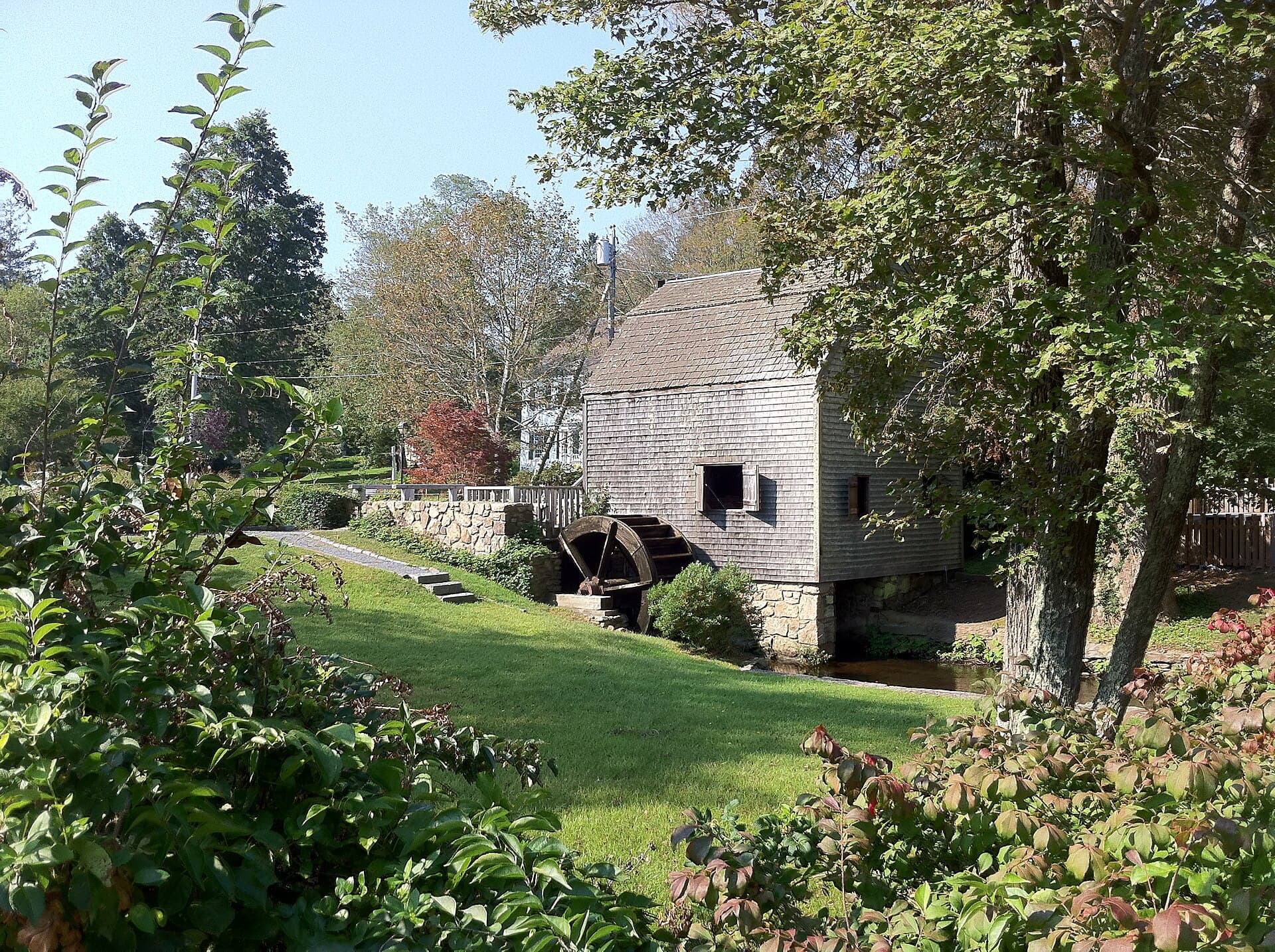
It stayed the only road until 1950, when the first stretch of the Mid-Cape Highway opened two miles south and started taking the traffic away; that road reached Dennis in 1952 and Orleans in 1959. Losing the traffic is the single most important thing that ever happened to Route 6A. Every piece of commerce that would otherwise have been built along it went to Route 132 and Route 28 instead, and the old road was left with what was already on it: villages, farm walls, a mill, and several hundred houses built between 1680 and 1860.
The Federal Highway Administration made it a National Scenic Byway in 2021, one of four in Massachusetts. That is a marketing designation rather than a protection, and it arrived nearly fifty years after the thing that actually protected the road.
The law that stopped the clock
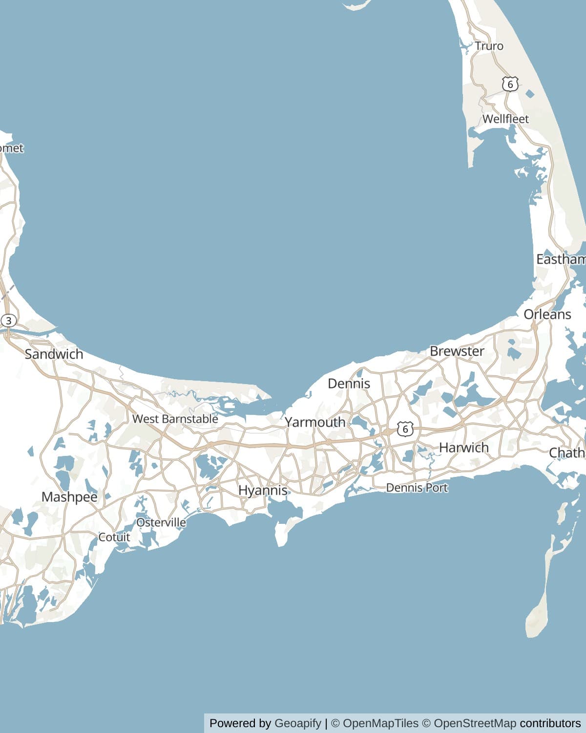
In 1973 the Massachusetts legislature passed Chapter 470, the Old King's Highway Regional Historic District Act, and six towns took it up. It covers everything north of Route 6 from Sandwich to Orleans, and it is not advisory. Change the outside of a building in the district and you go in front of your town's Old King's Highway committee: paint colour, window sashes, siding, roof pitch, fences, signs, solar panels, the lot. A satellite dish on a street elevation is a hearing.
The Cape Cod Commission, the Chamber and all six towns call it the largest historic district in the United States. They are the same six towns talking and nobody independent seems to have adjudicated it, so take the superlative as local pride and look at the mechanism instead, which is genuinely unusual: this is not a museum village or a preservation easement on a few buildings, it is ordinary zoning power over the appearance of about thirty four miles of working road where several thousand people live.
You will hear both sides of it from residents within an afternoon. It is why there is no strip development, no illuminated sign and almost no vinyl on 6A, and it is also why replacing your own windows takes three months. The National Register district in Barnstable alone, one of eight along the corridor, covers more than a thousand acres and nearly five hundred buildings.
How to read a house on 6A
Timothy Dwight, the president of Yale, came to the Cape in 1800, looked at the low shingled cottages and coined the phrase Cape Cod house. The pattern is a story and a half under a steep roof, a central chimney, and almost no ornament, built low and tight because the wind here has nothing to slow it down. What varies is the width, and the width tells you how a family did.
A half Cape is a door at one end with two windows beside it: the starter house, sometimes literally a wedding present, built to be added to. A three-quarter Cape has the door off centre with two windows on one side and one on the other, which is the half Cape after a good decade. A full Cape has the door in the middle and two windows each side. Once you have seen the sequence you cannot stop reading it, and on 6A you will pass all three within a mile.
Then the money arrives and the houses change shape. The Federal and Greek Revival piles in Yarmouth Port and Dennis, with their columns and their fanlights and their upstairs windows facing the water, are what the merchant fleet paid for between about 1820 and 1860. The widow's walks on the roofs are real, though the name is Victorian sentiment: they were built to reach the chimney with a bucket of sand.
Salt, glass and the sea
Every fortune along this road came out of salt water, one way or another. The first was salt itself. From the 1770s the bay shore filled up with evaporating works, shallow wooden vats under sliding roofs that turned seawater into salt for curing fish, and at the peak there were hundreds of them between Sandwich and Orleans. Cheap mined salt from New York killed the trade by the 1870s, and almost nothing of it survives except the odd weathered board reused in a barn.
The second was glass. Deming Jarves put the Boston and Sandwich Glass Company on the marsh edge in 1825 because Sandwich had cheap firewood, a harbour and nothing else going on, and for sixty years the town made pressed glass for the whole country. When the workers joined a national strike in 1887 the company let the furnaces go cold, and in 1888 it closed for good. The town lost its employer and its young people in one decade, which is a large part of why the streets around Shawme Pond still look the way they do.
The third and the biggest was the sea trade. Yarmouth, Dennis and Brewster sent an extraordinary number of men to sea as masters rather than crew: the Brewster Historical Society counts 99 sea captains living in that one town between 1780 and 1870, with 50 clipper masters there in the peak year of 1850, and the houses along 6A are the receipts. Their ships never came here. They took a packet up to Boston from a landing off what is now Breakwater Road and sailed for China from there. The clipper trade, then steam, then the canal, then the railway took it all away in turn.
The bay side
The other Cape is on the far side of this road, and it is a completely different animal from the outer beach. Cape Cod Bay is shallow, warm by August, and almost surfless, which is why the towns along it are where people bring small children. The flats from Brewster east are the extreme case: at low water they run out as much as two miles and you can walk into the middle of the bay in ankle-deep water at blood temperature.
Behind the beaches are the salt marshes, at Sandwich, at Barnstable behind Sandy Neck, at Bass Hole and around Wing Island. They are the reason the bay is productive, and they are also what the boardwalks exist to cross without wrecking. Inland from those, in the woods, are the kettle ponds, dents left by buried glacial ice and filled from below by groundwater rather than by any stream, which is why they are so clear and so cold at depth.
The spring event on this side is the herring. Alewives come in from the sea in April and force their way up the brooks to the ponds where they hatched, and Stony Brook in Brewster is the best place on the Cape to stand and watch it happen. The runs were town property for centuries, netted and divided and fought over in town meeting, and they are catch-and-release now while the stocks recover.
How long to give it
Two hours
Drive it end to end without stopping much, which is still worth doing. One stop at each end and one in the middle.
Sandwich village · Barnstable village · Scargo Tower · Rock Harbor, Orleans
One day
The version most people want. Start in Sandwich in the morning, eat somewhere in Yarmouth Port or Dennis, and time the last two hours for low tide in Brewster.
Sandwich village and the Dexter Grist Mill · The Sandwich Boardwalk · West Parish Meetinghouse · Barnstable village · Yarmouth Port and the Edward Gorey House · Scargo Tower · Stony Brook Grist Mill · Breakwater Beach and the flats
Two days
Sleep somewhere in the middle, at Barnstable or Yarmouth Port, and give the second day to Brewster and the bay. In April, put the herring run first.
Sandwich village, the boardwalk and Green Briar · Sandy Neck and West Parish · Barnstable village · Yarmouth Port and Gray's Beach · The Cape Playhouse and Scargo Tower · Stony Brook and the natural history museum · The Brewster flats at low tide · Nickerson State Park and Rock Harbor
When to come
April is the specialist's month: the alewives are running at Stony Brook, the road is empty, and half the shops are shut. If the herring is what you came for, it is the only month.
Late May and June are the best all-round compromise. Everything is open, the light is long, the flats are warming up, and the July traffic has not arrived.
September and October are the other answer, and the better one for the driving. The bay holds its heat into October, the antique shops are quiet enough to talk in, and the marsh grass turns the colour of a lion.
July and August put a queue on 6A that is worst through Dennis and Brewster in the late afternoon. The road is two lanes with no passing and a great many left turns, so it does not take much. Winter is beautiful and largely closed.
Know before you drive
- This is a two lane road through the middle of six villages, with driveways, cyclists and people crossing to the beach. The limits drop to 25 and 30 in the village centres and they are enforced. Budget an hour and a half without stops, not fifty minutes.
- There is no through-traffic reason to be on 6A. If you want to make time, Route 6 runs parallel two miles south and will do the same distance in half the time.
- Most of the beaches along the bay are town beaches and want a town sticker or a daily fee in season, typically collected from late June to early September. Nickerson State Park and Sandy Neck have their own gates and their own charges.
- Check the tide before walking out on the Brewster flats, and work out when it turns. Two miles of flat fills faster than it looks, and the channels fill first, which is what cuts people off.
- Parking in the village centres is on-street and limited, and in Sandwich and Yarmouth Port it fills by late morning in summer. Most of the stops on this page have their own small car park; the villages do not.
- The Cape Cod Rail Trail crosses or shadows this road from Dennis east, which means cyclists joining and leaving 6A at intervals. It runs about 25 miles from Yarmouth to Wellfleet, with extensions being added at the western end.
In an RV or with a trailer
Route 6A takes an RV for its whole length, but it is narrow through the village centres at Sandwich, Barnstable, Yarmouth Port and Dennis, with tight corners, overhanging trees and almost nowhere to turn round if you commit to the wrong side street. Nickerson State Park in Brewster is the one full campground on the road, with over 400 sites, no hookups, a dump station, and a booking window that is effectively the day it opens for a summer weekend. It charges for day parking from late May to mid-October, and a good deal more for an out-of-state plate. Sandy Neck allows oversand driving and self-contained overnight camping on the beach with a town permit and an inspection, which is a genuinely unusual thing to be able to do.
Questions
- What is the Old King's Highway?
- It is Route 6A along the north shore of Cape Cod, and also the name of the historic district around it. The road began as Wampanoag paths linking the harbours of Cape Cod Bay, became the colonial King's Highway and post road, and is now a 34 mile scenic byway. Since 1973 everything north of Route 6 from Sandwich to Orleans has been a protected district under a state act, which is why the road looks the way it does.
- How long does it take to drive Route 6A?
- About an hour and a half end to end without stopping, and a full day if you actually stop. It is a two lane road through six village centres with limits down to 25 in places, so it is roughly twice as slow as Route 6 covering the same ground.
- Is the Old King's Highway really the largest historic district in the country?
- That is what the six towns, the Chamber and the Cape Cod Commission all say, and nobody independent appears to have checked it against other candidates. What is not in dispute is the mechanism: a 1973 state act gives six towns design control over the exterior of every building north of Route 6 from Sandwich to Orleans, which is unusual for a district covering a working road rather than a museum village.
- What is the difference between Route 6 and Route 6A on Cape Cod?
- Route 6, the Mid-Cape Highway, is the fast road down the middle of the Cape, opened in stages from 1950 and mostly divided highway now. Route 6A is the old road along the bay side through Sandwich, Barnstable, Yarmouth Port, Dennis, Brewster and Orleans. Route 6 is how you get somewhere; 6A is somewhere.
- When can you see the herring run at Stony Brook?
- April into early May, with the peak usually in the second half of April and best on a warm afternoon with a good flow in the brook. The alewives hatch in the ponds above the mill, go to sea, and return years later to the same water to spawn. It is catch-and-release only.
- Can you walk out on the Brewster flats?
- Yes, and it is the best free thing on this road. At low tide the flats reach as much as two miles offshore, in warm ankle-deep water. Check the tide table, note when it turns, and start back early, because the channels fill first and will cut you off from the beach while there is still dry sand around you.
- What restrictions does the historic district put on houses?
- Any change to the exterior of a building in the district needs a certificate from that town's Old King's Highway committee: siding, paint colour, windows, roofing, fences, signs, solar panels and outbuildings all count. Interiors are not regulated. It applies to everything north of Route 6 in Sandwich, Barnstable, Yarmouth, Dennis, Brewster and Orleans.
Connects to
Sources: Cape Cod Chamber of Commerce, Historic Route 6A, Federal Highway Administration, Old King's Highway (Route 6A) byway record, Town of Orleans, Old King's Highway Regional Historic District, Sandwich Historical Commission, landmarks and the boardwalk, Sandwich Glass Museum, the Boston and Sandwich Glass Company, West Parish of Barnstable, meetinghouse history, Sturgis Library, the oldest library building in the United States, Dennis Historical Society, the Cape Playhouse, Town of Brewster, Stony Brook Gristmill and Museum, Massachusetts DCR, Nickerson State Park, Historical Marker Database, Commemorating the Battle of Rock Harbor, Historical Society of Old Yarmouth, the Cape Cod house.
Reviewed September 2026
Hear it from the road
Whistlestop tells you these stories automatically as you pass them. No searching, no tapping, nothing to ask.