Live on the road
Cape Cod Audio Tour
Whistlestop narrates far more of the drive than this guide can list, automatically, as you pass each one.

The field guide
What the ice left
Cape Cod is a pile of dirt a glacier dropped and the sea has been tidying ever since. Twenty three thousand years ago the Laurentide ice sheet reached its limit at what are now Nantucket and Martha's Vineyard. Three lobes of it made the Cape: the Buzzards Bay lobe on the west, the Cape Cod Bay lobe through the middle, and the South Channel lobe out along the arm. By eighteen thousand years ago the ice had gone back into the Gulf of Maine, leaving ridges of bulldozed debris where the front had stalled and broad aprons of sand and gravel where the meltwater ran out in front of it.
Those aprons are the outwash plains, and they are most of what you drive on. They are also why the Cape is so flat and so porous: rain does not run off it, it goes straight down into a freshwater lens floating on salt. The dents in the plain are kettle holes, marking blocks of stranded ice that were buried in outwash and took centuries to melt. Twenty of them within the seashore are deep enough to have reached the water table and become ponds, and they are unusually clear and unusually acidic because almost nothing flows into them.
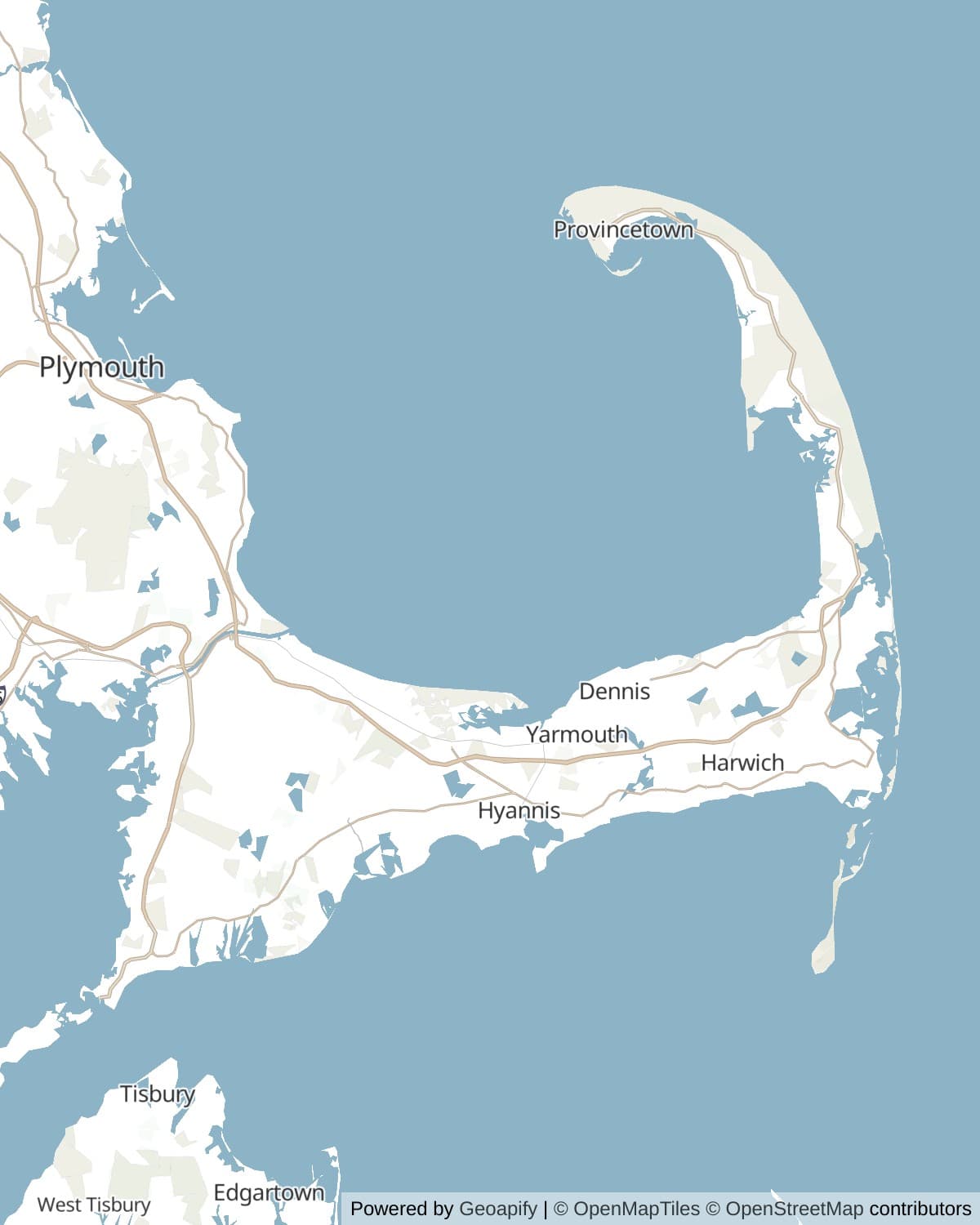
Everything since has been the ocean redistributing the pile. Waves cut into the cliffs of the outer shore and longshore currents carry the sand away, north toward Provincetown and south toward Monomoy. The hook that shelters Provincetown Harbor is made of Truro. Monomoy is made of Chatham. Nothing here is bedrock, which is the fact that explains almost every other fact on this page.
The Great Beach
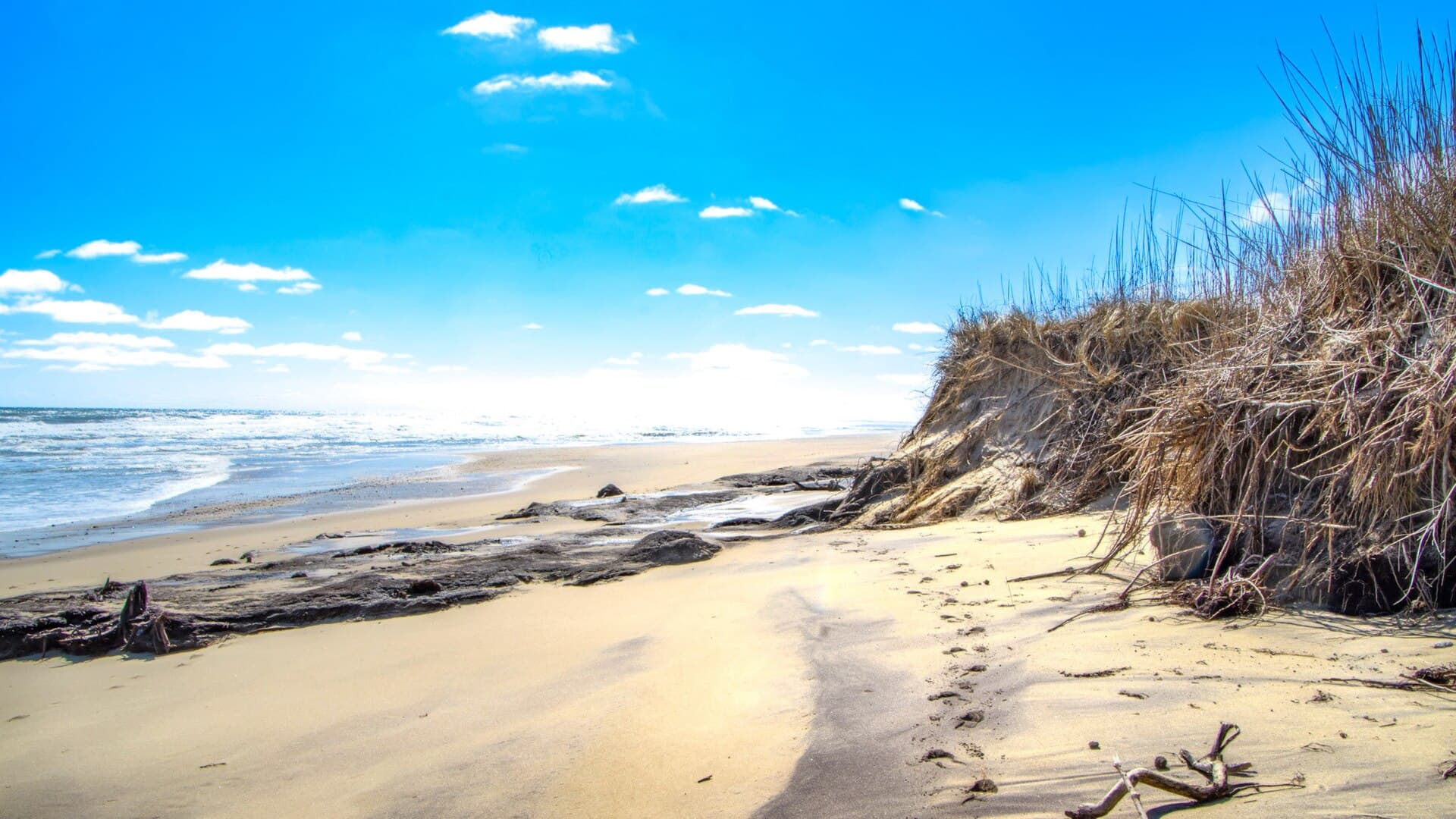
Forty miles of the Outer Cape face open Atlantic with nothing between here and Spain, and that shore is retreating. Three feet a year is the figure usually given for the oceanfront from Eastham through Truro, and the USGS is careful to say that averages mislead: one stretch can lose nine feet in a year while a stretch nearby holds for a decade, and the place doing the losing moves around. What is not in doubt is the direction.
The lighthouses keep the score. Highland Light was built in 1797 a comfortable 510 feet back from the cliff edge; by the early 1990s the gap was 128 feet, and in July 1996 the whole 430-ton tower was walked 450 feet inland on greased beams. Nauset Light followed that November, moved 336 feet with 37 feet left to spare. The Three Sisters, Eastham's original trio of 1838 towers, lost the argument outright and went into the sea in 1890.
This was the shore that killed ships. More than three thousand wrecks are recorded off the Cape, which is why the Massachusetts Humane Society put unmanned huts along the beach and why the US Life-Saving Service built nine stations here, their crews walking patrols through the night with the beat between stations measured so that two men met in the middle and exchanged a check. The Coast Guard inherited the work, and on 18 February 1952 a crew of four took a 36-foot lifeboat out of Chatham into a full nor'easter and came back with 32 of the 33 men from the stern half of the tanker Pendleton.
It is also the shore that made the writing. Thoreau walked it four times between 1849 and 1857 and the book he got out of it is still the best thing written about the place. Henry Beston meant to spend a fortnight in a cottage on Coast Guard Beach in 1926, stayed a year, and produced The Outermost House. The sea took Beston's cottage in the Blizzard of 1978, which is about as fitting an ending as a book about erosion could ask for.
Wampanoag country, and what came after
The Wampanoag have been here for something on the order of twelve thousand years, which is to say since not long after the ice left, and they are here now. The Mashpee Wampanoag Tribe holds the Old Indian Meeting House in Mashpee, the oldest Native American church building in the eastern United States, with a burying ground of its own around it; the Aquinnah Wampanoag are across the water on Martha's Vineyard. Twenty five square miles at Mashpee were reserved in 1665 by a deed from Wampanoag leaders to the tribe itself, confirmed by Plymouth Colony twenty years later. The Commonwealth abolished the self-governing Mashpee district in 1870 and made a town of it, and federal recognition did not come back until 2007.
The English arrival on the Cape is the one everybody has heard about and got slightly wrong. The Mayflower made its landfall at Provincetown on 11 November 1620, not Plymouth, and the Mayflower Compact was signed in that harbour. The company spent five and a half weeks exploring, taking corn from a Nauset cache at what is now Truro, and concluded there was not enough fresh water on the outer arm to keep them. They crossed the bay and left.
What followed was two hundred years of taking things out of salt water. Saltworks lined the bay shore, evaporating seawater by the acre. Wellfleet and Truro sent schooners to the Grand Banks. Whaling money built the Second Empire pile above Fort Hill and most of the big houses on the north side of the Cape. Every one of those trades collapsed in turn, coal killed the saltworks and kerosene killed the whales, and by the end of the nineteenth century the Cape was a poor place that people were leaving.
The summer people saved it and then nearly ate it. By 1959 the outer arm was subdividing fast enough that Congress moved, and on 7 August 1961 John Kennedy, who had summered at Hyannis Port since he was eleven, signed the Cape Cod National Seashore into being. It was the first national park assembled mostly out of private land, and the compromise that made it possible is still visible: there are houses inside the park, and towns, and roads, because buying everyone out was never the plan.
Seals, sharks and oysters
The gray seals came back, and nobody is neutral about it. Hunted to near nothing under state bounties into the 1960s and protected by the Marine Mammal Protection Act in 1972, they now haul out around Monomoy and Nauset in tens of thousands. Counts vary wildly depending on what is being counted: NOAA's pup-based estimate for United States waters was about 28,000 for 2021, while imagery-based counts for Cape Cod alone run far higher at the seasonal peak.
White sharks followed the seals, and the Outer Cape is now one of the densest seasonal aggregations of adult white sharks anywhere. State and Atlantic White Shark Conservancy researchers have catalogued hundreds of individuals off this coast. They arrive as the water warms in late spring and are most numerous from August into October, which is exactly when the beaches are busiest. The advice from every agency is the same and it is not dramatic: swim where there are lifeguards, stay in waist-deep water, do not swim near seals, and skip dawn and dusk.
Out in the bay it is whales. Stellwagen Bank sits six miles north of Provincetown, a glacial deposit shallow enough to concentrate sand lance and krill, and it feeds humpbacks, finbacks, minkes and the critically endangered North Atlantic right whale. It became a national marine sanctuary in 1992 after the Center for Coastal Studies in Provincetown nominated it a decade earlier. Commercial whale watching in the United States began from this harbour, and the boats run from late April to late October.
And then there are the oysters. Wellfleet was named Billingsgate after the London fish market before it took the name of an English oyster town, and Champlain had already called the harbour Port aux Huîtres in 1606. The bay-side flats are the productive part, running nearly ten miles from Brewster to North Eastham and reaching as much as two miles offshore at low water, far enough that people walk for half an hour and are still ankle deep.
The colony
Provincetown became an art town by accident of light and cheap rent. Charles Hawthorne opened the Cape Cod School of Art in 1899, the first outdoor summer school for figure painting in the country, and by the 1910s the trains were bringing students by the hundred. The Provincetown Art Association was founded in 1914 and is still going.
The theatre arrived a year later. The Provincetown Players formed in 1915 around George Cram Cook and Susan Glaspell, and in the summer of 1916 they staged an unknown Eugene O'Neill's Bound East for Cardiff in a converted fish house on a wharf. They moved to Greenwich Village that autumn and changed American theatre from there, but the first night was on the Cape.
Edward Hopper started coming to Truro in 1930 and built a small shingled studio on Stevens Way in 1934, three rooms looking at the bay, and painted the Cape for the rest of his life. The nineteen dune shacks out behind Provincetown are the same instinct at its most literal: no power, no plumbing, no road, and a waiting list. They were listed on the National Register in 2012, and residencies are still handed out partly by lottery.
Getting on and off
The Cape has been an island since 1914. That is when the canal opened, seventeen miles of sea-level channel with no locks, dug by August Belmont Jr. as a toll waterway after three centuries of people proposing it and nobody managing it. The Army Corps bought it in 1928, has run it free ever since, and widened it to 480 feet and then 540, making it the widest sea-level canal in the world. It cuts about 135 miles off the run around the outside, past a shore that had been killing coastal traffic for two hundred years.
Three bridges cross it, all opened in 1935 and all built by the Public Works Administration. The Bourne and the Sagamore carry the cars, and everything you have heard about summer Friday traffic at the Sagamore rotary is true. The third is the railroad bridge at Buzzards Bay, whose 544 foot lift span was the longest in the world until 1959 and which sits down at water level whenever a train is not due, which is most of the time.
The two highway bridges are now old enough to be a problem. They were designed for 1935 traffic, have no shoulders and no median, and the state and the federal government are replacing both. Federal and state money running past $2 billion is committed, almost all of it to the Sagamore, whose construction MassDOT expects to start in the winter of 2027 to 2028. The Bourne is the one still short. Nothing on the ground changes for a driver yet, but plan on it eventually.
How long to give it
One day
The Outer Cape only, which is the part that justifies the drive. Start at Salt Pond, work north, and give yourself an hour at the tip.
Salt Pond and Nauset Marsh · Coast Guard Beach · Nauset Light and the Three Sisters · The Marconi Station Site · Highland Light · The Pilgrim Monument · Race Point
Three days
Base in Eastham or Wellfleet. Give the first day to the elbow, the second to the seashore, and the third to Provincetown and the Province Lands.
Monomoy and Chatham · Fort Hill and the Penniman House · Salt Pond, Coast Guard Beach and Nauset Light · Marconi Station and Great Island · Highland Light · The Pilgrim Monument and Provincetown Harbor · Race Point and the Province Lands
A week
Enough to take the Upper Cape seriously and to drive Route 6A slowly, which is its own guide. Add a whale watch out of Provincetown and a day that is only a beach.
The Cape Cod Canal service road · Woods Hole and Nobska Light · The Old Indian Meeting House, Mashpee · Route 6A from Sandwich to Orleans · Chatham and Monomoy · The Outer Cape beaches and lighthouses · Provincetown, Stellwagen Bank and Race Point
When to come
June and September are the answer. The water is swimmable, the lifeguards are on, and the traffic is a fraction of July and August. The second week of September in particular is the Cape at its best.
July and August are the Cape everyone pictures and also the Cape at its most expensive and most congested. Bridge queues on a Friday afternoon and a Sunday evening are measured in hours, not minutes, and every seashore beach car park fills by mid-morning.
Autumn runs long here because the water holds its heat. October is gorgeous, quiet and cheap, and it is also peak white shark season, which matters only if you were planning to swim.
Winter is for people who have read Beston. Most of Provincetown closes, the wind off the water is serious, and the outer beach in a January gale is the most impressive thing on this page. Bring a plan for food.
Know before you drive
- The seashore charges for beach parking rather than admission: $25 a day for a vehicle, $20 for motorcycles, $15 per person on foot or by bike, and $60 for an annual pass, collected from late May through mid-September. The park takes cards only and no cash. An America the Beautiful pass covers it.
- There is one road out and one road back. Route 6 is the spine of the Outer Cape and it is a single lane each way for much of its length, so a breakdown at Wellfleet becomes everybody's afternoon. Leave early or leave late; do not leave at four on a Sunday.
- Cell service is fine in the towns and patchy in the Province Lands and out along Great Island. Download the map before you walk anywhere sandy.
- Swim where there are lifeguards, which on seashore beaches means late June to Labor Day only. The Atlantic side is steep, cold and rip-prone quite apart from the sharks, and the safety guidance is the same every year: waist deep, not near seals, not at dawn or dusk.
- Town beaches and seashore beaches are different systems with different stickers, and a town sticker will not get you into Coast Guard Beach or Race Point. Check which one you are aiming at before you drive there.
- Ticks are a real problem across the whole Cape, not just in the woods. Barnstable County runs among the highest Lyme and babesiosis rates in Massachusetts, and Massachusetts is among the worst states in the country. Long trousers on the dune trails, and check yourself afterwards.
In an RV or with a trailer
There is no camping of any kind inside Cape Cod National Seashore, which surprises people every summer; the campgrounds are all private or state-run and sit outside the park boundary, with Nickerson State Park in Brewster the biggest and the one that books out first. Route 6 and Route 6A both take an RV comfortably, but Provincetown's Commercial Street does not and neither do most of the beach car parks at the height of the season. Oversand driving on the Province Lands corridor needs a seashore ORV permit and a vehicle that passes inspection, and self-contained overnight permits are a separate and limited category.
Questions
- How long do you need on Cape Cod?
- One long day gets you the Outer Cape from Eastham to Provincetown, which is the part with the lighthouses, the Marconi site and the big beaches. Three days lets you add Chatham and Monomoy without rushing. A week is what it takes to drive Route 6A properly, get to Woods Hole and Mashpee, and still have a day that is just a beach.
- When is the best time to visit Cape Cod?
- Early June or September. The ocean has warmed up, the lifeguards are on duty, everything is open, and the crowds and prices are a long way below July and August. The second week of September is the sweet spot most locals would name.
- How bad is the traffic over the bridges?
- On a summer Friday afternoon heading on, and a Sunday evening heading off, it is measured in hours. There are only two highway bridges over the canal, both from 1935, and there is no third route. Travel mid-week or travel at odd hours. Both bridges are due to be replaced, with Sagamore construction expected to begin in the winter of 2027 to 2028, so expect the situation to get worse before it gets better.
- Are there sharks at Cape Cod beaches?
- Yes. The Outer Cape from Chatham to Provincetown is one of the densest seasonal gatherings of adult white sharks anywhere, because the gray seal population recovered. They are most numerous from August through October. Attacks are very rare, and the standard advice is to swim only at lifeguarded beaches, stay in waist-deep water, avoid seals, and stay out at dawn and dusk.
- Does it cost money to get into Cape Cod National Seashore?
- There is no entrance fee for the park itself. Parking at the six seashore swimming beaches costs $25 a day for a vehicle or $60 for an annual pass, collected from late May to mid-September, and the park is cashless. An America the Beautiful pass is accepted. Trails, the visitor centres and the Province Lands bike loop are free.
- Where did the Pilgrims actually land?
- Provincetown. The Mayflower anchored in Provincetown Harbor on 11 November 1620 and the Mayflower Compact was signed there before anybody stepped ashore. The company spent five and a half weeks on the outer Cape, decided there was not enough fresh water, and crossed to Plymouth in the middle of December.
- Can you camp in Cape Cod National Seashore?
- No. There is no camping inside the national seashore at all. The campgrounds are private or state-run and all sit outside the park, and Nickerson State Park in Brewster is the largest of them. Book well ahead for anything in July or August.
- What is the difference between Route 6 and Route 6A?
- Route 6 is the Mid-Cape Highway, the fast road down the middle that everybody uses to get somewhere. Route 6A is the Old King's Highway, the original north-shore road through Sandwich, Barnstable, Yarmouth Port, Dennis, Brewster and Orleans, and it runs through the largest historic district in the country. They serve completely different purposes and 6A has its own guide here.
Connects to
Sources: National Park Service, Cape Cod National Seashore, National Park Service, Cape Cod fees and passes, National Park Service, guide to the seashore beaches, USGS, Geologic History of Cape Cod (Robert N. Oldale), USGS, Geology of Cape Cod National Seashore, American Society of Civil Engineers, Cape Cod Canal landmark record, US Fish and Wildlife Service, Monomoy National Wildlife Refuge, NOAA, Stellwagen Bank National Marine Sanctuary, US Coast Guard Historian's Office, Chatham Lighthouse, Nauset Light Preservation Society, history and coastal erosion, Mashpee Wampanoag Tribe, the Old Indian Meeting House, Marine Biological Laboratory, history and archives, MassDOT, Cape Cod Bridges Program procurement announcement, Massachusetts Historical Society and MassMoments, the seashore signing.
Reviewed September 2026
Hear it from the road
Whistlestop tells you these stories automatically as you pass them. No searching, no tapping, nothing to ask.