The field guide
The land
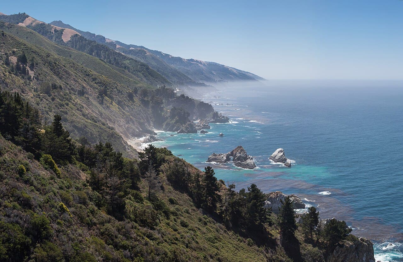
The Santa Lucia Range is young, restless, and in a hurry. Cone Peak stands 5,155 feet above the ocean barely three miles from the surf, one of the steepest coastal gradients in the contiguous United States. Nowhere else in the lower forty-eight does a mountain rise nearly a vertical mile that close to salt water, which is why the road spends ninety miles negotiating rather than traveling.
The rock itself is a traveler. The granite core of the range, which geologists call the Salinian Block, crystallized far to the south, then rode the San Andreas fault system hundreds of miles north over tens of millions of years. Big Sur is, geologically speaking, a piece of southern California that hasn't stopped moving; the range is still gaining height faster than the Pacific can tear it down, and the regular landslides are the receipts.
The other maker of this landscape is fog. Summer's marine layer pours into the canyons most mornings and burns off by afternoon, and the redwoods comb the drip out of it with their needles, a hidden water subsidy worth a season of rain each year. When the fog sits low, ten minutes up any ridge road puts you above a white ocean with peaks for islands.
The road itself
Highway 1 through Big Sur took eighteen years to build. Authorized in 1919 and blasted through the cliffs partly by convict crews from San Quentin, who were paid thirty-five cents a day plus time off their sentences and housed in camps whose names still dot the map. It opened on June 27, 1937: thirty-three bridges and a two-lane ribbon where there had been only wagon track and mule trail. In 1965 it became California's first officially designated Scenic Highway.
It has also been falling into the ocean, on and off, ever since. That isn't a flaw in the road; it's the price of the view. The same young, steep, fractured geology that makes the cliffs makes the slides, and Caltrans maintains this stretch the way a crew paints a bridge: perpetually.
The monster was Mud Creek, May 20, 2017: more than five million cubic yards of mountainside let go at once, burying a quarter mile of highway and adding fifteen acres of brand-new California to the coastline. The road wasn't dug out. It was rebuilt over the top, and the pavement there today rides on the slide. That same year, the Pfeiffer Canyon bridge cracked on a moving slope and had to be demolished and replaced, briefly turning central Big Sur into an island reachable only on foot.
The latest chapter was Regent's Slide, which came down from 450 feet above the roadway in February 2024 and kept a stretch south of Esalen closed for nearly two years before reopening in January 2026. There will be another; there is always another. Locals will tell you the road is best understood not as infrastructure but as a negotiation.
Three thousand years of neighbors
The Esselen lived in these canyons for thousands of years, one of the smallest tribes in California and among the least documented, pushed to the edge of the written record by the mission era almost before outsiders recorded anything at all. Their descendants are still here: in 2020 the tribe reacquired ancestral land along the Little Sur River, nearly two and a half centuries after losing it.
The name is a leftover compass direction. To the Spanish at Monterey, everything down the impassable coast was simply el país grande del sur, the big country to the south. El Sur Grande shrank to Big Sur, and the vagueness stuck: Big Sur has never been a town, has no legal boundaries, and residents will happily argue about where it starts and ends.
The names on today's parks are the homesteaders of the 1860s to '80s: Pfeiffer, Post, Partington, McWay. They ranched, cut tanbark oak, burned lime, and shipped everything out by cable hoist from dog-hole coves, because there was no road to ship it on. Electricity didn't reach parts of the coast until the 1950s, and a few canyons still live off the grid by choice.
The road brought the artists. Henry Miller lived on Partington Ridge from 1944 to 1962 and wrote Big Sur and the Oranges of Hieronymus Bosch about the colony of dreamers around him. Jack Kerouac came to dry out in a Bixby Canyon cabin and got a novel called Big Sur out of the wreckage. And in 1962, the old hot springs resort at Slates became the Esalen Institute, ground zero of the human potential movement, with gestalt therapy in the lodge and the Pacific under the baths.
Condors overhead, otters below
The birds circling the ridgelines on ten-foot wingspans are California condors, the largest flying land bird in North America, extinct in the wild in 1987 when the last twenty-two were captured for captive breeding. Ventana Wildlife Society began releasing them at Big Sur in 1997, and the central-coast flock they monitor now numbers around 112 free-flying birds. Watch the sky over Andrew Molera and the Coast Ridge: what looks like a small airplane usually isn't.
The southern sea otter survived extinction here and almost nowhere else. Hunted to presumed oblivion by the fur trade, a colony of about fifty was living quietly off Bixby Creek. Its public 'discovery' in 1938, just after the highway opened, is the reason the species exists at all. Every southern sea otter alive, roughly three thousand of them, descends from that Big Sur remnant.
The whale traffic is a commute. Some twenty thousand gray whales pass this coast twice a year, southbound to Baja's lagoons around December and January, northbound with new calves from March into May, often hugging the kelp line where the calves are safer from orcas. Summer brings humpbacks, and over the deep water of the submarine canyons, blue whales. Any high turnout works; Soberanes Point and the lighthouse are the classics.
Redwoods at the end of their range
Big Sur's canyons hold the southernmost naturally occurring coast redwoods on Earth. The groves thin and finally stop near Salmon Creek at the county line, beyond which there simply isn't enough fog to drink. Confined to the canyon bottoms where moisture pools, the redwoods leave the sun-blasted south slopes to yucca and chaparral, which is why a single switchback can swap Ireland for Mexico and back.
Higher up grows the range's own private tree: the Santa Lucia fir, the rarest fir in North America, clinging to steep rocky slopes in these mountains and nowhere else in the world. Botanists cross oceans to stand under one. Most drivers pass below without ever knowing it's there.
Fire wrote the understory. The Esselen burned the meadows deliberately; lightning handled the rest; the 2016 Soberanes and 2020 Dolan fires burned enormous stretches of the range within living memory. The redwoods shrugged, resprouting from blackened trunks within months, as they have for a few thousand years. The scorch marks visible from the road aren't damage so much as autobiography.
Know before you drive
Big Sur is gorgeous and genuinely remote, and the second part is easy to forget until it matters. The short version:
- Cell service is a rumor for most of the ninety miles. Download offline maps before Carmel or Cambria, because the coast won't help you.
- Gas exists, but it's famous: a handful of pumps at Big Sur village and Gorda, at prices that make the news. Fill up at either end.
- The road closes. Check Caltrans before committing. A slide can turn a through-drive into an out-and-back, and the southern stretch keeps its own schedule.
- Summer mornings are often fogged in until noon; the postcard light is late afternoon. Winter, between storms, has the clearest air of the year.
- Use the turnouts, for photos and for locals. The unofficial rule of Highway 1: if there are cars stacking up behind you, you're the traffic.
Hear it from the road
Whistlestop tells you these stories automatically as you pass them. No searching, no tapping, nothing to ask.
Coming to iPhone