Live on the road
Route 66 Audio Tour
Whistlestop narrates far more of the drive than this guide can list, automatically, as you pass each one.

The field guide
The road that stayed
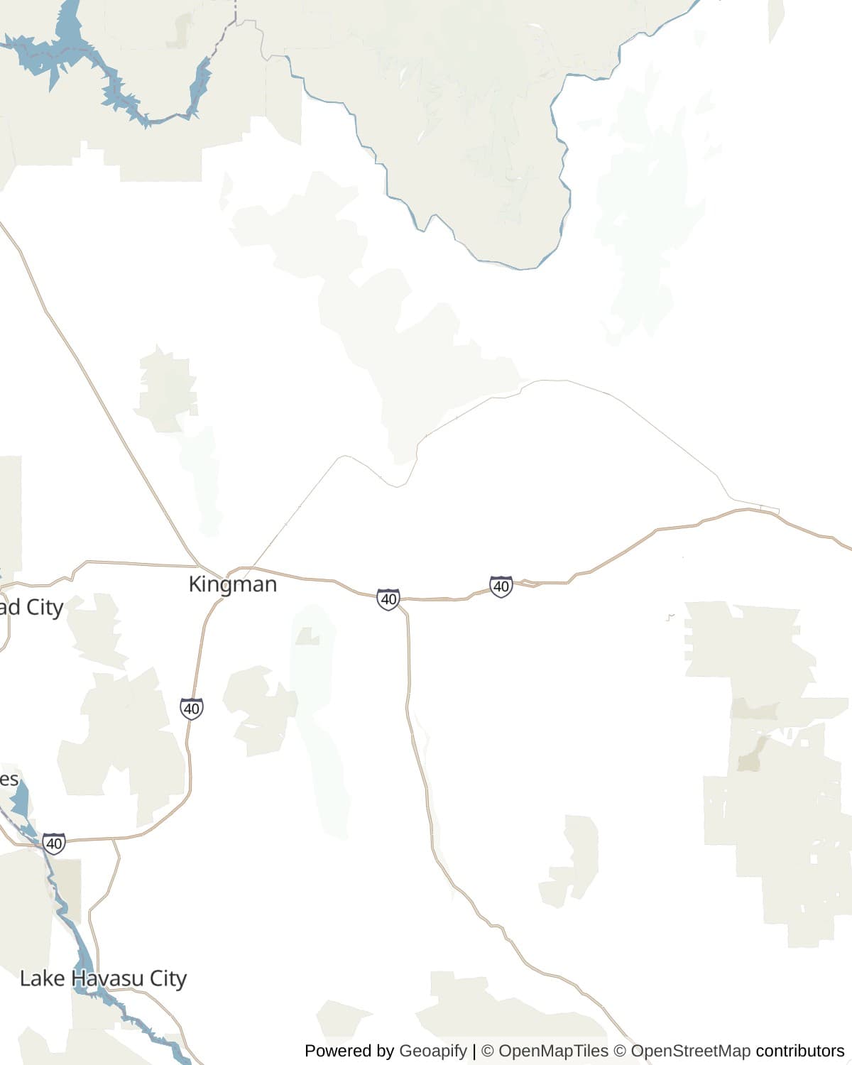
US Route 66 was commissioned in 1926, ran Chicago to Santa Monica, and was formally decommissioned in 1985 once the interstate system had replaced it everywhere. Almost everywhere: this stretch, Seligman to Kingman and on through the Black Mountains to Oatman, is regularly cited as the longest unbroken run of the original road still drivable anywhere, and the reason is mostly geography rather than sentiment. Where Route 66 elsewhere disappeared under the interstate built to replace it, Interstate 40 through this stretch of Arizona took a straighter, flatter line through the desert to the south, and the old two lane road through Peach Springs, Hackberry and Kingman was simply left where it was, unclaimed rather than erased.
That left it to fall apart on its own, which is what was happening when Interstate 40 finally reached Seligman on 22 September 1978 and took the last of the through traffic. Angel Delgadillo, whose family had been cutting hair in town since 1923, spent the next nine years building the case that the road itself was worth saving, and in 1987 the Historic Route 66 Association of Arizona he founded got the state to designate this exact stretch as Historic Route 66, the first such designation on the entire road. Every gift shop and trading post between here and Kingman is a direct result of that one stubborn argument.
Through Hualapai land
For roughly the middle third of this drive, the road crosses the Hualapai Reservation, created by executive order in 1883 on land the tribe had already occupied for well over a thousand years. Peach Springs, the tribal capital, sits at the center of it, and the reservation's own stretch of the Grand Canyon's western rim, reached from here rather than from the National Park entrance most visitors use, is the tribe's main economic engine today.
West of Peach Springs the road passes within a few miles of Valentine, where a boarding school built in 1903 along this same railroad and wagon road corridor once enrolled Hualapai, Havasupai, Hopi, Navajo and other children as part of the federal government's assimilation era Indian school system. It closed in 1937, was added to the National Register of Historic Places in 2003, and now belongs to the Hualapai Tribe, which is raising funds to rehabilitate the building as a community center.
Grand Canyon Caverns, just east of Peach Springs, predates all of that as a roadside attraction: discovered by accident in 1927, opened to the public within the year, and deep and dry enough that the federal government treated it as a serious fallout shelter during the Cuban Missile Crisis. The Havasupai Tribe, a separate nation whose own land borders the reservation to the north, bought the caverns in 2022 and reopened them in 2025 after a renovation, though the cave's long running underground motel room, the thing most people came to see, has since closed for good.
Into the Black Mountains
West of Kingman the road stops being flat. Sitgreaves Pass carries the old highway over the Black Mountains on a stretch of switchbacks locals still call the Arizona Sidewinder, and for thirty years, before a gentler route opened to the south in 1953, it was the only way across for anyone driving this road. Drivers occasionally paid Oatman locals to take the wheel over the grade rather than attempt it themselves, which is the kind of detail that sounds exaggerated until you see the road.
Oatman, on the far side, boomed as a gold camp in 1915, went quiet when the mines closed in 1924, and went quiet again when the 1953 realignment routed the highway around it instead of through it. What is left is a town of about a hundred people and, by most estimates, close to two thousand wild burros, descendants of pack animals turned loose when the mines shut down, that now wander Main Street more or less running the tourist economy. Staged gunfights happen twice a day; donations go to a children's hospital transport fund.
Driving it today
The entire stretch is paved two lane road, no permits or reservations required, and no entrance fee for the road itself; Grand Canyon Caverns charges separately for its cave tours. Services thin out fast between towns: fill up in Seligman or Kingman, because the stretch through the reservation and the run up to Sitgreaves Pass both go long distances without gas.
Sitgreaves Pass is the one place on this drive that asks something of the vehicle. The Bureau of Land Management, which now manages the road as the Route 66 Back Country Byway, discourages anything over 40 feet including a truck and trailer, and the eight miles of hairpin turns with no shoulder are a poor place to learn a rig's limits. Anyone towing something long is better off treating Kingman as the actual end of the drive and reaching Oatman, if at all, by the longer paved route through Golden Valley instead.
How long to give it
Half a day
Seligman, Grand Canyon Caverns and Kingman, the three stops that work for any vehicle and don't require the mountain crossing. Turn around in Kingman or continue on Interstate 40 rather than doubling back on Route 66 itself.
Seligman · Grand Canyon Caverns · Kingman
A full day
All nine stops, ending in Oatman by way of Sitgreaves Pass, with enough time to catch one of the town's twice daily staged gunfights before turning back. Not a drive for anything over 40 feet; see driving it today.
Seligman · Delgadillo's Snow Cap Drive-In · Grand Canyon Caverns · Peach Springs · Hackberry General Store · Kingman · Cool Springs Station · Sitgreaves Pass · Oatman
When to come
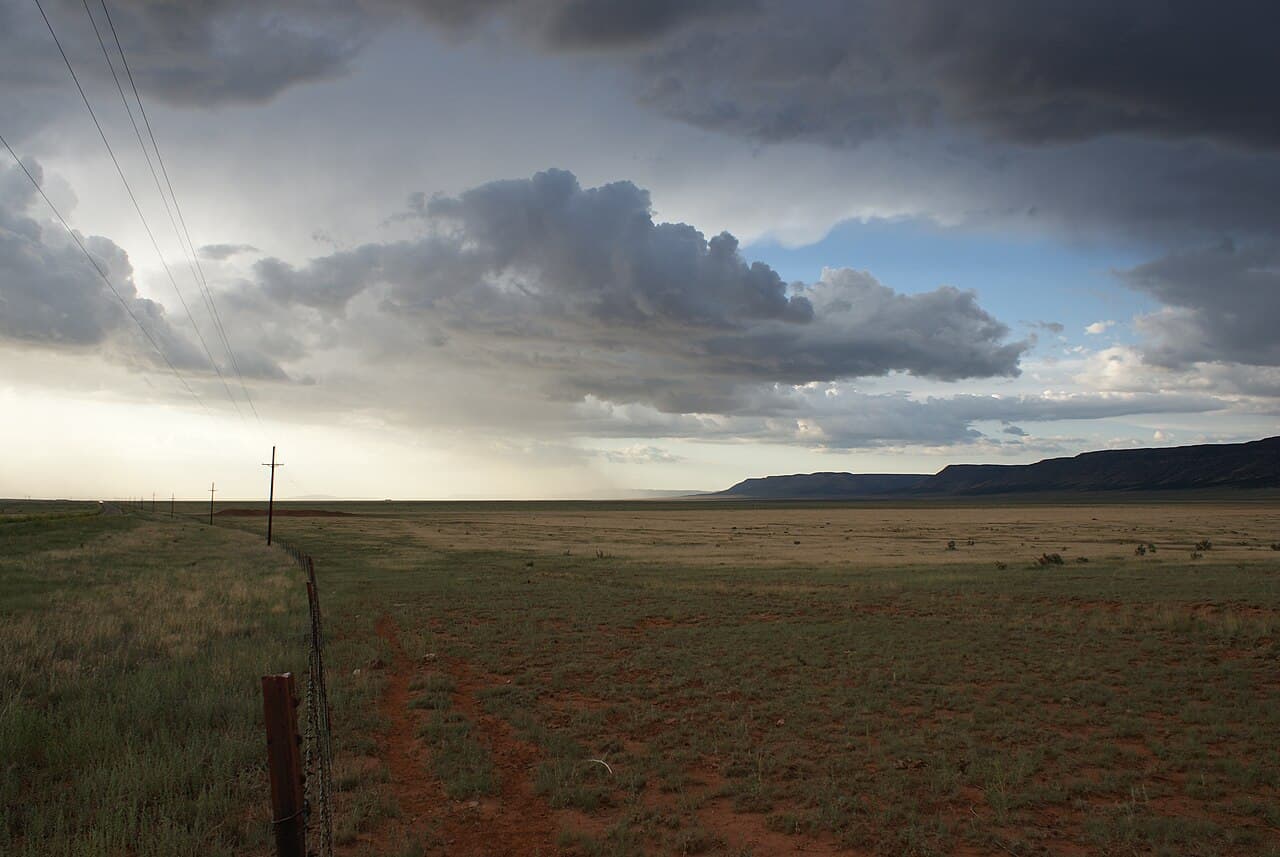
Spring and fall give the most comfortable driving temperatures; this is open, largely shadeless high desert for most of its length, and the reservation stretch in particular has long gaps with no services if a car runs into trouble on a hot afternoon.
Summer is when most travelers actually come, since it lines up with the season Route 66 itself is most romanticized for, and the road handles the heat fine; just carry water and expect the pavement to radiate it back at you by midafternoon.
Know before you drive
- No entrance fee or permit for the road itself. Grand Canyon Caverns charges separately for guided cave tours; the underground overnight room is permanently closed.
- The Bureau of Land Management discourages vehicles over 40 feet, including a truck and trailer, on the Sitgreaves Pass stretch between Kingman and Oatman; see the RV note.
- Fuel and services are sparse between towns, especially across the Hualapai Reservation between Peach Springs and Hackberry; fill up in Seligman or Kingman.
- Cell service drops out for real stretches on the reservation and over the mountain pass, more than the other corridors in this collection.
- Oatman's staged gunfights run twice daily, at 1:30 and 3:30pm local time as of 2026, and briefly close Main Street to traffic.
In an RV or with a trailer
Fine for anything up to 40 feet as far as Kingman; Seligman, Grand Canyon Caverns, Peach Springs and Hackberry are all flat, wide highway. Past Kingman, the BLM's own guidance discourages the 40 foot-plus combination over Sitgreaves Pass, and the eight miles of blind hairpin turns with no shoulder are not a place to find out a rig doesn't fit. A large rig wanting Oatman is better served by the longer paved route through Golden Valley, off this guide, than by the historic road over the pass.
Questions
- Is the original Route 66 still driveable from Seligman to Kingman?
- Yes, the entire stretch is paved two lane highway with no permits or fees required, commonly cited as the longest unbroken run of the original road still open anywhere.
- Can you still stay overnight underground at Grand Canyon Caverns?
- No. The cave's underground motel room closed for good in early 2026 after the Havasupai Tribe, which bought the caverns in 2022, chose to protect the cave's rare selenite formations. Guided tours and the underground restaurant remain open.
- Is Sitgreaves Pass safe to drive with an RV or trailer?
- The Bureau of Land Management discourages any vehicle combination over 40 feet on the eight mile stretch of hairpin turns between Kingman and Oatman. Larger rigs should reach Oatman, if at all, by the longer paved route through Golden Valley instead.
- What town inspired Radiator Springs in the movie Cars?
- Seligman, Arizona. Director John Lasseter researched the film here and modeled the character Doc Hudson on longtime Seligman barber Angel Delgadillo, who led the campaign that got this stretch of road preserved after Interstate 40 bypassed the town in 1978.
- When are the gunfights in Oatman?
- Twice daily, at 1:30 and 3:30pm local time as of 2026, staged in the street by the Oatman Ghost Riders with donations going to a children's hospital transport fund.
Sources: Route 66 Historic Back Country Byway, Bureau of Land Management, Historic Route 66 Association of Arizona, Explore Kingman, Kingman Office of Tourism, Underground hotel suite near the Grand Canyon closes, KJZZ, Peach Springs, Home of the Hualapai Indians, Legends of America, History of Cool Springs, Cool Springs Station, Schoolhouse at Truxton Canyon Training School, National Register of Historic Places.
Reviewed August 2026
Hear it from the road
Whistlestop tells you these stories automatically as you pass them. No searching, no tapping, nothing to ask.