Live on the road
Overseas Highway Audio Tour
Whistlestop narrates far more of the drive than this guide can list, automatically, as you pass each one.

The field guide
The road itself
Henry Flagler built a railroad down this chain of islands first, not a road. The Florida East Coast Railway's Key West Extension took seven years and cost more lives than money, finished in 1912 when Flagler himself rode it to Key West at eighty two, a year before he died. It ran for twenty three years before the Labor Day Hurricane of 1935, a Category 5 that made landfall almost exactly on Islamorada, tore out miles of track and killed an estimated four hundred people or more, well over half of them World War I veterans working in relief camps on Lower Matecumbe Key. A rescue train sent for them was swept off the rails by the storm surge before it could get them out.
The railroad's owners could not afford to rebuild it. The state could, and did, buying the right of way and the surviving bridges and paving over what the hurricane had left standing. The Overseas Highway opened in 1938, carrying cars on the same bridges that had carried trains, and it has been the only road connection between the Keys and the mainland ever since. There is no second route out; when a storm comes, this is the whole evacuation.
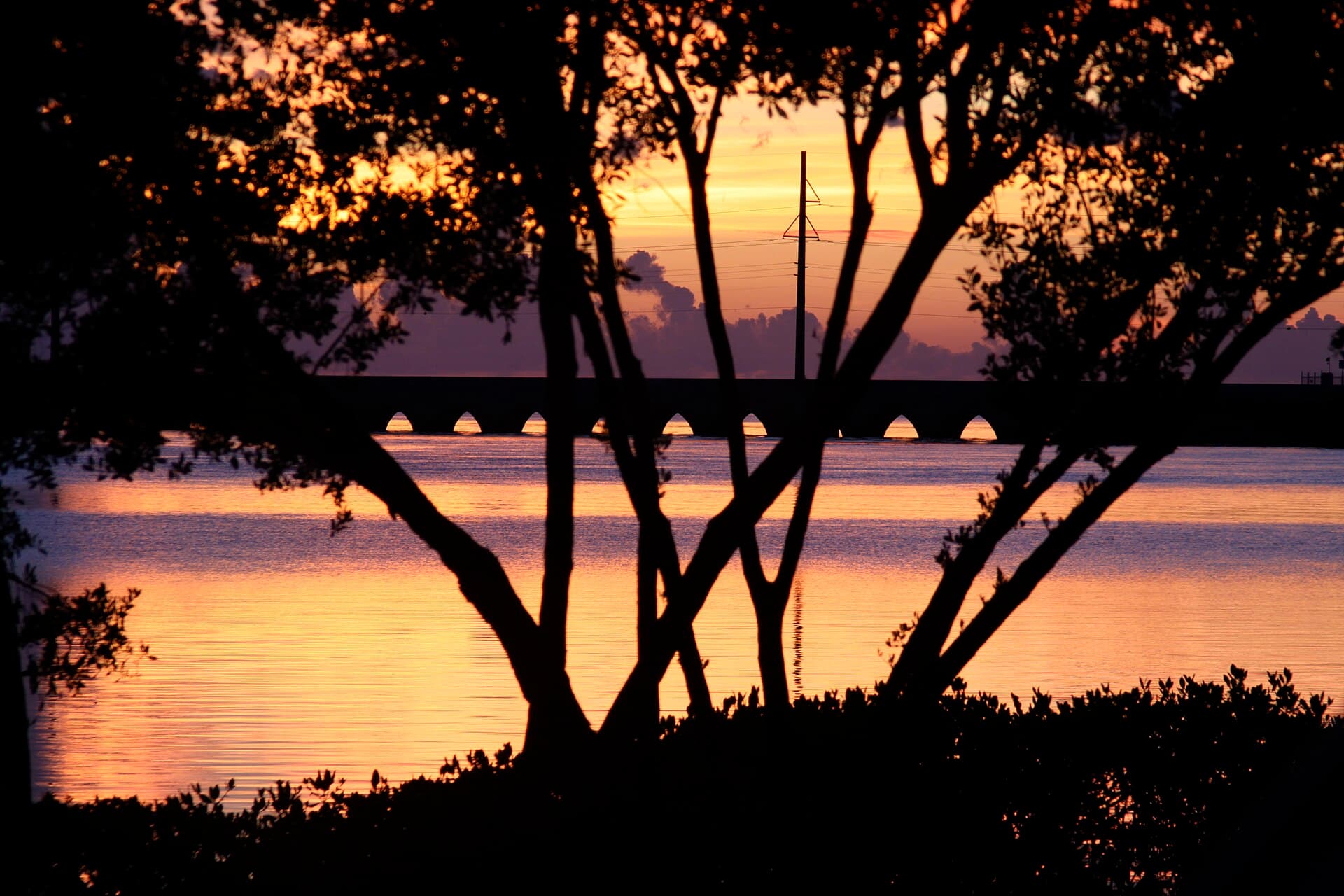
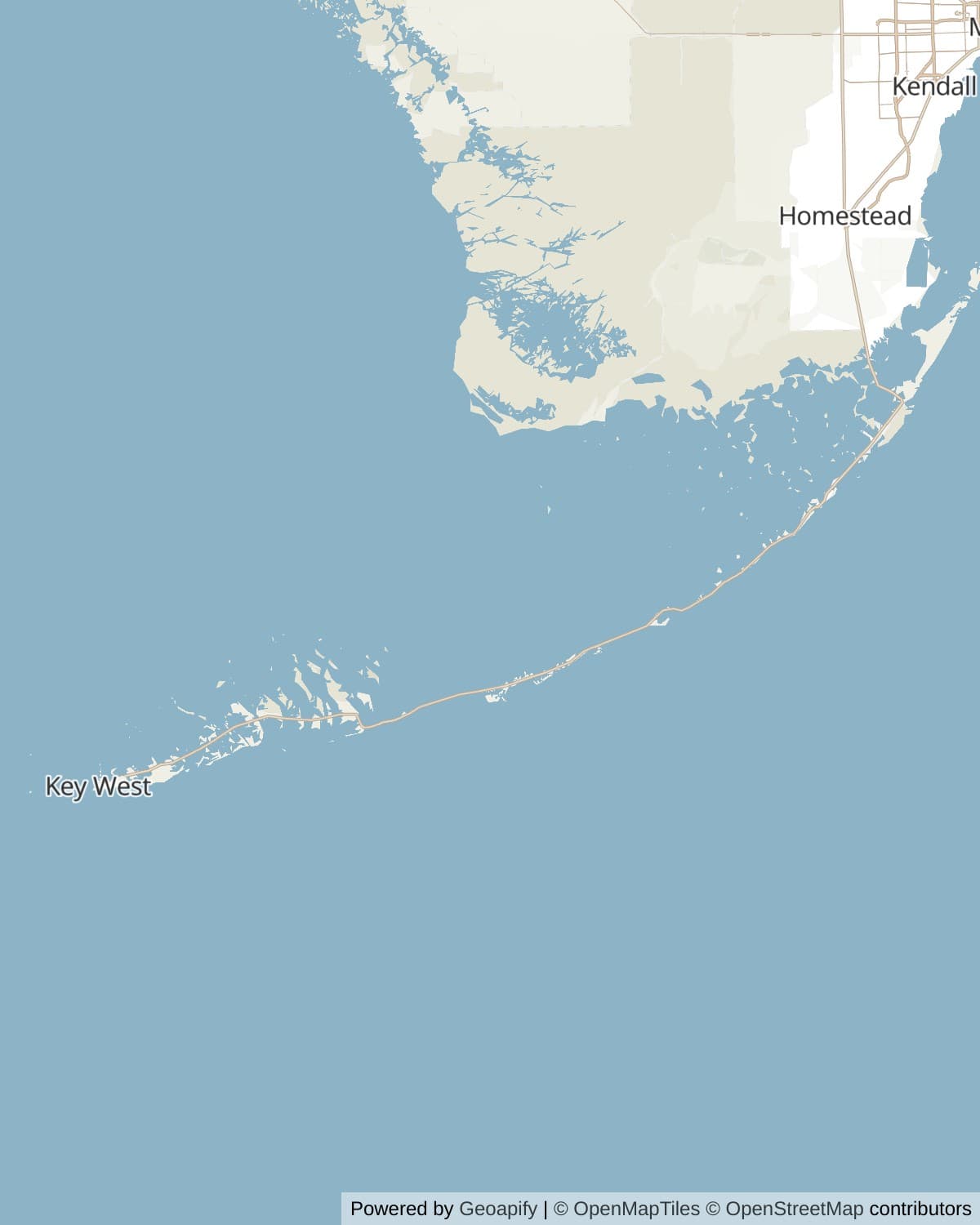
Forty two bridges carry the highway now across 113 miles from Florida City to Key West. Most of the route is two lanes, one each direction, narrowing further through the busiest stretches of Islamorada and Marathon, with a 55 mile an hour speed limit that drops hard around bridges, residential stretches and the Key deer crossings near Big Pine Key. There is nowhere to pass and nowhere to hurry; the road enforces its own pace.
What the bridges replaced
The Seven Mile Bridge is the one everyone remembers, and there have been two of them. Flagler's original, built between 1908 and 1912, ran just short of seven miles on 335 deck girder spans and nine thousand feet of concrete arch viaduct, an engineering feat with almost nothing to compare it to at the time. The current highway bridge opened in 1982 running parallel to it, and roughly two and a fifth miles of the old bridge still stand today, reopened in 2022 as a walking and biking route out to Pigeon Key after being closed for repairs since 2008.
Bahia Honda's old bridge tells a stranger version of the same story. The channel underneath it was too deep for a conventional pier design, so the original engineers ran the railroad on top of the bridge deck instead of beneath it, the reverse of how a bridge normally carries its track. The result looks like nothing else on the drive, a bridge with its roadway built into the underside of its own truss, and it is the reason Bahia Honda's old span could never simply be repaved for cars the way most of the others were.
The water on both sides
The reef that runs offshore the length of the upper Keys is the only living coral reef in the continental United States, and John Pennekamp Coral Reef State Park, opened in 1963, was the country's first attempt at protecting any part of it. In the summer of 2023 the hottest and longest marine heatwave in three decades bleached it on a scale nobody had planned for, killing off nearly every coral at two of the region's main restoration nurseries outright. Restoration groups have spent the years since building the capacity to react faster next time, including a new temperature controlled seawater lab that came online in 2026, which is the quiet reason so many dive shops in the Keys now run their own coral nurseries alongside the snorkel trips.
Ninety percent of the land in the Keys sits five feet or less above sea level, and the limestone underneath is porous enough that rising water does not need a storm to reach the road, it can simply come up through the ground on a clear day at high tide. Monroe County has said openly that some stretches of road and some homes on the lower islands may eventually be given up rather than defended, which is not the kind of thing local government usually says about its own infrastructure. None of that is visible on a normal drive through, but it is the reason a highway this exposed keeps needing rebuilt sections rather than staying finished.
Key West, and how far it actually is
The southernmost point marker overstates its own case, which is very Key West: the true southernmost point of the mainland United States is a few miles away on a closed naval base, not here. What the marker gets right is the relationship it is pointing at. Key West sits close enough to ninety miles from Havana and about a hundred and fifty from Miami that the sign's boast is roughly true, and that single fact does more to explain the place than its exact latitude does. Key West spent its nineteenth century as a wrecking port, salvaging cargo off ships that ran aground on the reef, and for a stretch between the 1820s and the 1850s it was the richest city per capita in the country because of it.
The literary and artistic reputation came later and stuck harder. Hemingway wrote here through the 1930s; Tennessee Williams kept a house on the island for decades afterward and, by local legend, started the tradition of applauding the sunset at Mallory Square himself, drink in hand. Duval Street runs the whole story at once now, bars and t shirt shops over what used to be sponge warehouses and cigar factories, gulf to ocean in a mile and a quarter that somehow takes half a night to walk.
More stories about places in and around the Florida Keys
Whistlestop's audio tours work wherever you are, automatically as you drive past landmarks and areas of interest. Here are some more curated stories you'll hear around the Florida Keys.
Natural Features
Lake Surprise
Read
Lake Surprise earned its name from the men who walked into it. In 1904 William Krome was surveying a route across Key Largo for Henry Flagler's Florida East Coast Railway when his crew found a shallow body of water that appeared on none of the charts they carried, reachable from Blackwater Sound and Barnes Sound only through obscure tidal creeks. Krome wrote in his diary that it was nearly two miles long by a mile wide, six to eight feet deep over a rock bottom, and not shown on any map or chart. They had no idea of its existence, he added, and it had played havoc with all of his calculations. Nothing else on the whole of Key Largo stood between his survey line and the open water it was aiming for. Filling a causeway across the lake should have been the straightforward part of the job. Instead the fill kept vanishing. The rock bottom Krome had recorded lay beneath a deep layer of unstable peat, and marl dredged from the sea bottom nearby sank into it almost as fast as the barges could place it. Fifteen months of dredging and dumping went into closing a gap a mile wide. The 1935 Labor Day Hurricane destroyed the railway, and the Overseas Highway was rebuilt along its right of way, so for seventy years cars crossed Lake Surprise on that same hard-won embankment. Then, between 2005 and 2008, the state rebuilt this stretch and took the causeway out altogether, carrying US 1 across on more than a mile of bridge so that water could move freely into Florida Bay again. The fill that took fifteen months to hold lasted a century, and was then deliberately removed.
Lake Surprise on Whistlestop →Roadside Attractions
Sombrero Beach
Read
There is very little sand in the Florida Keys, and the reason is that almost none of it arrives from anywhere else. Mainland Florida's beaches are quartz, carried down by rivers draining the southern Appalachians, and none of that sediment reaches this far out to sea. What the Keys have instead is carbonate, manufactured on the spot by coral, molluscs and the parrotfish that grind them down, and it is fine enough to settle as marl and mangrove flat rather than pile up into a strand. The reef offshore absorbs most of the wave energy that might otherwise build one anyway. So a proper sand beach here is a local exception, and Sombrero Beach, on the south shore of Key Vaca at the end of its own road, is the best of the handful in Marathon. The City of Marathon rebuilt the park in 2001 to be accessible throughout, with a paved path down from the road and shaded pavilions along the back of the sand. From April through October loggerhead turtles come ashore here after dark to nest, and the beach is managed around them. Four and a half miles offshore stands the Sombrero Key Light, lit in 1858 and the tallest of Florida's reef lights, an iron skeleton tower planted on the same reef that keeps this coastline from making much sand of its own.
Sombrero Beach on Whistlestop →Nancy Forrester's Garden
Read
Nancy Forrester spent the 1980s turning an acre of Key West's Old Town into a rainforest, planting it as a site-specific artwork meant to teach ecology, with more than 150 species of palm among the orchids and the bromeliads. For most of the time it stood it was the last undeveloped acre in Old Town. The parrots came afterwards and by accident: the first one arrived when somebody smuggled a bird and its cage into the garden and left it there, and others followed, surrendered by owners who could no longer keep them or who had died before they did. She opened the garden to the public on Christmas Day, 1993, and kept it open every single day of the year, holidays included, for the next fifteen years. Taxes and upkeep caught up with her in 2012, and the parcels were sold and built on. There is a swimming pool where a good part of the rainforest stood. What survived is the back garden on Elizabeth Street, where the sanctuary still operates, and which Forrester now describes as the smallest parrot sanctuary in the country. The birds are the whole point of it now: macaws and Amazons in open-air enclosures under what canopy is left, introduced by name and history in a storytelling hour each morning. A parrot can outlive the person who bought it by decades, which is how most of them got here, and it is why a garden built for plants is now run for birds.
Nancy Forrester's Garden on Whistlestop →Local Flavor
Alabama Jack's
Read
Card Sound Road is the old way into the Keys, laid along the route of the first Overseas Highway, and Alabama Jack's sits on it about a mile short of the bridge. Jack Stratham was a Georgia man out of Sumter County, nicknamed Alabama Jack by a construction foreman who had too many Jacks on the job and went by his accent instead. He had riveted on the Empire State Building and laid water mains under New York before he came south, and in 1953 he took a lease on just under an acre of dockside here. His wife Alice ran the kitchen, and her crab cakes and her lima bean soup were famous the length of this road. The bar they built has stayed open under four separate sets of owners in the years since. Hurricane Betsy knocked the building off its pilings in 1965. Stratham bought a barge, rebuilt on top of it and reopened in March 1966, which is why the place still sits partly out over the water on a hull. Phyllis Sague, a former science teacher, bought it around 1980 and her son Mike runs it now, and the conch fritters they are known for go through something like five hundred pounds of conch a week. Motorcycles fill the gravel most weekends. The restaurant stands on the mainland side of the water, before the toll booth, so it costs nothing to reach from Florida City and nothing to leave again.
Alabama Jack's on Whistlestop →Mrs. Mac's Kitchen
Read
The building went up in 1947 as Grainger's Gulf Side Inn, one of the few places along this stretch of the Overseas Highway where a traveller could get a meal. Jeff MacFarland opened Mrs. Mac's Kitchen in it in 1976, naming the restaurant for his mother and cooking her recipes, and a good deal of the original roadside shape has survived: a low building at Mile Marker 99.4 with licence plates and beer cans and buoys nailed across the walls and most of the ceiling. A cook named Angie, hired the year before, bought the place from him in 1988 and then ran it for the next thirty-five years, which is how a roadside kitchen came to be the longest continuously running restaurant anywhere in Key Largo. A second and larger location, Mrs. Mac's Kitchen II, opened a few hundred yards down the highway at Mile Marker 99, with a full bar and room for the crowds the original could not seat. Both were sold together in 2023, for three and a half million dollars, to the restaurateur Stephanie Figueroa, who kept the format intact rather than modernise a room people came for precisely because it had not changed. The kitchen claims the best Key lime pie in the Keys, which is a claim more or less every kitchen on this road makes, and this one has been making it longer than most of them have been open.
Mrs. Mac's Kitchen on Whistlestop →Porky's Bayside
Read
Porky's Bayside began around the middle of the last century as Bill Thompson's Villas and Marina, on the bay side of Key Vaca. The sources disagree about exactly when: the restaurant says 1950 and the local paper says the 1960s, and no public record settles it. Either way it arrived while Marathon was turning from a fishing settlement into a sportfishing and tourist town, in the decades after the Overseas Highway opened and the waterfront began filling up with subdivisions. The restaurant has changed names and changed owners several times over since then, but the small marina behind it has gone on working without a break, and its docks still fill up with charter boats every morning of the season. It runs now as an open-air tiki bar and restaurant built around barbecue smoked on site, local seafood landed a few yards away, and a deep-fried Key lime pie. There is a cook-your-catch service on the dock for anyone coming in off a boat with something worth eating. Mile Marker 47.5 puts it at the western tip of Key Vaca, just under a mile short of the point where the Seven Mile Bridge lifts off from Knights Key. That makes it close to the last bayside place to pull in before the highway runs out over open water for the better part of seven miles, with nowhere at all to stop until it comes back down on Little Duck Key.
Porky's Bayside on Whistlestop →No Name Pub
Read
No Name Pub opened in 1931 as a general store and bait and tackle shop on Big Pine Key, on the road that led to the No Name Key ferry. The first Overseas Highway had opened three years earlier with a gap in the middle of it: drivers boarded a car ferry at Lower Matecumbe, crossed some forty miles of open water, landed at No Name Key and drove on to Key West, passing this door on the way. An eatery was added in 1936. When the highway bridges finally closed the ferry gap in 1938 the traffic moved to the new road, and by the mid-1950s the store and the tackle shop had both shut, leaving behind only the bar and the restaurant that had grown up beside them, on a road that now led nowhere in particular. Sometime in the 1970s customers began stapling signed dollar bills to the walls, and the habit never stopped. Every surface inside, ceiling included, is layered in bills carrying names, dates and messages left by people who went out of their way to find the place, with estimates of the total on the walls running to around ninety thousand dollars. Staff periodically strip sections off and give the proceeds to local charities. The pub's own motto is that it is a nice place if you can find it, and the pizza is what most people order once they have.
No Name Pub on Whistlestop →Baby's Coffee
Read
Baby's Coffee is named after a building it left behind. Gary and Olga Teplitsky came down from New York in 1991 to start a coffee roasting company, and opened in a small place at the uptown end of Duval Street in Key West. By the company's own account, a Cuban family had owned that building back in the 1920s and called it Baby's Place, after their youngest son, who grew up to run a cantina in it. That story appears in no record outside the business's own telling, which is worth saying plainly, but the Teplitskys liked the name enough to keep it. Within a few years the roastery had outgrown Duval Street and moved out here to Mile Marker 15, on Saddlebunch Keys, about fifteen miles up the highway from the building the name came from. The company roasts arabica on site and ships it nationally, and calls itself the southernmost coffee roaster in America, which is difficult to argue with this far down the chain. It is also the only coffee roaster in the Florida Keys. The stop has become a fixture for cyclists on the Overseas Heritage Trail, who leave their cars here and ride the ten miles into Key West and back. Joe and Carnella Bracciale bought the business in 2024 and are opening a second shop on Fleming Street in Old Town, a block off Duval, which puts Baby's back within sight of where it started.
Baby's Coffee on Whistlestop →Green Parrot Bar
Read
Antonio Sanchez opened a grocery at the southeast corner of Whitehead and Southard in 1890, and something has been trading in the building ever since, which is the basis for the Green Parrot's claim to be the oldest bar in Key West. It was a grocery for the first fifty years of that. It became a bar around the start of the Second World War, working as the Brown Derby and serving submarine crews from the naval base a few blocks away, and it stayed a Navy room until the Navy drew down in the early 1970s. Judy Sullivan bought it then, renamed it the Green Parrot, and knocked the glass block out of the window openings to put shutters in, which is how a closed grocery room became the open-air bar it still is. Jim Bean bought the bar on his birthday in 1983 and ran it for twenty-seven years, building the live music room it is now known for. He died suddenly in 2010, and his longtime partner John Vagnoni brought in Pat Croce, the Philadelphia entrepreneur and former president of the 76ers, who keeps a house on the island. Locals call it the last little piece of old Key West. It has come through two world wars, the Depression and a long run of hurricanes, though not without shutting: it closed for Hurricane Irma in 2017, then ran a landline out of the bar so that several hundred people could queue up and call their families.
Green Parrot Bar on Whistlestop →Local Stories
Hurricane Monument
Read
Hundreds of World War I veterans were living in federal relief camps on Lower Matecumbe and Windley Key on Labor Day, 1935, working on the road that would become US 1, when the most intense hurricane ever recorded to strike the United States came ashore on top of them. Sustained winds reached 185 miles an hour, and a barometer at Craig Key read 26.35 inches, still the lowest pressure ever recorded at a hurricane landfall in this country. A train sent down from Miami to evacuate the camps lost time on the way and arrived after dark, and the surge caught it at Islamorada, sweeping eleven of its cars off the rails. The locomotive stayed upright on the track. An estimated 423 people died in the Keys that night, 259 of them veterans. The Works Progress Administration built this monument two years later and dedicated it on 14 November 1937 before a crowd of several thousand. It is faced in keystone quarried a few miles up the road at Windley Key, and its frieze, carved for the Florida Division of the Federal Art Project, shows coconut palms bent flat above a breaking wave. The cremated remains of roughly 300 victims, many of them never identified, lie in a crypt beneath a ceramic tile map of the Keys set into the plaza in front of it. The railway never reopened. Florida bought the right of way from the bankrupt company, and the highway the veterans had been building was carried across the railway's own bridges and finished in 1938.
Hurricane Monument on Whistlestop →Bud N' Mary's Marina
Read
Casting a fly to bonefish and tarpon in water barely deep enough to float a skiff was worked out on the flats around Islamorada, and this marina is where much of it was refined and passed on. The founding catch came first and belongs to someone else: in 1939 a guide named Bill Smith took the first bonefish ever deliberately caught on a fly, in Little Basin on the bay side of Islamorada, using a pattern he had tied himself. Bud and Mary Stapleton opened this marina five years after that catch, in 1944, on a boat basin that had already been working as a fish camp since the late 1930s, and it became the dock where the new sport was refined and handed on to the people who would go on to make it famous. Jimmie Albright learned it from Bonnie Smith, Bill's wife and a guide in her own right, who put a young Albright on his first bonefish during the war. He guided out of here for about three decades and left two knots behind him, the nail knot and the Albright Special, both still tied by anglers who have never heard of him. In 1948 and 1949 he took the writer Joe Brooks to early fly-caught tarpon and bonefish, and Brooks's magazine articles carried the sport to a national audience. Ted Williams and Jimmy Stewart both fished with him. Islamorada sits where the Atlantic, Florida Bay and the Gulf of Mexico come within a short run of one another, which is the geography underneath the town's claim on the title of sportfishing capital of the world.
Bud N' Mary's Marina on Whistlestop →Key West's Wreckers
Read
Key West grew rich in the middle of the nineteenth century without farming or manufacturing anything at all. The money came from wrecking, the licensed business of salvaging ships that struck the coral reef a few miles offshore, in a strait that funnelled almost every vessel moving between the Gulf of Mexico and the Atlantic seaboard past a shallow barrier with very little safe water through it. Federal law from 1825 required that salvage be landed at a United States port of entry, and Key West was the nearest one, which is the practical reason the trade settled on this island rather than in the Bahamas. When a ship went onto the reef, licensed wreckers raced out to refloat it, or to take off its cargo before the sea could. A federal court established here in 1828 heard every case and set the award, usually somewhere between a quarter and a third of the value of what was saved. The trade paid for the warehouses and the shipyards and for a good many of the houses still standing in Old Town, and it made Key West, by most accounts, the wealthiest city per capita in the country. What ended it was not one thing but several: new lighthouses on the reef itself, at Carysfort in 1852 and Sombrero Reef in 1858, better charts, and then steam power and steel hulls, which together made the reef survivable. The last great salvage came in 1905, and the court closed its book of wrecking licences in 1921.
Key West's Wreckers on Whistlestop →More are waiting in the app, which carries the whole record and picks up whatever is near the road ahead, ready to narrate as you drive.
How long to give it
One day
The drive as a straight shot, Key Largo to Key West with two stops. Snorkel or ride the glass bottom boat at Pennekamp in the morning, walk Pigeon Key or the old Seven Mile Bridge at midday, and be on Duval Street or at Mallory Square by sunset. This is a long day of driving with very little slack in it.
John Pennekamp Coral Reef State Park · Pigeon Key · Duval Street · Mallory Square
A weekend
Overnight in Marathon or Islamorada, splitting the drive in two. Day one covers the Upper Keys at an easy pace with time for the tarpon and the beach; day two is the Lower Keys and Key West, arriving with enough afternoon left for the lighthouse, the Hemingway house and dinner before the sunset crowd.
John Pennekamp Coral Reef State Park · Key Largo · Betsy, the giant lobster · Robbie's Marina, tarpon feeding · Anne's Beach · The Turtle Hospital · Seven Mile Bridge · Bahia Honda State Park · Southernmost Point Buoy · Key West Lighthouse · Ernest Hemingway House · Mallory Square
Three or four days
The whole list, unhurried, with two nights in the Middle or Lower Keys and two in Key West itself. This is enough time for the water: a snorkel trip out of Pennekamp, the train or the walk out to Pigeon Key rather than a drive by, an actual swim at Bahia Honda, and Key West seen at both its sunset crowd and its quiet morning.
John Pennekamp Coral Reef State Park · Key Largo · Betsy, the giant lobster · Robbie's Marina, tarpon feeding · Anne's Beach · The Turtle Hospital · Seven Mile Bridge · Pigeon Key · Bahia Honda State Park · National Key Deer Refuge · Southernmost Point Buoy · Key West Lighthouse · Ernest Hemingway House · Duval Street · Mallory Square
When to come
Winter and spring, roughly December through April, are the dry season and the peak season together: the lowest rain, the lowest humidity, and the highest prices and crowds, especially over the holidays and spring break. Hurricane season runs June through November, with the real risk concentrated August through October; a storm anywhere near the Keys can close the only road out with days of notice, so travel insurance and a flexible plan matter more here than on most drives in this collection.
Summer is hot, wet most afternoons, and quieter for it. The water is at its warmest for snorkeling, and the tarpon at Robbie's and the reef at Pennekamp do not care about the season the way the crowds do.
Know before you drive
- There is one road. US 1 is the only way in or out of the Keys by car, which makes it the entire evacuation route in a storm; check the forecast before committing to a Keys trip in hurricane season, June through November.
- The speed limit runs up to 55 but drops hard and often, especially around bridges, through Islamorada and Marathon, and near Big Pine Key, where it protects the Key deer as much as it protects drivers. Enforcement is real and constant.
- Fuel and food are available throughout, unlike some of the more remote corridors in this collection, but stretches of the Upper and Middle Keys run miles between exits with services. Fill up before a long push.
- John Pennekamp has one of its two boat ramps and its sewage pump out station closed for construction as of July 2026. The Southernmost Point Buoy has been temporarily moved one block to Duval Street Pocket Park while its usual plaza is rebuilt, expected back on site late in 2026. Check current status for both before you go.
- Pigeon Key is not reachable by car. Walk or bike the old Seven Mile Bridge, ride the shuttle, or take the passenger train from the depot; there is no drive up option.
- Cell signal is generally reliable the whole route, a contrast with the more remote corridors here, though it can still thin out mid bridge on the longest spans.
In an RV or with a trailer
The drive is manageable in an RV, but two things matter. The Seven Mile Bridge and several others have no shoulder and limited turnouts, so a breakdown mid span is a genuine problem; keep fuel and tires ahead of trouble rather than behind it. And overnight parking is tight and often reserved everywhere in the Keys, Key West especially, so book a site well ahead rather than planning to find one on the day.
Questions
- How long does the drive from Miami to Key West actually take?
- About three and a half hours nonstop from Florida City, at the posted limits, for the 113 miles of the Overseas Highway itself. Almost nobody does it nonstop; the stops in this guide alone are worth a full day at minimum, and three or four days lets you actually get in the water along the way.
- Is the Southernmost Point Buoy actually the southernmost point in the US?
- No. The true southernmost point of the continental United States sits a few miles away on Boca Chica Key, inside a naval air station closed to the public, which is why the city built this marker in 1983 as the nearest publicly reachable stand in. It is a photo marker, not a survey point, and it is currently relocated one block to Duval Street Pocket Park while storm damage to its usual plaza is repaired, expected back on site late in 2026.
- Can you drive out to Pigeon Key?
- No. The only ways there are on foot or by bike along the old Seven Mile Bridge, by shuttle bus, or by the small passenger train that runs from the Pigeon Key depot several times a day. The old bridge's ramp to the island was closed from 2008 to 2022, and there has never been a road all the way out for private cars.
- What's the best time of year to drive the Keys?
- Winter through spring for the weather and the crowds both; it is dry, mild and the busiest season of the year. Hurricane season runs June through November, with August through October the highest risk, and because US 1 is the only road out, a storm anywhere near the Keys can close the entire route with days of notice.
- Is there really only one road to Key West?
- Yes. The Overseas Highway is the sole route connecting the Florida Keys to the mainland by car, which is also why it doubles as the only hurricane evacuation route for everyone living on the islands.
Sources: Overseas Highway, National Register of Historic Places nomination, Florida State Parks, John Pennekamp Coral Reef State Park, Florida State Parks, Bahia Honda State Park, National Key Deer Refuge, U.S. Fish and Wildlife Service, The Turtle Hospital, Marathon, Pigeon Key Historic District, City of Key West, Southernmost Point Buoy.
Reviewed August 2026
Hear it from the road
Whistlestop tells you these stories automatically as you pass them. No searching, no tapping, nothing to ask.