Live on the road
The Outer Banks Audio Tour
Whistlestop narrates far more of the drive than this guide can list, automatically, as you pass each one.

The field guide
The land that will not hold still
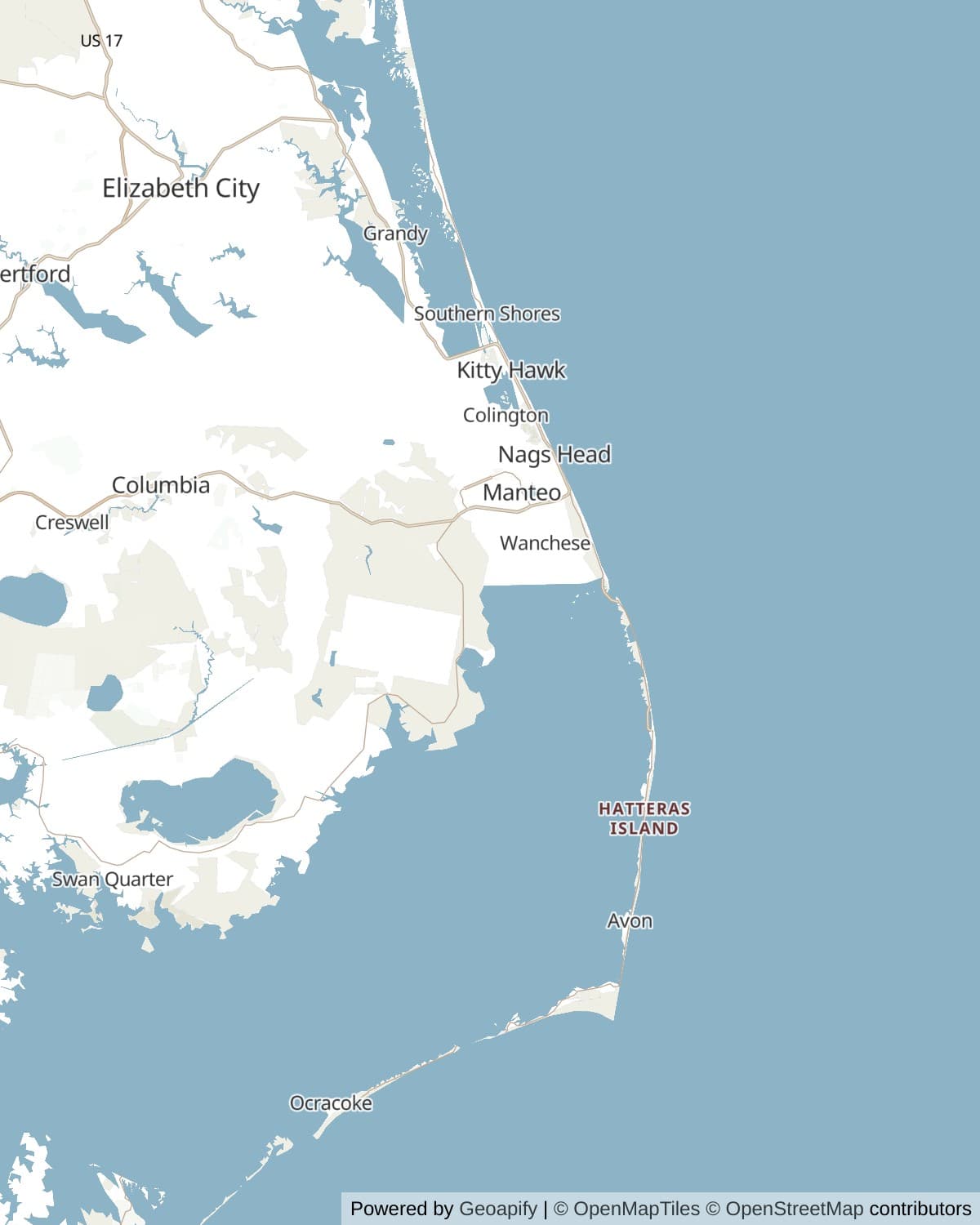
The Outer Banks stand as much as thirty miles off the North Carolina mainland, unusually far out for a barrier chain, with Albemarle and Pamlico Sounds filling the gap behind them. In places the island underfoot is a few hundred yards wide: ocean on the left, sound on the right, and just enough dry ground in between for two lanes and a shoulder. There is no bedrock anywhere in this. It is sand, piled up by waves and wind on the drowned edge of the continental shelf, and it behaves accordingly.
A barrier island is not anchored, it migrates. Storm waves wash sand from the ocean face clear across to the sound side, so the island rolls slowly over itself and moves landward while staying roughly the same shape. Geologists call the process overwash and it is the islands working correctly, which is inconvenient, because the highway and the villages are sitting on top of it. Every stretch of NC 12 that keeps getting buried is a stretch where the island is trying to do its job.
The inlets come and go on the same logic. Oregon Inlet was opened by a hurricane in September 1846 and named for the first vessel through it; Hatteras Inlet opened in the same storm. In September 2003 Hurricane Isabel cut a fresh inlet straight through Hatteras Island, isolating the southern villages, and the state filled it back in within about two months. New Inlet, up on Pea Island, has opened and closed repeatedly since colonial charts first bothered to record it.
So the map you are driving is a snapshot. Names on it that sound permanent, Cape Point, Diamond Shoals, the bar at Oregon Inlet, describe sand that has measurably moved since the last survey, and much of what the Wright brothers looked at in 1903 is somewhere else now.
The road itself
Before there was a road there was the beach. Drivers went down Hatteras Island on the hard sand at low tide, asked locally about the tides, and got stuck when they guessed wrong. The Wright Memorial Bridge reached the northern banks from the mainland in 1930, the highway down Hatteras Island was finished through the 1950s, and Ocracoke's stretch was paved in 1957, which is recent enough that plenty of people alive on the island remember it happening.
NC 12 has been losing arguments with the ocean ever since. The worst of them was always the S curves north of Rodanthe, where the island is narrow and low and the surf came over the pavement several times a year, sometimes closing the only road to a dozen villages for days. The answer, finally, was to stop fighting: the Rodanthe jug handle bridge, 2.4 miles and about $145 million, swings out over Pamlico Sound and back, leaving the ocean to do whatever it likes to the old alignment. It opened on 28 July 2022, and its curve is shaped the way it is partly to keep clear of a protected wreck on the sound bottom.
The same thinking rebuilt Oregon Inlet. The Bonner Bridge of 1963 spent its last decades under near constant repair as the channel scoured out its footings, and the Marc Basnight Bridge that replaced it in February 2019 is 2.8 miles of span designed to be lengthened if the inlet keeps migrating. Between the two of them, roughly $400 million has been spent so that a two lane road can stay where a chain of sand bars is not staying.
The southern part of this drive has a formal name. On 16 October 2009 the run from Whalebone Junction down through Hatteras and Ocracoke and on across to the Down East villages was designated the Outer Banks National Scenic Byway: 138 driving miles and another 25 spent on ferries, which is the only byway designation in the country where a quarter of the mileage is water.
The Graveyard of the Atlantic
Everything dangerous about this coast meets at Cape Point. The Labrador Current comes south along the shore carrying cold water, the Gulf Stream comes north carrying warm, and where the two collide the sand they are both moving settles out into Diamond Shoals, a shifting bar reaching roughly a dozen miles offshore. Sailing ships riding the Gulf Stream north had to round it; sailing ships coming south had to cross it; and the weather at the seam of two currents is its own hazard, with fog and sudden gales generated by the temperature difference alone.
The wrecks accumulated for four centuries. Estimates vary wildly with the boundaries drawn, from several hundred on the shoals themselves to several thousand along the whole North Carolina coast, and the honest answer is that nobody has a complete count. What is not in doubt is the range: Spanish and English ships, Civil War blockade runners, coastal schooners, steamers, and a great many fishing boats whose loss made the local paper and no other record.
Then came 1942. In the first months of Operation Drumbeat, German U-boats worked this coastline almost at will, sinking ships within sight of the beach while the towns behind kept their lights on and silhouetted the targets. People watched tankers burn from their porches; oil, wreckage and bodies came ashore for months. HMT Bedfordshire, one of the British trawlers lent to help, was torpedoed with all hands in May and four of her crew are buried on Ocracoke. On 14 April, off Bodie Island, the destroyer USS Roper sank U-85 with the loss of her entire crew, the first U-boat sunk by the United States Navy in the war.
Most of it is still down there. The Monitor National Marine Sanctuary, named for the ironclad that foundered off Hatteras in 1862, now protects a set of these wrecks, and the museum at Hatteras village is the place to see what has been brought up from them.
The service that went out anyway
Because ships kept coming ashore, the United States Life-Saving Service built stations along these islands from 1874, close enough together that a surfman walking the beach at night from one would meet a surfman walking from the next, exchange a token to prove he had gone the whole way, and turn around. When something went aground the crew rowed out to it, or fired a line across it with a small cannon and brought people over one at a time in a breeches buoy. The work was seasonal, badly paid, and dangerous in the way the job description implies.
One family did an unreasonable amount of it. The Midgetts of Chicamacomico have taken more Gold and Silver Lifesaving Medals across the generations than any other family in the service's history, and the most famous of them is John Allen Midgett, who on 16 August 1918 rowed six men into burning gasoline to take 42 sailors off the tanker Mirlo. The station he ran is still standing at Rodanthe, complete with its boathouse, and is the most intact life-saving station left in the country.
Nine miles up the road, Pea Island holds the story that should be better known than it is. Richard Etheridge was born enslaved on Roanoke Island in 1842, joined the Union Army in 1863, served in what became the 36th United States Colored Troops, and in January 1880 was appointed keeper of the Pea Island station, the first African American to command one. The white surfmen refused to serve under him, so the station was crewed entirely by Black men, and it stayed that way until it closed in 1947. Five months after he took charge, arsonists burned the station to the ground. Etheridge and his crew rebuilt it, and he ran it until he died in 1900.
On 11 October 1896 the schooner E.S. Newman came ashore in a hurricane with the captain's wife and three year old son aboard, in surf too heavy to fire a line into. Etheridge sent his men into the water roped together in pairs, and nine separate times they swam out and carried somebody back. Every soul aboard was saved. The Life-Saving Service gave them nothing at all. The Coast Guard awarded the Gold Lifesaving Medal to Etheridge and his crew in 1996, a hundred years later.
Bankers
The villages are strung down the islands in a line and their names read like a list of half remembered stories: Duck, Kitty Hawk, Rodanthe, Waves, Salvo, Avon, Buxton, Frisco, Hatteras, Ocracoke. People who live on the banks call themselves Bankers, and until very recently they lived out here largely without reference to the mainland, fishing, running boats, salvaging what the sea gave them, and hunting waterfowl for the northern markets in numbers that eventually had to be legislated against.
Isolation of that length does something to a language. Ocracoke's brogue, which linguists at North Carolina State University have been recording for decades, turns high tide into something close to hoi toide and has kept vowels and words that left the mainland generations ago; a visitor is a dingbatter. It is thinning now, as brogues do once a bridge and a ferry and a television arrive, and the people who speak it most strongly are the ones who were adults before 1957.
The other thread runs through Roanoke Island. Union forces took it in February 1862, and the Freedmen's Colony that formed there grew to thousands of formerly enslaved people who built houses, ran a sawmill, filled schools, and enlisted; Richard Etheridge was among them. The federal government returned the land to its prewar owners after the war and the colony was dispersed by 1867, which is why almost nothing of it survives above ground and why the story took so long to be told at all.
Horses, birds and turtles
The horses are the oldest residents. DNA and conformation testing has placed the Corolla herd with the Colonial Spanish types, consistent with animals landed or wrecked here in the sixteenth century and left to become feral, and the same stock survives on Ocracoke and on Shackleford Banks further south. The Corolla herd runs at roughly a hundred animals over the beaches and marshes north of the pavement. Ocracoke's have been fenced since 1959. They are small, hard footed, and entirely capable of drinking from the freshwater lenses under the dunes, which is most of the reason they are still here.
This is one of the great bird coasts. The banks sit on the Atlantic Flyway at exactly the point where it narrows, and Pea Island alone has recorded more than 370 species; winter fills its impoundments with snow geese and tundra swans, and the flats hold shorebirds through the migrations. Piping plovers and American oystercatchers nest on the open sand, which is why sections of beach close in early summer, and why the closures are not negotiable no matter how empty the beach looks.
Sea turtles come ashore from May into August, mostly loggerheads with a scattering of greens and the occasional leatherback. Cape Hatteras National Seashore counted 409 nests in 2026, its second busiest season on record behind 473 in 2019, and the numbers have trended up since systematic monitoring began. If you drive the beach, the rules about night driving and about not leaving holes in the sand exist for hatchlings, which orient by the brightest horizon and will head inland toward a porch light without hesitating.
How long to give it
One day
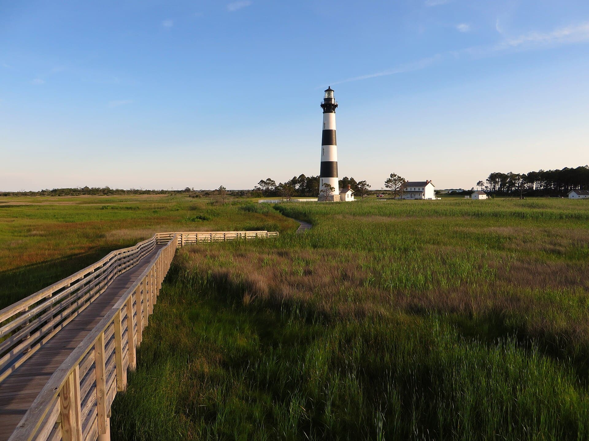
Nags Head to Hatteras village and back, which is the drive most people actually do. Wright Brothers in the morning while the light is good on the field, Bodie Island and the Basnight Bridge before lunch, Pea Island and Chicamacomico in the afternoon, the Cape Hatteras Lighthouse at the far end. No ferry, no Corolla, and no time to sit down on a beach.
Wright Brothers National Memorial · Jockey's Ridge State Park · Bodie Island Lighthouse · Oregon Inlet and the Marc Basnight Bridge · Pea Island National Wildlife Refuge · Chicamacomico Life-Saving Station, Rodanthe · Cape Hatteras Lighthouse, Buxton
Two or three days
The whole road, with a night on Hatteras Island and a night on Ocracoke. Day one is Corolla down to Nags Head, taking the horses in the morning when they are moving. Day two crosses Oregon Inlet and works down to Buxton. Day three is the ferry and Ocracoke, which wants an unhurried afternoon rather than a stop, and the last boat back is late enough that you do not have to rush it.
Currituck Banks and the wild horses · Currituck Beach Lighthouse · Wright Brothers National Memorial · Jockey's Ridge State Park · Fort Raleigh and Roanoke Island · Bodie Island Lighthouse · Pea Island National Wildlife Refuge · Chicamacomico Life-Saving Station, Rodanthe · Cape Hatteras Lighthouse, Buxton · Cape Point · Hatteras village and the Graveyard of the Atlantic Museum · The Ocracoke pony pen · Ocracoke village
A week
Long enough to stop treating it as a drive. A week gets you a beach permit and a morning at Cape Point, a wild horse tour that actually goes up the beach rather than around Corolla, the walk through Nags Head Woods, two or three days based on Ocracoke, and the weather margin to move a plan when a storm shuts the road, which in this landscape is a normal event rather than bad luck.
Currituck Banks and the wild horses · Nags Head Woods Preserve · Nags Head Beach Cottage Row · Fort Raleigh and Roanoke Island · Pea Island National Wildlife Refuge · Cape Point · The Ocracoke pony pen · Ocracoke village
When to come
Late spring and early autumn are the drive at its best: warm water, workable crowds, and the light that makes the dunes worth photographing. May and early June come before the school holidays fill every cottage, and September and October are the local favourite, with the ocean still warm from summer and the villages quiet again.
Hurricane season runs June through November and peaks from August into October. This matters more here than it would elsewhere, because NC 12 is the only road and a single overwash can cut Hatteras Island in half for days. Storms far out to sea also close beaches and stop the ferry with a clear forecast overhead.
Winter is bleak, cheap and genuinely rewarding if the weather is not what you came for. Pea Island's impoundments fill with snow geese and tundra swans, the beaches empty completely, and a nor'easter seen from the right side of a window is the whole point of the place. Many businesses close from January into March, and the ferry runs a reduced schedule.
Know before you drive
- One road, and that is the whole planning problem. NC 12 is the only route down the islands, so an overwash, an accident or a storm closure has no detour. NCDOT posts current road conditions, and every local knows before the state does.
- The Cape Hatteras Lighthouse is closed to climbing through 2026 for a major restoration. The grounds, the visitor centre and the museum stay open. Bodie Island and Currituck Beach are both climbable in season, and Ocracoke has never been open to the public.
- The Hatteras to Ocracoke ferry is free, takes about 70 minutes, and takes no reservations; it is first come, first served, and in July and August the queue at midday can be two boats long. A July 2026 state budget law requires tolls on this and three other free routes from 1 January 2027, with rates still being set when this was written, so check before you assume it is free. The Cedar Island and Swan Quarter routes to the mainland are longer, already tolled, and do take reservations.
- Beach driving needs a permit from the National Park Service on seashore beaches, and a separate one for the four wheel drive area north of Corolla. Airing down your tyres is not optional; the recovery services on this coast do a steady trade in people who thought it was.
- Cell coverage is decent through Nags Head and thins going south. It is patchy on the lower island and on Ocracoke, and it is the first thing to fail in a storm. Download maps before Oregon Inlet.
- Fuel exists in every village but the gaps between them are real, particularly the 20 odd miles of empty refuge and dune between Nags Head and Rodanthe, and the 13 miles from the Ocracoke ferry landing to the village. Fill up before the bridge.
In an RV or with a trailer
The road is flat, straight and easy in anything, and the National Park Service runs four campgrounds along the seashore, including one at Ocracoke. Two cautions. The Hatteras ferry takes RVs but loads by length and on a busy afternoon a long rig can watch a boat leave without it, so go early. And there is very little shoulder anywhere on NC 12: pulling off to look at something usually means finding an actual parking area rather than stopping where you are.
Questions
- How long does it take to drive the Outer Banks?
- About three and a half hours of actual driving from Corolla to Ocracoke village, plus roughly 70 minutes on the Hatteras ferry and however long the queue for it runs. Nobody does it in one push. Two or three days is the sensible minimum if you want to stop, and a week is not too much.
- Can you climb the Cape Hatteras Lighthouse?
- Not through 2026. It is closed for a major restoration that has stripped and repointed the brickwork and is fitting a replica of its original first order Fresnel lens, and the reopening has slipped after structural problems were found near the top. The grounds, visitor centre and museum are open. Bodie Island and Currituck Beach lighthouses are both open for climbing in season.
- Where do you see the wild horses, and can you drive to them?
- North of Corolla, where the pavement ends and about eleven miles of beach runs up to the Virginia line. You need four wheel drive and a permit to take your own vehicle, and a great many people take a guided tour instead, which is the easier option and comes with somebody who knows where the herd was that morning. A county ordinance requires you to stay fifty feet away, in a vehicle or on foot.
- Is the ferry to Ocracoke free, and do I need a reservation?
- The Hatteras to Ocracoke ferry has been free and first come, first served, with no reservations taken. A state budget law passed in July 2026 requires the Ferry Division to start collecting tolls on this route from 1 January 2027, and the rates were still being decided as this was written, so confirm before you travel. The longer Cedar Island and Swan Quarter routes from the mainland are tolled and do take reservations.
- What is the best base for an Outer Banks trip?
- It depends which half you care about. Nags Head and Kill Devil Hills put you within twenty minutes of the Wright Brothers memorial, Jockey's Ridge, Roanoke Island and Bodie Island, with the most places to eat. Avon or Buxton put you next to the Cape Hatteras Lighthouse and Cape Point and an hour closer to the ferry. Ocracoke is a different trip again and rewards at least one night rather than a day visit.
- Why does NC 12 keep washing out?
- Because the islands are supposed to move. Storm waves carry sand from the ocean side across to the sound side, which is how a barrier island migrates landward, and a fixed road laid across that process gets buried by it. The two big recent bridges, at Oregon Inlet in 2019 and at Rodanthe in 2022, both give up defending an alignment and route around the problem over water instead.
Sources: National Park Service, Cape Hatteras National Seashore, National Park Service, Cape Hatteras Lighthouse restoration project, National Park Service, Wright Brothers National Memorial, National Park Service, the four powered flights of 17 December 1903, US Fish and Wildlife Service, Pea Island National Wildlife Refuge, NOAA, Monitor National Marine Sanctuary shipwrecks, NOAA, the wreck of U-85, National Park Service, the Ocracoke British Cemetery, US Coast Guard Historian's Office, Ocracoke Lighthouse, National Coast Guard Museum, the Mirlo rescue, NCDOT, ferry tolling, NC State Parks, Jockey's Ridge State Park, The Nature Conservancy, Nags Head Woods Preserve, Outer Banks Conservationists, Currituck Beach Lighthouse, Chicamacomico Life-Saving Station Historic Site, Graveyard of the Atlantic Museum, Federal Highway Administration, Outer Banks Scenic Byway.
Reviewed September 2026
Hear it from the road
Whistlestop tells you these stories automatically as you pass them. No searching, no tapping, nothing to ask.