Live on the road
The Black Hills Audio Tour
Whistlestop narrates far more of the drive than this guide can list, automatically, as you pass each one.

The field guide
The land
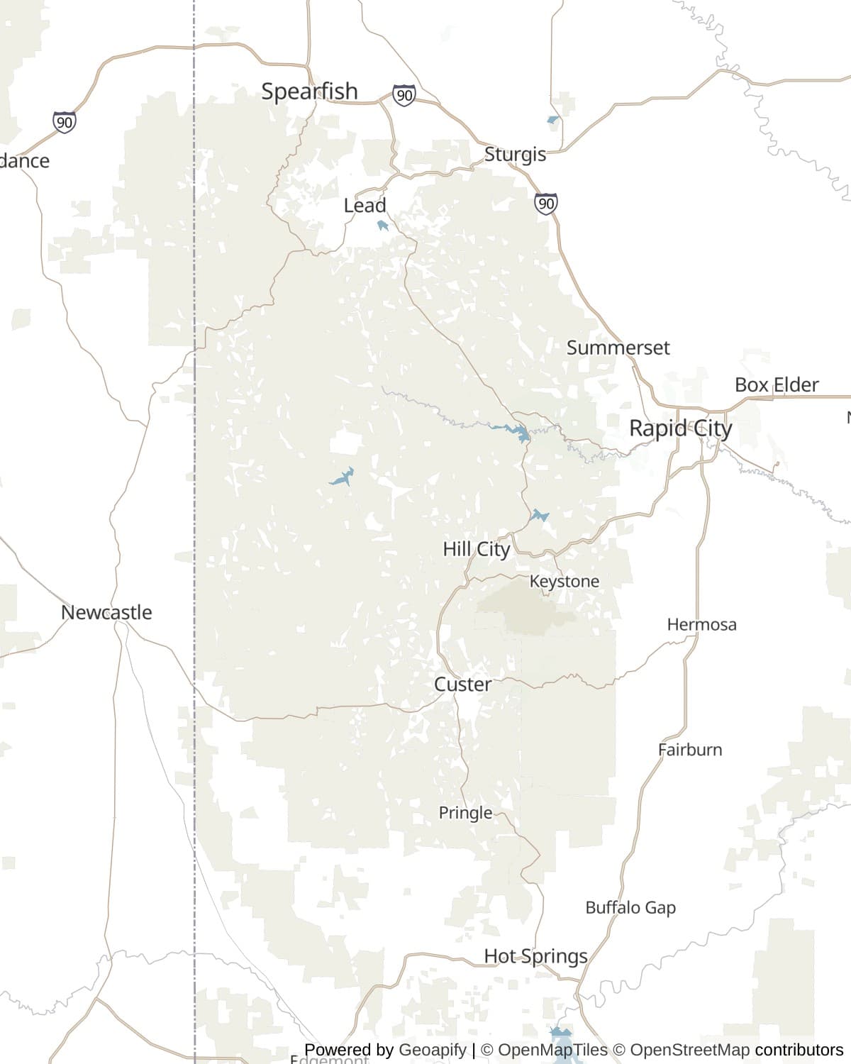
The Black Hills are an island. Roughly five thousand square miles of mountains sitting out in the middle of the northern Great Plains with nothing of their height for hundreds of miles in any direction, they were pushed up as a long blister when the Rockies were rising, and then the top was stripped off. What that left is a bullseye you can read from a map or from a car window. In the middle is the granite core, dated to about 1.8 billion years, standing up in spires and domes. Around it runs a ring of pale limestone, and around that a ring of soft red shale.
The red ring is the Spearfish Formation and it circles the entire range as a shallow valley. Everybody in the hills calls it the Race Track. In Lakota it is Ki Inyanka Ocanku, and the account attached to it is a great race run around the hills by the two legged and the four legged to settle the order between them, the track worn red by the running. The geology and the story are describing the same feature, and the road system inherited it: US 385, US 16 and the interstate all use the soft ring because it is the easy going.
The name is a description of what the range looks like from thirty miles out on the grass. Ponderosa pine covers the slopes so densely that the hills read as a dark mass against a pale prairie, which is what He Sapa means, and what got translated into English as the Black Hills. Up close the same forest is open and dry and smells of butterscotch in the sun, and the pines stand far enough apart to drive between.
The high point is Black Elk Peak, posted at 7,242 feet, with a stone fire tower on the summit that the Civilian Conservation Corps finished in 1938. You will see it called the highest summit in the United States east of the Rocky Mountains. That is true if the Black Hills are not part of the Rockies and false if they are, and geologists are not unanimous, so treat it as a good line rather than a settled fact. What is not in dispute is that from the top, on a clear morning, you can see into four states.
The road itself
Peter Norbeck was governor of South Dakota and then a United States senator, and what he actually wanted to be was the person who decided where the roads went. He got both of the ones that matter here built over the objections of engineers who told him they could not be built at all, which in fairness was a reasonable thing to say about the Needles Highway.
That one came first, finished in 1922: fourteen miles of switchback and blasted rock threading between granite fins, with two tunnels cut through the fins themselves rather than around them. The Needles Eye Tunnel is eight feet across and nine feet nine high, and those two numbers are the single most useful thing on this page, because they decide whether your vehicle drives the byway or takes the long way round. Iron Creek Tunnel is a little larger at eight nine by ten ten. Neither was widened, and neither will be.
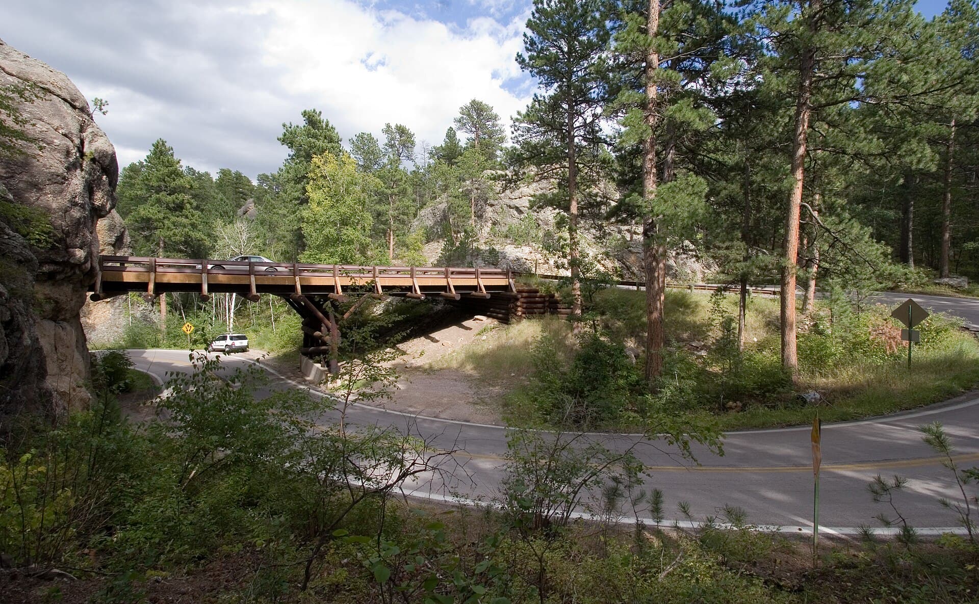
Iron Mountain Road went in during the early 1930s while Mount Rushmore was being carved a few miles north, and Norbeck laid it out on foot and on horseback at 63, already ill, choosing the route for what it would show rather than for how it would climb. Seventeen miles of it hold 314 curves, 14 switchbacks, three tunnels and three pigtail bridges, the timber spirals that let the road cross over itself and drop a full level in the space of a curve. The three tunnels are aimed. Come through the Doane Robinson tunnel southbound and the four faces are sitting in the far end of it, framed, which is not a coincidence and was not luck: Gutzon Borglum regarded the road as part of the memorial.
Norbeck also left instructions, and they are still the best advice anyone has given about this drive. It was not meant to be a super highway. To do the scenery justice you should drive no more than twenty miles an hour, and to do it full justice you should get out and walk. He died in 1936, four years before the faces were finished. The loop his two roads make with SD 89 and SD 244 was named the Peter Norbeck Scenic Byway and made a National Scenic Byway on 23 September 1996: sixty eight miles, and nobody sensible does it in under three hours.
Whose hills these are
The Fort Laramie Treaty of 1868 set aside the Great Sioux Reservation, the Black Hills inside it, and put a lock on the door: Article 12 required the signatures of three quarters of the adult men of the tribe before any part of it could be ceded. That clause is the whole of what follows.
In 1874 George Armstrong Custer led a column into the hills, in breach of the treaty he was crossing, and announced gold. Miners came anyway and the army stopped trying to turn them back. In 1877 Congress passed an act removing the Black Hills from the reservation. There is no valid record that three quarters of anybody signed anything.
The tribes never accepted it and never stopped saying so, through a century of litigation. In 1980, in United States v. Sioux Nation of Indians, the Supreme Court agreed with them by eight votes to one, upholding a finding that the taking was a Fifth Amendment seizure requiring compensation, and describing the record in terms courts do not usually reach for: a more ripe and rank case of dishonorable dealings will never, in all probability, be found in our history. The award came to roughly $106 million.
The Sioux refused it, unanimously, and have refused it every year since, because taking payment for the Black Hills would settle the sale of the Black Hills. The money has sat in a federal trust account gathering interest ever since and is now generally said to be worth over a billion dollars. Nobody outside the Interior Department knows the real figure. When a CNN reporter filed a freedom of information request for the balance, the Oglala Sioux Tribe asked in March 2025 that it be refused, on the grounds that publishing the number was an underhanded route to an implicit acceptance, and the tribal president restated the position that has not moved since 1980: the Black Hills are not for sale.
None of this is only in the past tense, and the hills are marked with it. The mountain now called Rushmore was Tunkasila Sakpe, the Six Grandfathers. Harney Peak became Black Elk Peak by unanimous federal vote in 2016. American Indian Movement activists occupied Rushmore in 1971, renamed it Mount Crazy Horse and planted a prayer staff to cover the faces until the treaty was honoured. And at Bear Butte, an hour north, people are fasting and praying on the mountain every summer while the traffic goes past below.
Two mountains being carved
The idea started as a tourist scheme. Doane Robinson, South Dakota's state historian, proposed in 1923 that the Needles be carved with figures out of the history of the West: Lewis and Clark, Sacagawea, Red Cloud, Buffalo Bill Cody, Crazy Horse. Conservationists refused to let him touch the Needles, and the sculptor he hired refused the subjects. Gutzon Borglum wanted a monument that was national rather than regional, moved the site to a granite face called the Six Grandfathers, and chose four presidents.
Work ran from October 1927 to October 1941. Around four hundred people worked on it at eight dollars a day, climbing seven hundred stairs and then being winched down the face in bosun chairs; about ninety per cent of the rock came off with dynamite and the last few inches were drilled and hand smoothed. Not one of them was killed. The heads are sixty feet from chin to hairline. The whole thing cost $989,992.32, most of it federal. Behind the faces is a corridor cut seventy feet into the mountain for a Hall of Records that was abandoned in 1939 and never finished. Borglum died in March 1941 and his son Lincoln completed the work.
Before Rushmore, Borglum spent a decade on Stone Mountain in Georgia for the United Daughters of the Confederacy, and after Helen Plane wrote asking for it, he agreed to include a Ku Klux Klan altar in the design. He unveiled Lee's head in January 1924, fell out with the association, smashed his own models in March 1925 and left the state; his work was blasted off the mountain. Whether he ever formally joined the Klan is not established, and Smithsonian's own account says there is no proof he did. What is documented is that he was deeply involved in Klan politics, and that his correspondence is explicit about a belief in Nordic superiority. His museum at Rushmore displays the portrait a Klan Grand Dragon inscribed to his good friend Gutzon Borglum.
Seventeen miles southwest, the answer to Rushmore has been under construction since 1948. Henry Standing Bear wrote to the Boston born sculptor Korczak Ziolkowski asking for a memorial that would let the white man know the red man had great heroes too, and the first blast went off on Thunderhead Mountain on 3 June that year. The face was dedicated in 1998, 87 and a half feet high, half as tall again as any head on Rushmore. The left hand was finished in 2024. Finished, the carving would be 563 feet high and 641 long, and the foundation has never given a completion date. Ziolkowski's condition was that no federal or state money would ever be accepted, so it is paid for by the people who drive in to look at it, and the foundation reported $128 million in assets and $14.5 million of annual revenue in 2024.
It is not a settled thing among the people it is being carved for. Crazy Horse would not allow himself to be photographed and was buried in a place his family kept secret. The Lakota medicine man John Fire Lame Deer wrote in 1972 that making a beautiful wild mountain into a statue of him is a pollution of the landscape, and that it is against the spirit of Crazy Horse. Elaine Quiver, a descendant of his aunt, said in 2003 that nobody had asked her family's permission, and that carving the sacred Black Hills where the burial grounds are is a desecration. Russell Means called it an insult to the entire being of his people. Seth Big Crow, a great great nephew, has questioned who is profiting from the name. Two carved mountains, one built on land the Supreme Court said was stolen and one built in objection to it, and both of them cut into rock that a great many people would rather nobody had cut at all.
Bison, burros and borrowed goats
Custer State Park runs about 1,300 bison across 71,000 acres, and the Wildlife Loop Road exists to put you among them. Every autumn, on a Friday morning in late September, riders and trucks push the whole herd into corrals to be counted, tested and sorted; several thousand people come to watch, which makes the Buffalo Roundup one of the very few livestock management operations in the world with its own arts festival.
The genetically important herd is the smaller one to the south. Wind Cave's bison are one of only four free roaming herds on public land in North America with no cattle ancestry, and they are brucellosis free. They descend from twenty animals: fourteen shipped out from the Bronx Zoo by the American Bison Society, which arrived on 28 November 1913, and six more from Yellowstone in 1916. That herd is now the stock other public lands rebuild from.
The donkeys that lean into car windows on the Wildlife Loop are the most photographed animals in the hills and are not wild in any strict sense. They descend from a working pack string that carried visitors from Sylvan Lake up to the top of Harney Peak beginning in 1927. When that operation ended, the burros were let go into the park, established themselves, and worked out the rest for themselves. Feeding them is discouraged and universally ignored.
The mountain goats are not native either, and are here by accident. Canada gave six of them to Custer State Park in 1924, they got out of their pen, and their descendants have had the run of the granite ever since. A couple of hundred of them now work the ledges, most reliably on the rock around Mount Rushmore and on the canyon walls near Bridal Veil Falls. Elk, pronghorn, coyotes and mountain lions are all here as well, along with prairie dog towns big enough to be visible from the road, and the black footed ferrets that Wind Cave has been putting back into them.
What is under the hills
The pale limestone ring around the granite core is riddled, and two of the three longest caves in the United States are underneath this one forest, twenty miles apart. Between them they account for 388 mapped miles of passage, and both were found the same way, by somebody noticing air coming out of a hole in the ground.
Wind Cave breathes because the pressure inside it and the pressure outside are rarely the same. When a front comes through, air pours in or out of the natural entrance hard enough to take a hat off, and that reverses with the weather. Theodore Roosevelt made it a national park in January 1903, the first cave anywhere in the world given that protection, and 168 miles have been surveyed since under about a square mile of prairie. Its particular treasure is boxwork, thin blades of calcite left standing when the rock around them dissolved, so that the ceilings look like the inside of a honeycomb. Roughly 95 per cent of all the boxwork known on Earth is in this one cave. The Lakota call the place Oniya Oshoka, where the earth breathes inside, and their emergence story begins at its mouth, with people persuaded up out of the spirit lodge before the world was ready and turned into the first bison herd for it.
Jewel Cave was found in 1900 when the prospectors Frank and Albert Michaud felt cold air coming out of a crack in a canyon wall, widened it with dynamite and got into a chamber lined with calcite crystals. Roosevelt protected that one too, in 1908, the first national monument in the country created for a cave. Surveyors have now mapped 220 miles of it, second longest in the United States and fifth in the world, and here is the arresting part: by measuring how much air moves through the entrance with the barometer, the volume of the whole system can be estimated, and the 220 mapped miles come out at something between three and five per cent of it.
The other hole in these hills was dug on purpose. Gold found at Lead in 1876 became the Homestake, bought the next year by George Hearst and two partners for $70,000, and it went down eight thousand feet and produced more than forty million troy ounces before it shut at the end of 2001, the largest and deepest gold mine in the Western Hemisphere. What replaced it is stranger and better. From the late 1960s Ray Davis had been running an experiment at the 4,850 foot level, a tank of dry cleaning fluid counting neutrinos arriving from the centre of the sun, and finding only a third as many as theory required. He was assumed to be wrong for thirty years and turned out to be right, which is what the 2002 Nobel Prize was for. The National Science Foundation took the workings over in 2007, and the Sanford Underground Research Facility now hunts dark matter under a mile of rock and is being enlarged to catch a beam of neutrinos fired eight hundred miles through the Earth from Fermilab, outside Chicago, with nothing but the planet in between.
How long to give it
One day
The byway and nothing else, which is a perfectly good day and the one most people have. Drive Iron Mountain Road northbound in the morning so the tunnels are pointing at the faces with the light behind you, then work anticlockwise round to the Needles and finish on the Wildlife Loop in the late afternoon when the bison are moving. Three hours of driving stretched across eight.
Iron Mountain Road · Mount Rushmore National Memorial · Cathedral Spires · Needles Highway and the Needles Eye · Sylvan Lake · Wildlife Loop Road
Three days
Enough to get off the byway. Day one is the loop above. Day two goes south and west to Crazy Horse and both caves, which want timed tickets booked before you leave. Day three is the hour north to Deadwood and the Spearfish Canyon byway, with Bear Butte on the way if you start early. This is the shape most trips should be and the one most trips are not.
Iron Mountain Road · Mount Rushmore National Memorial · Needles Highway and the Needles Eye · Wildlife Loop Road · Crazy Horse Memorial · Jewel Cave National Monument · Wind Cave National Park · Bear Butte · Deadwood · Spearfish Canyon and Roughlock Falls
A week
Long enough to walk. A week buys the seven miles up Black Elk Peak from Sylvan Lake, a wild caving tour rather than the paved loop at Jewel Cave, a morning at the Mammoth Site with a paleontologist rather than twenty minutes on the walkway, the Sanford Lab visitor centre at Lead, and the slack to sit still on the Wildlife Loop until something happens. It also lets you drive Iron Mountain Road twice, in both directions, which is not a joke.
Iron Mountain Road · Mount Rushmore National Memorial · Black Elk Peak · Wildlife Loop Road · Crazy Horse Memorial · Jewel Cave National Monument · Wind Cave National Park · The Mammoth Site, Hot Springs · Bear Butte · Deadwood · Sanford Underground Research Facility, Lead · Spearfish Canyon and Roughlock Falls
When to come
September is the best month here and it is not close. The crowds thin after Labor Day, the aspens and birches in the canyons turn through late September and early October, the bison are in rut and audible, and the Needles Highway is still open. The Buffalo Roundup falls on a Friday morning in late September and fills every room within fifty miles, so book months out or plan around it.
June through August is when the hills work properly and when everybody else is here. Everything is open, the cave tours run at full frequency, and the evening lighting ceremony at Rushmore is a summer thing. Two dates to know: the Sturgis Motorcycle Rally, which ran 7 to 16 August in 2026 and puts something like half a million motorcycles into these roads, and the Fourth of July, which does the same with cars.
Winter closes the good part. The Needles Highway shuts with the first snow and does not reopen before 1 April, and Iron Mountain Road closes on and off through the season, which removes most of the byway. What is left is genuinely worth having if you want it empty: Rushmore is open all year and looks better under snow than it does in July, the caves hold their own temperature whatever the surface is doing, 54 degrees in Wind Cave and 49 in Jewel Cave, and the bison are easier to find on white ground than on brown.
Know before you drive
- Custer State Park charges its own entrance licence, separate from anything federal: $25 a vehicle for seven consecutive days as of 2026, and it is required on the Needles Highway and the Wildlife Loop. An America the Beautiful pass does not cover it, because this is a state park.
- Mount Rushmore has no entrance fee and a $10 parking charge, valid for a year from purchase, $5 for over 62s. No federal pass covers it either, because the car park is run under a concession contract rather than by the Park Service.
- Book cave tours before you arrive. Wind Cave and Jewel Cave both sell timed tickets through recreation.gov, both cap group sizes underground, and both routinely sell out the good tours days ahead in summer. Take a layer: Wind Cave holds 54 degrees and Jewel Cave 49, year round, and there are a lot of stairs.
- The Needles Eye Tunnel is eight feet wide and nine feet nine high. Measure your vehicle rather than estimating it, including anything on the roof, and if it does not fit then the Needles Highway is not a shortcut you can improvise your way through: there is nowhere to turn round once you are committed.
- Distances are short and the times are not. Nothing on this page is more than about seventy miles from anything else, but the byway is signed at 25 miles an hour and often slower, so budget by the hour rather than the mile. Rapid City, Custer, Hill City, Keystone and Hot Springs all make reasonable bases; Custer is the most central for everything south of Rushmore.
- At Bear Butte, stay on the trail, do not touch or photograph the prayer cloths and tobacco ties in the trees, and give way to anyone who is there to pray. The state asks this explicitly and it is the one request on this page that is not about your convenience.
- Fuel and signal are both fine by western standards, with pumps in every town named here. Coverage drops out in the canyons and on the wooded parts of the byway, which matters mainly because the turnings are not always obvious. Download the area before you set off.
In an RV or with a trailer
The Needles Highway is closed to you and so, in practice, is Iron Mountain Road: eight feet by nine foot nine at the Needles Eye and ten foot nine by eleven at the tightest Iron Mountain tunnel rules out almost every motorhome and most trailers, and the switchbacks would rule out the rest. Park the rig and take the car, or use US 16 and US 385 round the outside, which is a good drive in its own right. Custer State Park has four campgrounds with RV sites and Custer, Hill City and Hot Springs all have full hookup parks; the state park sites book out for the Buffalo Roundup a year ahead.
Questions
- How long does it take to drive the Peter Norbeck Scenic Byway?
- Sixty eight miles that take between three and four hours if you only stop for photographs, and a full day if you use it properly. Iron Mountain Road alone is signed for an hour over seventeen miles, and the Needles Highway for an hour over fourteen. Norbeck's own recommendation was no more than twenty miles an hour.
- Can I take an RV on Iron Mountain Road or the Needles Highway?
- Almost certainly not. The Needles Eye Tunnel is eight feet wide and nine feet nine high, Iron Creek Tunnel is eight nine by ten ten, and the three Iron Mountain tunnels run from ten foot nine to twelve feet wide and about eleven feet high. Measure before you commit, because there is nowhere to turn around. The alternative route on US 16 and US 385 is fine in anything.
- Do the tunnels really line up with Mount Rushmore?
- Yes, and deliberately. Peter Norbeck chose the alignment of Iron Mountain Road for what it would frame rather than for how it would climb, and Gutzon Borglum treated the road as part of the memorial. The Doane Robinson tunnel is the famous one: driving north, the four faces sit centred in the far opening.
- Is it worth visiting Crazy Horse Memorial when it is not finished?
- That depends what you want from it, and it is a fair question to ask before paying to get in. What is carved is the face, dedicated in 1998 and taller than any head on Rushmore, plus an outline of the arm and the finished left hand. There is no completion date. The site also holds the Indian Museum of North America and a large Native arts programme, which is what a good many visitors come away talking about. Some Lakota people object to the carving existing at all, and those objections are worth reading before you go rather than after.
- Which cave should I choose if I only have time for one?
- Jewel Cave for scale and decoration, Wind Cave for the boxwork and the story. Jewel's Scenic Tour is longer, has more stairs and shows you more crystal; Wind Cave's Natural Entrance and Fairgrounds tours put you among the honeycomb formations that this cave has essentially all of. If you have children or knees, ask at the desk: both parks run shorter and easier options, and both sell out.
- Why do the Lakota say the Black Hills were stolen?
- Because the Supreme Court agreed with them. The 1868 Fort Laramie Treaty guaranteed the hills and required three quarters of the tribe's adult men to sign off any cession; gold was found in 1874 and Congress took the hills back in 1877 without those signatures. In 1980 the Court upheld a ruling that this was an unconstitutional taking and awarded roughly $106 million, calling the record a more ripe and rank case of dishonorable dealings than would probably ever be found in American history. The Sioux have refused the money every year since, because accepting it would complete the sale.
- When is the Custer State Park Buffalo Roundup?
- A Friday morning in late September, with an arts festival running around it for three days. Roughly 1,300 bison are driven into corrals for counting, testing and sorting, and the public watches from two viewing areas on the Wildlife Loop. Get there before dawn, expect the loop road to be managed for the morning, and book accommodation many months out.
Sources: South Dakota Game, Fish and Parks, Custer State Park scenic drives and tunnel clearances, South Dakota Game, Fish and Parks, Buffalo Roundup, South Dakota Game, Fish and Parks, Bear Butte State Park, Travel South Dakota, Iron Mountain Road, National Park Service, Mount Rushmore carving history, National Park Service, Mount Rushmore fees and passes, National Park Service, the Lakota emergence story at Wind Cave, National Park Service, Wind Cave National Park, National Park Service, Jewel Cave National Monument, Crazy Horse Memorial Foundation, Sanford Underground Research Facility, ICT, the Oglala Sioux Tribe on the sealed value of the Black Hills claim, Bureau of Indian Affairs, the Sioux land award is not a settlement of the Black Hills claim, The Mammoth Site of Hot Springs, Black Hills National Forest, Federal Highway Administration, Peter Norbeck Scenic Byway.
Reviewed September 2026
Hear it from the road
Whistlestop tells you these stories automatically as you pass them. No searching, no tapping, nothing to ask.