Live on the road
Battle Road Audio Tour
Whistlestop narrates far more of the drive than this guide can list, automatically, as you pass each one.

The field guide
The road itself
The Battle Road was not built for a battle and did not have that name until afterwards. It was the Bay Road, later the Old Concord Road, the ordinary way between Boston and the inland farm towns, and by 1775 it had been carrying carts, cattle and post riders for well over a century. What happened on the nineteenth of April happened on a working road, past working farms, in front of the people who lived there.
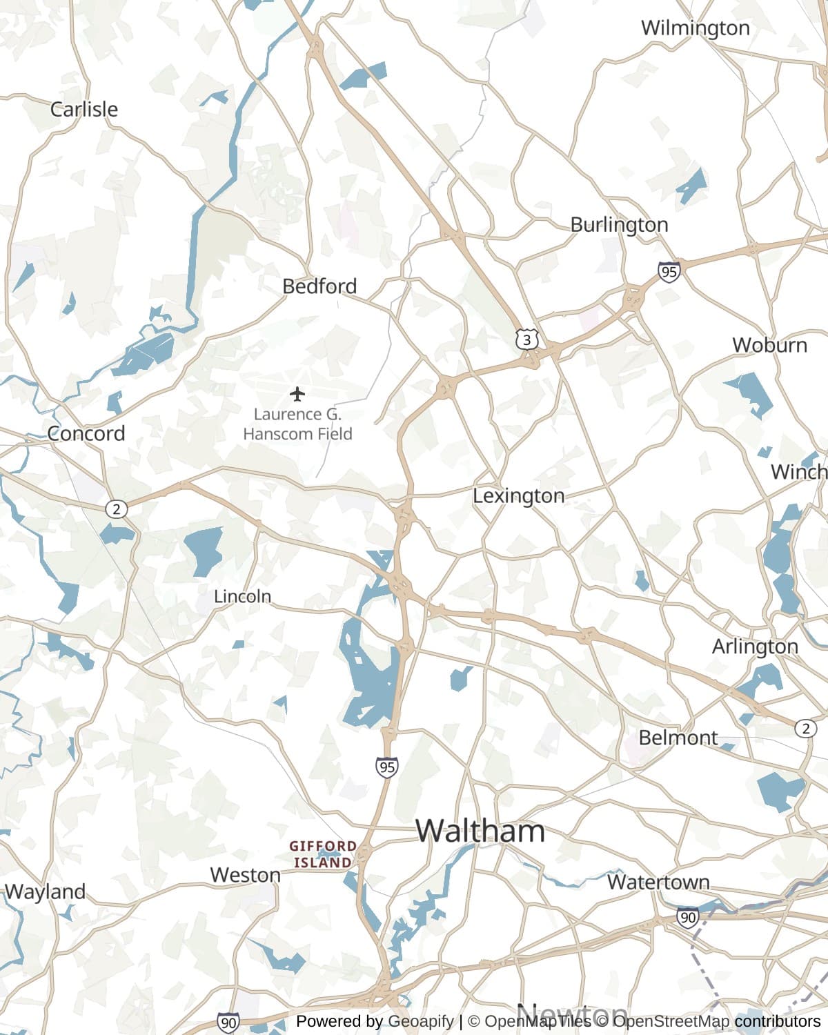
Five miles of it are preserved, from Meriam's Corner in Concord east through Lincoln to the park's boundary in Lexington. Minute Man National Historical Park was created on the twenty-first of September 1959 to hold that stretch along with two other pieces: the North Bridge in Concord, three miles north of the road, and The Wayside on Lexington Road. The rest of the sixteen miles is under the modern towns, which is its own kind of interesting. The retreat runs through what are now driveways and dry cleaners.
There are two ways along the preserved section and it is worth knowing which is which before you arrive. The Battle Road Trail is a five mile path for walking and cycling, and much of it sits on the original roadbed. Route 2A is the modern two lane highway beside it, and that is what you drive. They braid around each other, and the parking areas along 2A are how you get from one to the other.
The morning of the nineteenth
The alarm went out of Boston late on the eighteenth, carried by Paul Revere and William Dawes on separate routes. They met Doctor Samuel Prescott, a Concord man riding home from Lexington, and the three of them went on together. Around one in the morning a British patrol stopped them on the road in Lincoln. Revere was captured, Dawes turned back, and Prescott alone got through to raise Concord. The ride that everyone can name was finished by the man almost nobody can.
At about five, seventy-seven militia were standing on Lexington Green under Captain John Parker when the leading British companies came up. Somebody fired. Two hundred and fifty years of argument have not settled who, and the depositions taken within days contradict each other. What followed was a British volley and a bayonet charge, and eight colonists dead on the common, Parker's own cousin Josiah among them.
The column reached Concord around eight, searched the town for the military stores it had come for, and found very little; most had been moved days earlier. About four hundred militia gathered on the hill above the North Bridge, watched smoke rise from the town center, and came down. The volley they fired there was the first time colonial troops were ordered to shoot at the King's soldiers. Emerson gave it the phrase everybody knows in a hymn written for the monument in 1837.
The running fight
The battle that matters militarily started at Meriam's Corner, around noon, when the British had turned for home. Crossing the brook forced the flanking parties down off the fields and back into the column, and a Reading company fired into the crowd of them. From that point the retreat was under fire almost continuously, and the character of the day changed: not two armies facing each other, but a column strung out along a road with militia companies arriving from every town within a day's march and shooting from behind whatever was to hand.
The terrain did most of the work. At the Bloody Angle the road bends twice in a few hundred yards and the fire came from both sides at once. On Fiske Hill it climbs and turns. At the place now called Parker's Revenge, the Lexington company that had been scattered at dawn was waiting on a rise with the specific intention of getting some of its own back. The British answer was to send flankers out to clear the walls, which worked when they had the men to do it and stopped working as they tired.
Percy's relief brigade met the exhausted column at Lexington in the afternoon with about a thousand fresh men and two field pieces, one of which was set up in the garden of Munroe Tavern while the tavern dining room was used to work on the wounded. It bought a pause, not an escape. The last stretch through Menotomy was the bloodiest ground of the entire day, house to house and hand to hand, and more men died there than at Lexington and Concord together.
By the time the column reached Charlestown that evening the British had lost 73 killed, 174 wounded and 53 missing. The colonists had 49 killed, 39 wounded and 5 missing. Neither side had planned anything resembling this, and by the following morning several thousand militia were camped around Boston and the siege had begun.
Whose road it was
The thing the guidebooks understate is how domestic all of this is. The fighting went through farmyards belonging to named people who were standing in them. Ephraim and Elizabeth Hartwell ran the tavern at what is now the middle of the trail, and three of their sons went out as minute men that morning: Samuel, thirty-three, and John, twenty-eight, both sergeants, and Isaac, twenty-three, a private. All three served on in the war.
Ebenezer Fiske's house stood where the road climbs the hill that carries his name, and by the early afternoon it had wounded men from both sides in it. Samuel Whitney, who mustered the Concord minute men, lived in the house on Lexington Road that would later belong to Hawthorne and then the Alcotts. Jason Russell was fifty-eight and lame and would not leave his own house in Menotomy, and died in the doorway of it.
That is the difference between this road and a battlefield. A battlefield is a field somebody chose. This was a route between towns that had been there for a hundred and fifty years, and on one particular Wednesday the war came down it past everybody's front gate.
What the ground still says
For a battle this famous, a surprising amount is still being established, and the evidence comes out of the dirt rather than the archives. The site of Parker's Revenge was known only approximately until a project beginning in 2013 combined archival work, geophysical survey, metal detection and excavation to reconstruct the 1775 landscape and find where the shooting actually happened. Fired musket balls were the key: where they lie, and which direction they were traveling, maps an engagement that no participant described precisely.
The same method produced the most recent find. In July 2024 the park announced five musket balls recovered near the North Bridge, in the ground where the British had formed up to hold the crossing. All five had been fired from the opposite bank rather than dropped during loading, which makes them physical remains of the volley Emerson was writing about. Two and a half centuries on, the ground is still handing over the primary sources.
How long to give it
Two hours
The two set pieces and nothing else. Park at the North Bridge, walk down to the river and the Minute Man statue, then drive round to Hartwell Tavern and walk the Bloody Angle, which is the most legible piece of ground on the whole road.
North Bridge · Hartwell Tavern · The Bloody Angle
Half a day
The full length of the preserved road, west to east, in the order the retreat took it. Drive Route 2A and get out at the parking areas, or leave the car at the Minute Man Visitor Center and walk or cycle the five mile trail one way.
North Bridge · Meriam's Corner · The Bloody Angle · Hartwell Tavern · Paul Revere Capture Site · Parker's Revenge · Fiske Hill · Lexington Battle Green
A full day
Add the ends. Start on Lexington Green early, work west to Concord for the North Bridge, then come back east along the road the way the column did, and finish in Arlington at the Jason Russell House, where the day was at its worst. Concord's literary houses are on the same street if the nineteenth century is more your period than the eighteenth.
Lexington Battle Green · North Bridge · The Wayside · Meriam's Corner · Hartwell Tavern · Fiske Hill · Munroe Tavern · Jason Russell House
When to come
Patriots' Day, the third Monday in April, is the anniversary and the reason many people come. There are reenactments on Lexington Green before dawn and along the Battle Road through the day, and the towns fill up accordingly. It is the best time to be here and the hardest time to park, and some roads close. If you want the atmosphere, take it. If you want the ground, come another week.
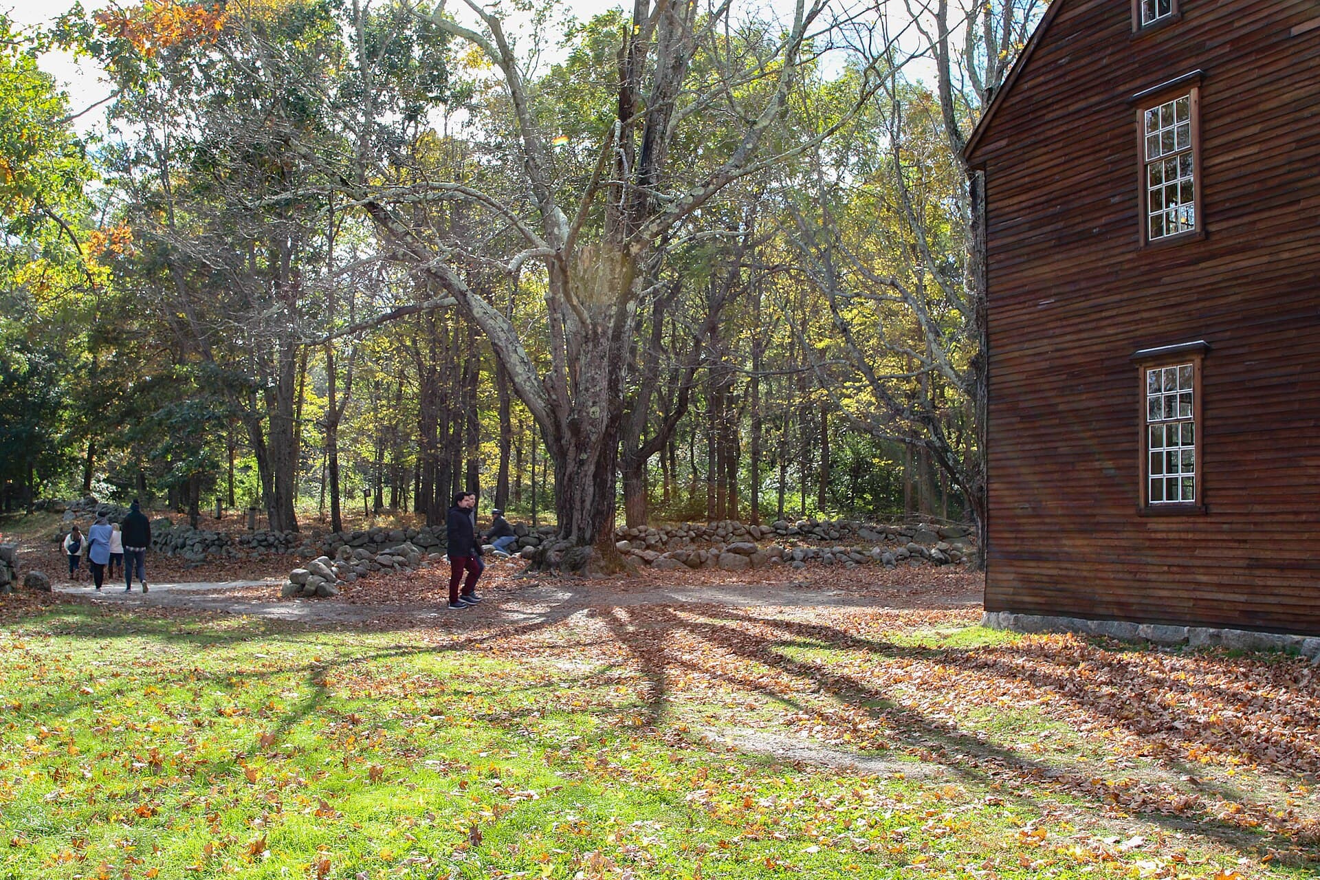
Autumn is the quietest good season, with the stone walls and the field edges at their most photogenic and the historic buildings still open. The park's buildings work on a seasonal calendar and the visitor centers and taverns generally close over the winter, so a January visit gets you the landscape and locked doors. The grounds and the trail stay open year round, but the trail surface takes weather and can be muddy or icy.
Know before you drive
- There is no entrance fee for the park or any of its buildings.
- The Battle Road Trail is for walking and cycling. The road you drive is Route 2A alongside it, with parking areas at intervals; the two are separate and the trail is closed to vehicles.
- Building hours are seasonal and the visitor centers, Hartwell Tavern and The Wayside each open on their own schedule. Check the park's site the week you go rather than assuming.
- This is dense suburban Massachusetts, so fuel, food and phone signal are never a problem. Traffic is, particularly on Route 2A at rush hour and everywhere on Patriots' Day.
- The three units of the park are not contiguous. The North Bridge is about three miles north of the Battle Road section and needs its own stop and its own parking.
In an RV or with a trailer
Route 2A is an ordinary two lane state highway and a motorhome drives it without difficulty. Use the visitor center parking at Lincoln or Concord rather than the small roadside pull-offs along the road, and note that the Battle Road Trail itself is closed to vehicles of any size.
Questions
- Can you drive the Battle Road?
- Not the preserved five miles. That section is the Battle Road Trail, open to walkers and cyclists only. You drive Route 2A, which runs alongside it and gives access to the parking areas, and you walk the parts you want to see. The rest of the sixteen mile route is ordinary public road through Lexington, Arlington and Cambridge.
- Where did the Revolution actually start, Lexington or Concord?
- Both towns have a claim and they are arguing about different things. The first shots and the first deaths were on Lexington Green at about five in the morning, where the militia were not ordered to fire. The North Bridge in Concord, about four hours later, was the first time colonial troops were ordered to fire on British soldiers, which is the event Emerson called the shot heard round the world.
- How long does it take to walk the Battle Road Trail?
- The trail is five miles one way, from Meriam's Corner to the park's eastern boundary in Lexington, and it is level. Two to three hours at a walking pace if you stop and read, rather less on a bicycle. There is no loop, so plan for a return walk, a second car or a bike.
- What is Patriots' Day?
- The Massachusetts and Maine state holiday marking the nineteenth of April 1775, observed on the third Monday in April. Along this road it means dawn reenactments on Lexington Green, events through the park, and a great many more people than usual.
- Is Paul Revere's ride the way the poem tells it?
- No. Revere rode, and he was one of several riders, and he did not finish. A British patrol took him in Lincoln around one in the morning and released him a few hours later without his horse. Samuel Prescott was the rider who got through to Concord. Longfellow wrote the poem in 1860, eighty-five years afterwards, and was not attempting history.
Sources: Minute Man National Historical Park, National Park Service, American Battlefield Trust, Lexington History Museums, on Munroe Tavern, Parker's Revenge Archeological Project.
Reviewed August 2026
Hear it from the road
Whistlestop tells you these stories automatically as you pass them. No searching, no tapping, nothing to ask.